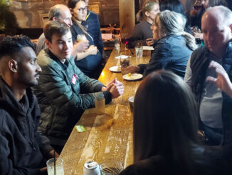
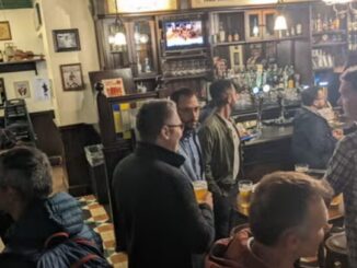
Kelowna GoGeomatics Canada Bowling & February Social!
We will start out with a bowling reservation from 5:30 to 6:30, then moving onto a table (the time slot is for 6:45 but we should hopefully be able to move seamlessly). GoGeomatics is a […]
Laurier Professor Charts Northern Ice Roads A Laurier professor pioneers the mapping of northern ice roads, crucial lifelines in remote Canadian regions. Utilizing geospatial technology and satellite imagery, the project aims to improve the accuracy […]
Teledyne Geospatial congratulates the U.S. Geological Survey (USGS) and Dewberry, a privately held professional services firm, on the publication of a new topobathymetric lidar dataset for the Potomac River. The Potomac River flows from the […]
Access to space-based information, in near real-time, about both natural and human-caused disasters, including earthquakes, hurricanes, oil spills and flooding, provides decision-makers with actionable insights to address some of the world’s most pressing challenges. CHORUS, […]
We are driven by our survival tendency. And that compels us to know or be able to predict the future. From looking into the crystal ball and predicting the future to locating stars and their […]
In the words of Will Cadell, “Geospatial is changing everything.” That was not only one of the opening lines of a visionary talk by Cadell, founder and CEO of geospatial consultancy Sparkgeo, it seemed to […]
Prague: a fitting setting for a mobile mapping innovation New Tool Helps Solve Geospatial Imaging Challenges An Extremely Detailed Guide to an Extremely Detailed Map of New York City Neighborhoods A Series of Interesting Interactive […]
We are thrilled to announce that ITRES is exhibiting at the GoGeomatics Expo, Nov 6-8th in Calgary. ITRES (1979) is an Alberta-based airborne hyperspectral remote sensing imager manufacturer and worldwide mapping survey provider. ITRES imagers […]