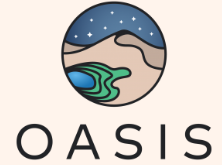
||||||
Technology

Canadian Geospatial Briefing April 5th: 1. Wolf Research Using GPS and Indigenous Knowledge. 2. Newfoundland Company Takes Lead in Drone Industry. 3. Yellowknife Man Creates Google Earth Alternative. 4. Apple Map’s New 3D Features in Toronto 5. UPEI’s Massive Drone Fleet. 6. Next Generation 911 Service Using GIS.

A study on eastern wolves near Georgian Bay is taking a unique approach by braiding western scientific techniques together with Indigenous knowledge systems. Researcher Jesse Popp and Theodore Flamand, the Wiikwemkoong species-at-risk coordinator, are working […]

|
Technology

Canadian Geospatial Briefing Nov 15: 1. UK and Canada Space Agencies Sign MOU on Joint Activities; 2. Canadian Flood Maps; 3. Bell and ESRI Canada: Integrated Smart City Ecosystems; 4. Government of Canada Supports Canadian Satellite-Based Emissions Detection System; 5. ‘What3Words’ App in Search & Rescue

UK and Canada Space agencies sign MOU on joint activities and information sharing The UK Space Agency and the Canadian Space Agency have signed a Memorandum of Understanding on joint activities and information sharing on space, the British High […]

Education & Careers

Book Review: GIS RESEARCH METHODS

GIS Research Methods: A non-technical overview of the science and tools behind geographic information systems and geographic information science for researchers, practitioners, students and academics who may not have an extensive GIS or Geography background. Author:  Nick […]