RPAS

Unleash the future of geospatial innovation

Unleash the Future of Geospatial Innovation at Canada’s National Geomatics Expo 2024

PRESS RELEASE Calgary, Canada The National Geomatics Expo 2024, Canada’s leading geospatial event, is set to ignite Calgary from October…

Canada's National Expo RPAS Program

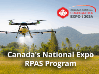
Canada’s National Expo RPAS Program 

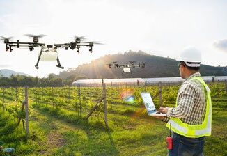
The RPAS (Remotely Piloted Aircraft Systems) is rapidly emerging as a key tool in the Geospatial industry. With the ever-evolving…

Transport Canada shares Facts About Canadian Drones and RPAS Certification in 2023

In February 2023, Transport Canada released a newsletter on Remotely Piloted Aircraft Systems (RPAS), which included interesting statics on the…

Geo Week 2023 – Cool Stuff!

The Geo Week exhibition and conference, held in Denver Colorado, February 13-15, attracted 3,000 attendees from over 50 countries. And…

May 2022 Geospatial Training Online, QGIS, Project Management, Intro to R for GIS

Geospatial & Location Technology Programs and Courses GeoTechTraining.com offers a wide variety of training opportunities built on current standards led…

From floppy disks to cloud computing – Exploring 35 years of Remote Sensing in the NWT

In 1987, Frobisher Bay was renamed Iqaluit, the loonie was released by the Canadian mint, and there were 13 UTM…

Geospatial Training at GeoIgnite: March 4th to the 14th

GeoIgnite offers a wide variety of training opportunities built on current standards led by leading industry experts. Upgrade your knowledge and…

Sales of Illegal RPAS Pilot Certificates and Drone Registration Cards

Transport Canada recently became aware of sales of wallet-sized “Transport Canada Drone Pilot Certificate” and “Transport Canada Certificate of Registration” via eBay through a seller located in the United States. There were listings where the Drone Pilot Certificate and Certificate of Registration were sold separately and individually.

QGIS: Performing Viewshed Analysis on Archaeological Sites

In 1927 a Vancouver bylaw was enacted that limited the height of buildings to a maximum of six stories in…

Outil de versionnement des données géographiques à code source ouvert pour des environnements multi-contributeurs (partie 1)

Note des éditeurs : Cet article a été écrit conjointement par Nicolas Gignac, Dami Sonoiki (eHealth Africa) et Samuel Aiyeoribe (eHealth Africa). Ces auteurs…

GIS Open Source versioning tool for a multi-user Distributed Environment (part 1)

Editors note: This article has been jointly written by Nicolas Gignac, Dami Sonoiki (eHealth Africa) and Samuel Aiyeoribe (eHealth Africa). These authors…

Geospatial Earth Observation Using Blimps, Balloons and Kites

These days drones are all the rage. Nevertheless, there are other ways to collect data from the sky! Blimps, balloons and kites…