• facebook
  • Twitter
  • Linkedin
  • Youtube
  • Linkedin Group
  • Post a Job
  • Post an Ad
  • Post an Event
  • Post a Directory Listing
  • Post a Press Release
  • Media Kit
  • My Account
  • Shopping Cart
  • Login
GoGeomatics
  • MAGAZINE
    • BIM & GIS
    • Community
    • Conference news
    • Earth Observation
    • Education & Careers
    • GEOAI
    • Announcements
    • Reality Capture & Lidar
    • Science
    • Technology
    • Between the Poles
  • Directories
    • ASSOCIATION
    • INDUSTRY
    • EDUCATION
    • Open Data
  • EVENTS
    • GeoIgnite Events
    • Events Calendar
    • GoGeomatics Meetups
  • Services
    • Advertising
    • Marketing
    • Post a Job
    • Post an Ad
    • Post an Event
    • Post a Press Release
    • Post a Directory Listing
    • Media Kit
    • Web Design
  • Find a Job
  • Volunteer
    • Start a GoGeomatics Group
    • Editors & Writers Group
  • About Us
    • About Us
    • Contact Us
    • Frequently Asked Questions
  • Videos
Homesatellite data

satellite data

NOAA-Freeze||
Earth Observation

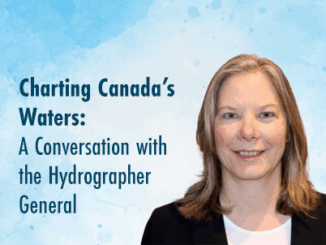
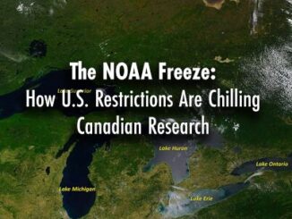
The NOAA Freeze: How U.S. Restrictions Are Chilling Canadian Research

10 March 2025 Benedicta Antwi Boasiako | Arctic Research

A quiet but seismic shift is underway! The U.S. National Oceanic and Atmospheric Administration (NOAA), a cornerstone of global environmental research, has placed strict restrictions on its scientists’ international engagements. Without explicit clearance, NOAA-affiliated researchers […]

Community

Charting Canada’s Waters: A Conversation with the Hydrographer General

17 February 2025 Kruti Mehta | AI

Hydrography is a cornerstone of safe and efficient navigation in Canada’s vast and complex waterways. From charting the world’s longest coastline to adhering to international maritime standards, the Canadian Hydrographic Service (CHS) ensures maritime safety […]

Earth Observation

Key Environmental Mapping Initiatives Shaping Canada’s Geospatial Landscape

27 January 2025 David Legris | Canada

In 2024, Canada saw significant strides in environmental mapping, with both federal and provincial governments taking active roles in enhancing geospatial data for climate resilience, land management, and natural resource protection. From updating critical digital […]

Technology

Canadian Geospatial Digest for October 7th, 2024

7 October 2024 Volunteer Editors and Group Writers | 2023 report

An Era Ends with the Retirement of the Canadian Digital Elevation Model (CDEM) State of the Canadian Space Sector 2023 Autonomous Food Delivery at the Toronto Zoo Uncovering the Legacy of Indigenous Residential Schools through […]

Community

The Public Good Program is Back at GoGeomatics Expo

15 August 2024 GoGeomatics Expo | ABMI

The Geomatics for the Public Good program at the National Expo highlights how geomatics technology is being harnessed across federal, provincial, and municipal levels to enhance public services and improve citizens’ quality of life. Human […]

|
Technology

Canadian Geospatial Digest for August 15, 2022

15 August 2022 GoGeomatics Canada | alberta

Apple Maps is Coming to Your City this Summer, Satellites show World’s Largest Beaver Dam, Who lives in Canada’s Hottest Urban Centres, Western University Investigates Storm Apple Maps is Driving, and Walking, Through Canadian Cities […]

Technology

Geoignite 2020 Video: Maxar: Elevation suite – an overview of elevation products

5 October 2020 Paul Yeung | 3D

Ryan Hamilton & John Roos from Maxar Technologies presented their earth observation satellites and new advances in photogrammetry. They allow high levels of detail in 3D models that previously only airborne sensors could provide. […]

Hydrospatial||||
Technology

GeoIgnite 2020 Video : Hydrospatial – Understanding Coastal Flooding, Detection & Response for Tsunami

21 September 2020 Tanya Tejassvi | Canadian hazards information service

The GeoIgnite annual conference 2020 was power packed with discussions and presentations about compelling technologies, impressive scientific advancements and upcoming government initiatives in the Geospatial sector. Covid-19 did not hamper the event, and in fact […]

Posts pagination

« 1 … 3 4 5 »

Events

Notice
There are no upcoming events.

View All Events

Services

  • Post a Job
  • Post an Ad
  • Post an Event
  • Post a Directory Listing
  • Post a Press Release
  • Media Kit
  • My Account
  • Shopping Cart
  • Login

Jobs

Post a Job
  • GIS Technician
    Sudbury, Ontario
  • Asset/GIS Coordinator
    Edson, AB
  • Civic Operations GIS Technologist (Permanent, Full-Time) – 1953
    Kamloops, British Columbia
  • Senior Manager, Data Science – Geospatial
    Mississauga, Ontario
View All Jobs
  • Directories
    • Associations Directory
    • Industry Directory
    • Education Programs
    • Open Data
  • Volunteer
    • Start a GoGeomatics Group
    • Editors & Writers Group
  • About Us
    • GoGeomatics Media Kit
    • Who We Are
    • Contact Us
    • FAQ’s
    • Advertising
    • Marketing
  • Subscribe
GoGeomatics
GoGeomatics is the largest and most popular communications hub promoting the Canadian geospatial community. The business was incorporated in 2011. GoGeomatics hosts over 100 fun, free, location technology networking events each year in cities across Canada.

© 2026 GoGeomatics

  • facebook
  • Twitter
  • Linkedin
  • Youtube
  • Linkedin Group