• facebook
  • Twitter
  • Linkedin
  • Youtube
  • Linkedin Group
  • Post a Job
  • Post an Ad
  • Post an Event
  • Post a Directory Listing
  • Post a Press Release
  • Media Kit
  • My Account
  • Login
GoGeomatics
  • MAGAZINE
    • BIM & GIS
    • Community
    • Conference news
    • Earth Observation
    • Education & Careers
    • GEOAI
    • Announcements
    • Reality Capture & Lidar
    • Science
    • Technology
  • Directories
    • ASSOCIATION
    • INDUSTRY
    • EDUCATION
    • Open Data
  • EVENTS
    • GeoIgnite Events
    • Events Calendar
    • GoGeomatics Meetups
  • Services
    • Advertising
    • Marketing
    • Post a Job
    • Post an Ad
    • Post an Event
    • Post a Press Release
    • Post a Directory Listing
    • Media Kit
    • Web Design
  • Find a Job
  • Volunteer
    • Start a GoGeomatics Group
    • Editors & Writers Group
  • About Us
    • About Us
    • Contact Us
    • Frequently Asked Questions
  • Videos
Homeshapefiles

shapefiles

Lidar CANEX 2025 Panel:
Conference news

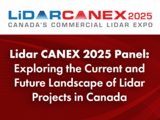
Lidar CANEX 2025 Panel: Exploring the Current and Future Landscape of Lidar Projects in Canada

26 February 2025 Alicia Schrader | Canada

A distinguished panel of experts from various sectors gathered at Lidar CANEX 2025, to discuss the evolving landscape of Lidar technology in Canada. The premier B2B online forum was held on January 29. LidarCANEX is Canada’s […]

Education & Careers

Graph Databases – Recent development in Neo4j may help accommodate the Geospatial Community

26 January 2017 Emmanuel Stefanakis | 2016

Graph Databases and GIS & Technology (GIS&T) In the era of big data, graph databases are becoming very popular as they can address important challenges in terms of data size and data complexity. A graph […]

||
Technology

The Future of GIS Software? QGIS A Popular Open-Source GIS for the Masses

16 January 2017 Francis Guo | 2015

In today’s geomatics society, ArcGIS, developed by Esri, is a giant and dominates the GIS software market. However, there are some other great and powerful GIS software applications. QGIS is a typical GIS application among […]

Careers & GIS and Geomatics||
Education & Careers

Grow or Die – 3 Key GIS Career Needs

7 May 2015 Tyler Mitchell | 2013

The premise of a liberal arts or science degree is to get a wide range of exposure across several disciplines.  The end goal being a “well rounded” education.  I’ve always liked to believe that was […]

No Picture
Newsmakers & Press Releases

the PYXIS innovation™ Releases the Worldview Software Development Kit

29 October 2014 GoGeomatics Newsmakers | 3D

the PYXIS innovation™ team is pleased to announce the release of the WorldView™ Software Development Kit (SDK), the world’s first Digital Earth mash-up engine. “Geospatial data integration is the one of the hardest, most expensive […]

No Picture
Education & Careers

Evaluation of the Data BC Portal, GIS Section

25 February 2013 Marcus Hinds | 2013

The province of British Columbia (B.C.) recently revised their portal. The main page offers a number of services to the general public of B.C., such as provincial services, ministries and governmental departments.  Sub portals attached […]

No Picture
Technology

Evaluation of the Service New Brunswick Geographic Data & Maps Section

18 February 2013 Marcus Hinds | aerial

Service New Brunswick  (SNB)  is serving up geospatial data to the community so lets have look at what they are doing.  The portal allows access to all provincial services including, Service New Brunswick locations, employment […]

Events

Notice
There are no upcoming events.

View All Events

Services

  • Post a Job
  • Post an Ad
  • Post an Event
  • Post a Directory Listing
  • Post a Press Release
  • Media Kit
  • My Account
  • Login

Jobs

Post a Job
  • Canada Maps and Poster Gallery Volunteer Leads — GeoIgnite 2026
    remote
  • GIS & Data Analytics Lead
    Beaumont, AB
  • Lead Surveyor, Projects/Arpenteur-géomètre principal, projets; arpenteuse-géomètre principale, projets
    North Bay, Thunder Bay
  • Senior GIS Developer
    Calgary, AB
View All Jobs
  • Directories
    • Associations Directory
    • Industry Directory
    • Education Programs
    • Open Data
  • Volunteer
    • Start a GoGeomatics Group
    • Editors & Writers Group
  • About Us
    • GoGeomatics Media Kit
    • Who We Are
    • Contact Us
    • FAQ’s
    • Advertising
    • Marketing
  • Subscribe
GoGeomatics
GoGeomatics is the largest and most popular communications hub promoting the Canadian geospatial community. The business was incorporated in 2011. GoGeomatics hosts over 100 fun, free, location technology networking events each year in cities across Canada.

© 2025 GoGeomatics

  • facebook
  • Twitter
  • Linkedin
  • Youtube
  • Linkedin Group