Statistics Canada
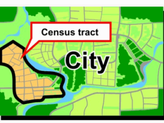
What are Statistics Canada’s geographic terms: CT, CSD, CMA and more
Geographic data are applied in any location-based projects. We all might hear a lot about geographic terms but when we…
GeoIgnite 2020 Video: Statistics Canada DEIL experiments and outputs with open geospatial data
GeoIgnite is Canada’s National Geospatial conference hosted by GoGeomatics Canada. GeoIgnite was held online using Zoom from July 22nd to…
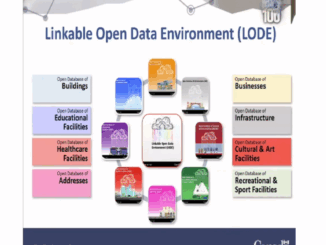
The Linkable Open Data Environment (LODE): Supporting Geospatial Analysis with Open Data
Over the past 2 years Statistics Canada’s Data Exploration and Integration Lab (DEIL) has launched and developed the Linkable Open…
What is the Canadian Statistical Geospatial Explorer?
Statistics Canada produces statistics that help Canadians better understand their country. The agency ensures Canadians have the key information on…
Leadership in Times of Disruption: GeoIgnite 2020 talks at a Glance
Canada’s geospatial community is gathering next week for GeoIgnite 2020. The second annual conference is being held online this year…
Eric Loubier -DG- CCMEO Keynote Announcement GeoIgnite 2020 Online
The GeoIgnite conference committee is excited to announce our keynote is the Director General, Eric Loubier, Canada Centre of Mapping…
GeoIgnite: Leadership in Times of Disruption
Join us virtually this year for Canada’s National Geospatial Leadership: GeoIgnite conference on July 22nd to 24th, 2020! This event will…
Using GIS to study health care services and utilization––from local to national
Access to timely and quality health care is an important determinant of health and well-being. Despite universal health coverage in…
It’s a Geospatial world we live in: Find Your Happy Place
When does a space become a place? There are a myriad of small open spaces and buildings throughout towns and…
QGIS & WorldClim: Using Zonal Statistics to Map Temperature Patterns
There has never been a time in the history of GIS when so much free, high quality data has been…
Volunteer & Map Canada: Statistics Canada Crowdsourcing Pilot Project
Statistics Canada has launched a new pilot project using OpenStreetmap. For many Canadians outside of the geomatics community this is…
Open Data, Open Source, Open Possibilities
Back in 2006 I (Jim) was a student at BCIT and a Vancouver resident, eager to obtain some local data…