weather

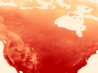
QGIS & WorldClim: Using Zonal Statistics to Map Temperature Patterns

There has never been a time in the history of GIS when so much free, high quality data has been…

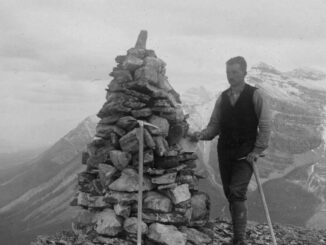
Canadian Surveyors “Remark” on History with Elk Pass Boundary Restoration Survey

The Alberta-British Columbia Boundary Commission has just completed a monument restoration survey to restore a number of deteriorated provincial boundary…

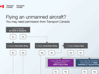
UAVs in Canada – Key Exposures to Loss and Ways to Protect Yourself

This article was written by Mark Sampson for the Association of Ontario Land Surveyors. Mark’s contact details are at the…

Earth Observation Represents a $43 Billion Opportunity Over Next 10 Years

NSR’s Satellite-Based Earth Observation (EO), 8th Edition report, released yesterday, projects data, value-added services, information products, and big data analytics…

MDA signs contracts for RADARSAT-2 information

Richmond, BC – MacDonald, Dettwiler and Associates Ltd. (“MDA” or the “Company”) (TSX: MDA), a global communications and information company,…

Seeing Through Wildfire Smoke in Fort McMurray, Alberta with Infrared Imaging

Images of the massive wildfire that engulfed Fort McMurray, Alberta earlier this year have been seared into our collective consciousness.…

Airbus Defense And Space Signs Deal with Vancouver’s 3v Geomatics

Airbus Defense and Space and 3v Geomatics Inc. (3v Geomatics) signed a multi-year agreement that will provide 3v Geomatics with…

Thinking About Geomatics: How to Find the Right Device for Data Collection

Finding the right device for data collection I was at CNAM recently and a number of discussions reminded me of…

NetCDF: a growing standard for encoding georeferenced data in binary form

Recently, the Open Geospatial Consortium (OGC) has announced an extension to the OGC CF-netCDF 3.0 encoding standard that specifies how…

Paul Barker: What is Web GIS? Exploring the ‘new’ GIS

GIS has always been an integral part of forward thinking organizations. However, it has long struggled to break out of…

An API for the World’s Weather & Climate Data

Planet OS is excited to announce the launch of our first API designed specifically for geospatial and Earth observation data.…

June Seo: Geomatics Engineering Student at NAIT & GoGeomatics Edmonton Group Leader

GoGeomatics Canada is pleased to introduce June Seo to the community. She is one of the great new group leaders…