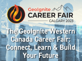
• facebook
  • Twitter
  • Linkedin
  • Youtube
  • Linkedin Group
  • Post a Job
  • Post an Ad
  • Post an Event
  • Post a Directory Listing
  • Post a Press Release
  • Media Kit
  • My Account
  • Login
GoGeomatics
  • MAGAZINE
    • BIM & GIS
    • Community
    • Conference news
    • Earth Observation
    • Education & Careers
    • GEOAI
    • Announcements
    • Reality Capture & Lidar
    • Science
    • Technology
  • Directories
    • ASSOCIATION
    • INDUSTRY
    • EDUCATION
    • Open Data
  • EVENTS
    • GeoIgnite Events
    • Events Calendar
    • GoGeomatics Meetups
  • Services
    • Advertising
    • Marketing
    • Post a Job
    • Post an Ad
    • Post an Event
    • Post a Press Release
    • Post a Directory Listing
    • Media Kit
    • Web Design
  • Find a Job
  • Volunteer
    • Start a GoGeomatics Group
    • Editors & Writers Group
  • About Us
    • About Us
    • Contact Us
    • Frequently Asked Questions
  • Videos
HomeWildfires

Wildfires

Education & Careers

The GeoIgnite Western Canada Career Fair: Connect, Learn & Build Your Future

29 October 2023 GoGeomatics Expo | Archaeology GIS

Co-located with the GoGeomatics Expo, the GeoIgnite Western Canada Career Fair is where Canada’s top organizations will recruit from a diverse pool of professionals, including students and graduates from the Expo’s Education Partners, the University […]

Community

GoGeomatics Expo Adds New Program: Geomatics for Climate Resiliency

16 October 2023 GoGeomatics Expo | Archaeology GIS

In recognition of the pressing global environmental challenges we face today, the Expo has added a new program to highlight how geomatics theories and technologies are being applied to combat climate change, wild fires and […]

Technology

Canadian Geospatial Digest July 10th, 2023

10 July 2023 Volunteer Editors and Group Writers | Agriculture and Agri-Food Canada

Great Bear Rainforest trophy hunting tenures mapped Mapping Lake Huron Shoreline 100 years in the future The Canadian Agri-Food Asset Map Canada’s wildfires 911 and GIS, City of Edmonton’s journey to become NG911 compliant Great […]

Technology

Canadian Geospatial Digest June 26th, 2023

26 June 2023 Volunteer Editors and Group Writers | ArcGIS

Making investments in energy-modelling tools to bolster efforts in reducing emissions “Open Urban Forests” The First National View of Urban Forestry Geospatial Data in Canada Hazardous fuel map to predict wildfires Canadian Wetland Inventory Achieving […]

Technology

Celebrating Earth Day with Conventional and Unconventional Applications of Geospatial Technology: Part 1 

24 April 2023 Jake MacLean | Canada

With the passing of Earth Day this weekend, GoGeomatics Canada would like to celebrate our planet and highlight some of the critical ways that geospatial technology helps to make for a cleaner, greener Earth. While […]

Technology

Canadian Geospatial Digest April 17th, 2023

17 April 2023 Volunteer Editors and Group Writers | 3D scanning

Minerva Intelligence launches Canada’s first wildfire risk map using AI and ML Alberta grain elevators preserved in virtual reality W5, CTV creates a map of asbestos cement pipes delivering drinking water in Canada University of […]

WIldFireSat|||
Technology

Canada’s WildFireSat: Giving Fire Fighting a Helping Hand

10 April 2023 GoGeomatics Canada | Canada

Each year in Canada, 7500 wildfires burn 2.5 million hectares (about the size of Nova Scotia). That number is projected to double by 2050. Although Canada is a world leader in wildfire management, wildfires are […]

|||
Technology

International Geospatial Briefing for August 22nd, 2022

22 August 2022 GoGeomatics Canada | AI

Mapping Earth’s deepest points, the collision of Geology and Geospatial ISS to get a new hyperspectral remote sensing lab A new interactive map illustrates the history of shark attacks Tracking wildfires and droughts worldwide with […]

Posts pagination

« 1 2 3 4 »

Events

Notice
There are no upcoming events.

View All Events

Services

  • Post a Job
  • Post an Ad
  • Post an Event
  • Post a Directory Listing
  • Post a Press Release
  • Media Kit
  • My Account
  • Login

Jobs

Post a Job
  • Canada Maps and Poster Gallery Volunteer Leads — GeoIgnite 2026
    remote
  • GIS & Data Analytics Lead
    Beaumont, AB
  • Lead Surveyor, Projects/Arpenteur-géomètre principal, projets; arpenteuse-géomètre principale, projets
    North Bay, Thunder Bay
  • Senior GIS Developer
    Calgary, AB
View All Jobs
  • Directories
    • Associations Directory
    • Industry Directory
    • Education Programs
    • Open Data
  • Volunteer
    • Start a GoGeomatics Group
    • Editors & Writers Group
  • About Us
    • GoGeomatics Media Kit
    • Who We Are
    • Contact Us
    • FAQ’s
    • Advertising
    • Marketing
  • Subscribe
GoGeomatics
GoGeomatics is the largest and most popular communications hub promoting the Canadian geospatial community. The business was incorporated in 2011. GoGeomatics hosts over 100 fun, free, location technology networking events each year in cities across Canada.

© 2025 GoGeomatics

  • facebook
  • Twitter
  • Linkedin
  • Youtube
  • Linkedin Group