
Canada has a population of more than 37.9 million and is growing at a steady pace. Faced with a growing need for space, sustainable management of land cover and land use is critical to protecting natural resources and addressing key climate and sustainability goals. To keep up with a continually changing landscape due to climate change, industry and governments alike are looking to diversify their toolkits for a more efficient way to monitor change over farmland, forests, and expanding cities. Advances in Earth observation and geospatial analysis technologies are enabling these organizations to gain deeper visibility on a daily basis.
Near-daily satellite imagery empowers sustainability programs to:
- Detect land cover and land use changes: Complementing traditionally available datasets and alerts with higher spatial and temporal resolutions
- Validate and classify land cover and land use conversions: Pulling high-resolution imagery from just before and after an alert to validate and classify any land conversion
- Leverage analysis tools for a broader view of ground conditions: With daily monitoring and very high-resolution tasking, you can apply indices such as NDVI or NDWI to assess vegetation health and water resources
Agriculture
Rising global food demands for one of Canada’s most important industries means yields must improve alongside population growth. Traditional agricultural and livestock practices no longer apply, and the industry needs to adapt to changing conditions. Near-daily satellite imagery and simple analysis tools can be used to develop precision agriculture solutions that help farmers and policy-makers make more proactive, targeted decisions.
Large constellations, such as Planet’s 180 Dove satellites, are able to capture nationwide, daily images at field-level detail. Because the Dove constellation images in RGB and near-infrared spectral bands, users can detect changes in crop health before irreparable damage is done. Early indications of change help direct scouting efforts, improve yields, and save farmers time and resources.
Forest monitoring
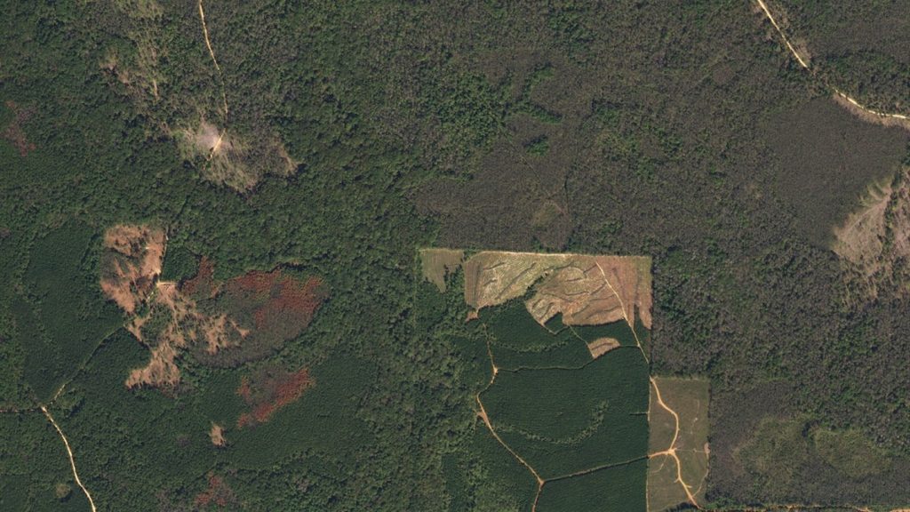
Canada has more forest area per person than any other country, covering 347 million hectares of land and supporting diverse ecosystems. These forests serve as a stabilizing force, helping us capture carbon to lessen the impacts of climate change. However disease, invasive pests, and enormous wildfires are becoming more common issues threatening these important ecosystems.
Similar to use cases in agriculture, high-frequency, high-resolution satellite data can enable more proactive, broad-area monitoring of these threats, so that industry and agencies can better protect and manage threatened forests over the next several decades. Near-infrared and red edge spectral channels show the early onset of disease and can predict where it might spread.
Sustainable Development
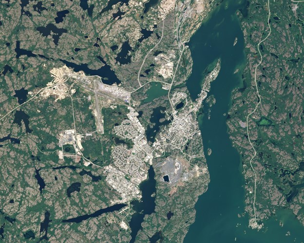
Earth observation satellites offer a unique perspective on our environment. From space, they can see the current distribution of land cover, the influence of human beings on natural resources, and the dynamics of constantly changing land use over space and time. Satellite imagery captures even the most remote areas of the planet, where on-the-ground mapping is almost impossible due to the vast size and remoteness; for example, the cold landscape of the Nunavut territory, the steppes of Central Asia, or the tropical forests of Southeast Asia.
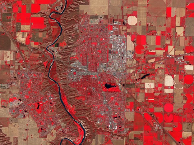
Satellite images can be decisive in helping manage city and infrastructure growth in protected areas. With a growing population comes a growing need to accommodate living space while protecting natural resources and agricultural production systems that are ecologically, socially, and economically sustainable. Satellite data can help industry and state officials effectively monitor broad areas overtime for more effective decision making.
Near-daily, high-resolution satellite imagery offers a more modern, accessible workflow to empower governments, NGOs, and corporations to accurately measure and report on land cover change and land use risks.
For more information on advanced land use monitoring and sustainable development please see here.


Be the first to comment