
The Art of Being a Cadastral Surveyor: The key abilities every surveyor needs
There is an art to being a land surveyor. Surveyors take extremely accurate measurements with sophisticated tools to create plans that become legal models of the physical environment. For example, on even a small parcel of land the locations of the buildings, trees, grass, fences, signs, fire hydrants, water valves, gas and sewage lines, as well angle of the parcel to the street. These features need to be measured with sub centimeter accuracy and be represented in a plan that becomes an official legal document, having the full weight of municipal planning laws behind it. A typical map does not meet these criteria. It’s important surveyors and potential surveyors have a certain skills and abilities to do their work.
Mathematics
Today’s surveyors can rely on computers to do the math for us. However, it is essential land surveyors know how to do the math themselves and not just rely on computers. There can be times when the calculations don’t seem correct or the data is missing valuable information which the technology cannot provide. Every potential surveyor and practicing surveyor needs an eye for math, calculus, and algebra
Research Skills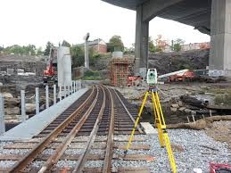
Gathering data, delving into the historical facts, and researching legal documents, is all part of the skill set and trade of a professional surveyor. As a prospective surveyor, you should enjoy learning about a parcel of land and how the boundaries were originally defined. If you are a history buff, you will find researching the land title and other pertinent historical facts fascinating.
Legal Knowledge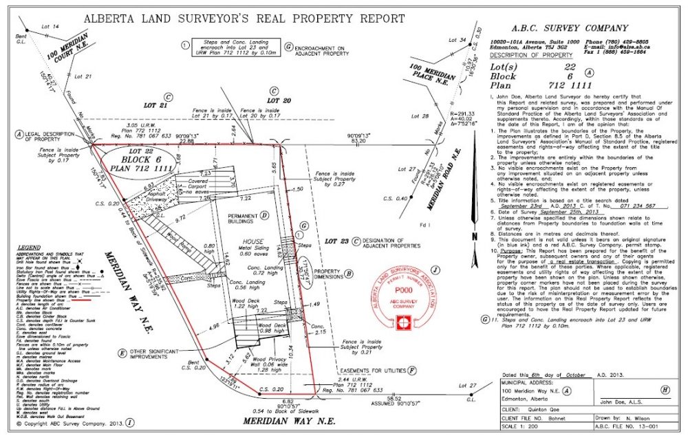
As a land surveyor, working in the cadastral discipline of surveying, you must know the Land Survey Act in relation to boundaries, parcels and divisions, etc. in the jurisdiction you are working. In Canada, surveyors are licensed provincial and federally. Surveyors must have the knowledge of the law where they are working as it relates to that jurisdiction. Interpreting survey law is a requirement of every professional surveyor for legal agreements.
Being a CAD Whiz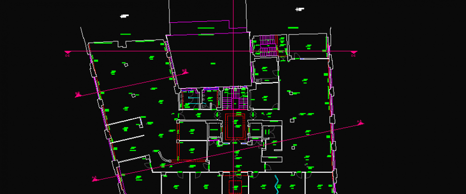
CAD or Computer Aided Design, is one of the fundamental elements that has increased over the years in the surveying world. Surveyors are exposed to AutoCAD Civil 3D, MicroStation InRoads, MicroSurvey and GPS software. In today’s surveying industry, the professional licensed surveyor would need to know how to use multiple surveying software. This task could be delegated to office staff who would import field survey data points and design registered plans for the client. However, to further enhance your surveyor career or to become expandable in your role it doesn’t hurt to have the required software skills.
Teamwork
Surveyors hire teams of professionals to work with. This could mean delegating the field work to survey assistants and computer work to CAD operators. The surveyor might be the most experienced in the team so to provide mentoring to new and younger staff coming into the profession. By having strong interpersonal skills, it can go a long way to help understand, explain and communicate effectively to your team. This may seem easy, but as a surveyor you are managing staff in an array of different fields, from the new and upcoming into the field, to those that been in the field longer that yourself and to those making a career transition into the field with a diverse set of transferable skills.
Attention to Detail
A land surveyor must have a keen eye for even the minute details of the surveying project. This may include the exact bearings for the property line, placing the standard iron bar in the appropriate place. There is no room for error or misjudgment because the surveying world is based on very accurate measurements. It may help if you have the entrepreneurial spirit to be motivated and inspire the survey project.
These are just some of the key abilities that someone wanting to establish a career in the profession of cadastral surveying would need to review in order to get started. There are more areas to cover in relation to industry trends, changes and the growth of the profession. As well as the different disciplines of land surveying: geodesy, hydrographic, photogrammetric and geographic information management.
For further information on surveyor careers The Association of Ontario Land Surveyors is a good place to start. http://www.aols.org/


Be the first to comment