

David Belanger
David Bélanger is the project manager of the National Elevation Data Strategy at Canada Centre for Mapping and Earth Observation (CCMEO) from Natural Resources Canada. The objective of the strategy is to make a detailed 3D representation of the country available to Canadians in support of Government priorities, through collaboration with federal agencies, provinces, territories, private sector and international partners.
David Bélanger est le Gestionnaire de projet de la Stratégie nationale de données d’élévation au Centre canadien de cartographie et d’observation de la Terre (CCCOT) de Ressources naturelles Canada. La stratégie vise à mettre à la disposition des canadiens une représentation tridimensionnelle détaillée du pays à l'appui des priorités du gouvernement, en collaborant avec les organismes fédéraux, les provinces, les territoires, le secteur privé et des partenaires internationaux
Articles by David Belanger

CANADA’S NATIONAL ELEVATION DATA STRATEGY UPDATE NOVEMBER 2023
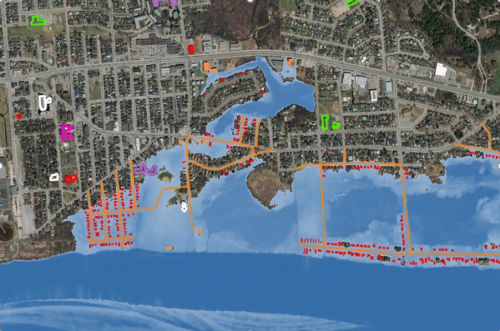
Fall 2023 LIDAR ACQUISITIONS 2023 IN SUPPORT OF THE FLOOD HAZARD IDENTIFICATION AND MAPPING PROGRAM (FHIMP) Since 2021, Natural Resources…
CANADA’S NATIONAL ELEVATION DATA STRATEGY UPDATE NOVEMBER 2022
Fall 2022 LIDAR ACQUISITIONS 2022 IN SUPPORT OF THE FLOOD HAZARD IDENTIFICATION AND MAPPING PROGRAM (FHIMP) Flood hazard maps are…
CANADA’S NATIONAL ELEVATION DATA STRATEGY UPDATE
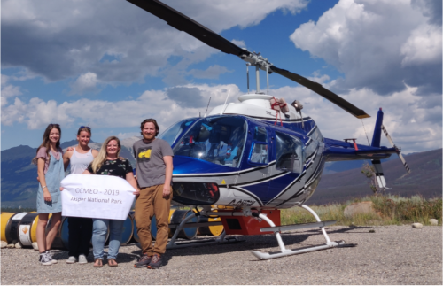
Fall 2021 LIDAR ACQUISITIONS 2021 The 2021 LiDAR acquisition period is already coming to an end. In addition to integrating…
NATIONAL ELEVATION DATA STRATEGY UPDATE
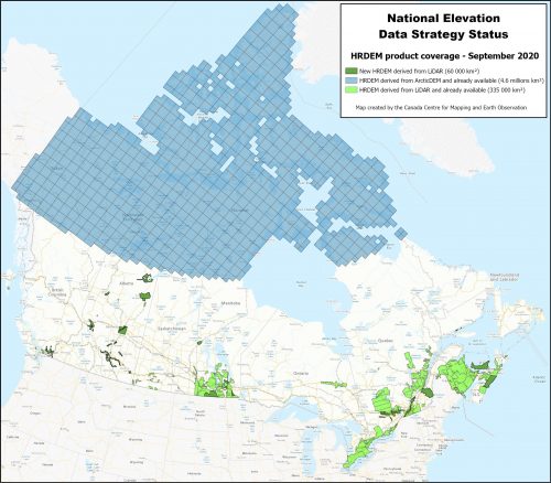
July 2020 STATUS OF THE LIDAR ACQUISITIONS The National Elevation Data Strategy team of the Canadian Centre for Mapping and…
CANADA’S NATIONAL ELEVATION DATA STRATEGY UPDATE
November 2019 HRDEM FOR THE ENTIRE CANADIAN ARCTIC! In August, Natural Resources Canada (NRCan) made available a new release of the High…
Government of Canada: National Elevation Data Strategy Update with AI & Big Data
Natural Resources Canada (NRCan) is increasing the HRDEM product coverage by 30,000 km2 by publishing 21 new datasets in six…

Canada’s National Elevation Data Strategy Updates from NRCan
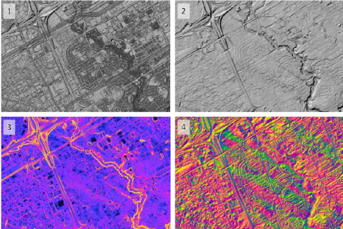
New Data Generated from LiDAR! Natural Resources Canada (NRCan) is proud to announce a new release of the product High…
