International Geospatial Digest for September 2nd, 2024
- Geospatial Database OpenStreetMap Comes of Age
- In Lithuania’s Capital, Drones, Maps, and AI Unite City Functions
- Mapping Australia’s deepest-known cave system Delta Variant
- The Geospatial Industry Is Getting Ready for the Modernized National Spatial Reference System
- New satellite demonstrates the power of AI for Earth observation
- Maxar’s second WorldView Legion duo launched
Geospatial Database OpenStreetMap Comes of Age
OpenStreetMap is having it’s 20th anniversary this year. The free geographic database, maintained by a community of volunteers, has seen major growth over the last 20 years in the geospatial community. OpenStreetMaps achieved its success through contributors adding data from open licensed geodata sources in addition to other volunteer hours. The success of OpenStreetMaps is through the many big name providers such as already known to be using OSM data in their location-related services are Apple, Facebook, Strava, Tesla, and Garmin to name a few. This is a key example of how the geospatial community has far reaching influence across many industries. Read more here.
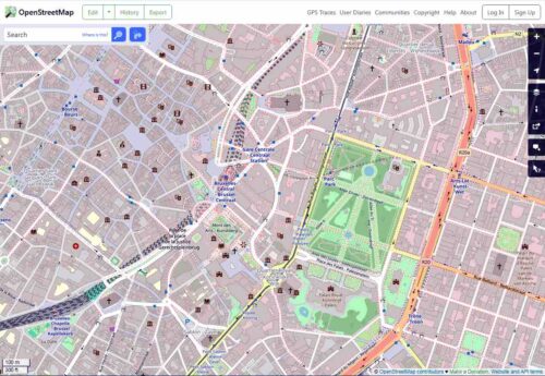
Open Street Map Screen Shot
In Lithuania’s Capital, Drones, Maps, and AI Unite City Functions
Digital twins has showcased how common of a tool it is across the world. Lithuania is no exception in it’s decision to use geospatial assets and tools for city governments to understand and manage cities. The article discusses 3 major topics: drone footage and mapping tools applications, AI to assist with better planning applications and consulting, understanding data helps with future projections and counters to better plan for these changes. Digital twins and data management has proven again that the geospatial sector is heading in a more efficient and data-oriented industry. Read more here.

The City of Vilnius, Lithuania’s capital, employs drones and AI functions to run the city in the present and decide how to change it in the future.
Mapping Australia’s deepest-known cave system Delta Variant
Field data collection has always been a difficult, yet rewarding venture. In this particular case, mapping large cave systems is up there with some of the most adventurous and remote surveying work out there. The article does not go into specifics, but LiDAR is generally used to map cave systems. Ciara Smart spearheaded this mapping project of Mt Field National Park, Australia. Over the last two years, the Southern Tasmanian Caverneers have made numerous trips to map out so far and is one of the most difficult cave mapping projects the team has faced. Read more here.
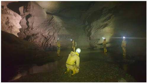
The Southern Tasmania Caverneers in a section of the master cave named Mother of God streamway. (Supplied: Stephen Fordyce)
The Geospatial Industry Is Getting Ready for the Modernized National Spatial Reference System
The national spatial reference system (NSRS), being led by the National Geodetic Survey (NGS), is looking at a new datums and the repercussions of how these changes will affect the geospatial industry. As modernization is required, there’s still concerns over the implementation, but measures are being taken to ensure that the transition happens smoothly. The most important factor at the moment is making sure that the awareness for this transition is widespread so companies and professionals can prepare for this change. Read more here.

Austin Deppe | Shutterstock
New satellite demonstrates the power of AI for Earth observation
The European Space Agency, ESA, has launched its new satellite Φsat-2. The cubesat design boasts an artificial intelligence paired with a multispectral camera that can analyzes and processes imagery while in orbit. This most certainly sets the bar for what satellites can do for the future. Φsat-2 runs the following apps on board: Cloud detection, Street map generation, Maritime vessel detection, On-board image compression and reconstruction, Marine anomaly detection, and Wildfire detection. Read more details here.
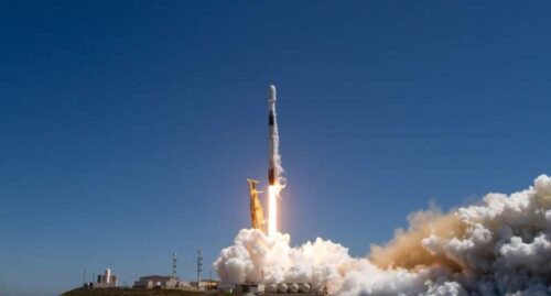
ESA’s Arctic Weather Satellite and Φsat-2 satellite lifted off on a Falcon 9 rocket from the Vandenberg Space Force Base in California, USA, on 16 August 2024 at 20:56 CEST (11:56 local time). Credit: SpaceX
Maxar’s second WorldView Legion duo launched
Maxar Intelligence has thier third and fourth WorldView Legion satellites currently going through the commissioning process. The first images are expected to be recieved relatively soon. The satellites are part of a group of 6 that are capable of dawn-to-dusk Earth observation imagery collection. The fifth and sixth satellite are expected to launch in the coming months. Read more here.

Image © 2024 Maxar Technologies


