Last year GoGeomatics brought our readers up to date on the 2012 country report from NRCan to the United Nations. This year we are taking a look at some of the highlights of the 2014 Country Report of Canada to the United Nations. This publicly available document is prepared by the Canada Centre for Mapping and Earth Observation and Natural Resources Canada, with input from the Federal Committee on Geomatics and Earth Observation.
We encourage students, professionals, managers, and those with an interest in all things geospatial at NRCan and the broader geospatial community to read the full report. It’s an easy read, and provides a complete picture of recent changes, current initiatives, and future goals. Here’s our breakdown of the top three stories in the Report.
1. Canadian Geomatics Community Round Table (CGCRT)
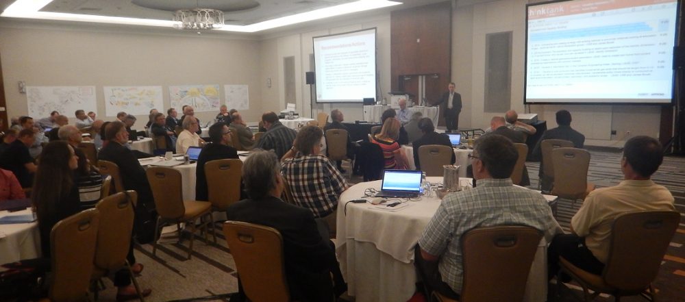
GoGeomatics has been keeping you up-to-date on the CGCRT’s developments, and it’s no surprise that it features largely in the UN Report. Nearly two years ago, an elected Steering Committee was created to develop a Pan-Canadian Geomatics Strategy. The steering committee is unique in that it is represented by public, private, and non-profit segments of the geomatics community. The CGCRT gathered input from the community, and finalized the Strategy at their June 2014 Workshop in Ottawa.
Finalizing the Pan-Canadian Geomatics Strategy at the June 2014 Team Canada event
Currently, the Steering Committee is exploring models for a new governing body, as Country Report states that their term is up in January 2015. The mandate of the new governing body will focus on implementing, monitoring, and reporting on the Strategy. We hope for more news and communications for the CGCRT soon.
2. Canadian Geomatics Environmental Scan and Economic Value Study
This study was launched by Natural Resources Canada in Spring 2013 to:
- Provide a snapshot of the current geospatial information market in Canada and profile the Canadian geomatics sector
- Identify technological, economic, social and demographic trends
- Provide an analysis of the current labour market, education and training
- Quantify the economic impact of open geospatial information within the Canadian economy
- Make recommendations on the future strategic direction for geospatial information in Canada
Results of the study are expected very soon, Winter 2014/2015. These results are expected to be hugely significant for the geomatics sector, as broad studies have not been conducted for over a decade. The study will allow us to better understand the current situation and emerging trends in Canadian geospatial activities, and their overall direct and indirect economic value and contribution to the Canadian economy. Rumors and concerns have been swirling around the community for months, as there have been many delays on this project. When the report is realized, GoGeomatics will take an in-depth look at what’s inside and what it means.
3. Satellite Facilities
This year, the Government of Canada has installed four new antennas at NRCan’s satellite stations across Canada. These stations are strategically located to provide full coverage of Canada, and even extend beyond to the continental US and Canada’s three oceans. They are located in Prince Albert, Saskatchewan; Gatineau, Quebec; and Inuvik, Northwest Territories.
Inuvik is the youngest station, established in 2010. Currently, NRCan is in the process of expanding the Inuvik facility. We’ll be bringing you the story on how this expansion will play out, and the ways that it will change Inuvik, and Canada as a whole.
4. Federal Geospatial Platform (FGP)
The Federal Geospatial Platform is a three-year, $40-million project to address the current challenges of open data sharing in Canada. The Platform is bringing together data from the 21 FCGEO (Federal Committee on Geomatics and Earth Observation) departments and agencies to enable the rapid search of all federal geospatial data assets. It will be a free and accessible central hub for Canadians, government, and industry.
At NRCan’s kick-off to Geography Awareness Week 2014, GoGeomatics learned that the FGP is currently in its sixth month of a three-year plan. As the Platform is phased into operation, it will play a key role in a range of complex issues where geospatial data are necessary.
Stay tuned to the GoGeomatics Magazine, because we’ll be bringing you more in-depth stories on some of these initiatives and developments, and a few others, as part of our series on NRCan.


Be the first to comment