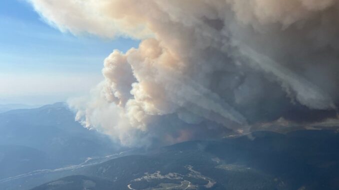
As climate patterns shift, Canada’s wildfire season is growing longer and more severe. After devastating seasons in 2023, 2024, and 2025, provinces are ramping up preparedness efforts. With ongoing drought in northwestern regions and a warmer, El Niño–influenced summer ahead, the country could be heading into another intense wildfire season.
Coast to coast, provinces are gearing up for wildfire season. Here’s how they’re preparing.
New Brunswick has announced the completion of its first four Community Wildfire Resiliency Plans (CWRPs). A central aspect of each CWRP was a comprehensive quantitative wildfire risk assessment carried out by Emergency Solutions International (ESI) using a civic-address-level method.
This technique allowed for:
- Hazard scoring specific to each structure at every address within the study areas.
- Identification and prioritization of essential infrastructure and key hazards.
- Mapping of potential wildfire impacts and exposure.
- Establishing a data-driven basis for mitigation efforts and operational planning.For each community finalizing their CWRPs, it is essential to have a statistically valid sample of assessed structures to accurately gauge the overall risk across the broader community.
On the other side, due to the increasing severity of wildfires in British Columbia and prolonged drought conditions have impacted the rural communities with scarce water resources. To support these communities, Living Lake Canada has launched a water resource mapping project that includes Parson and the surrounding neighborhoods in partnership with Parson Community Hall.
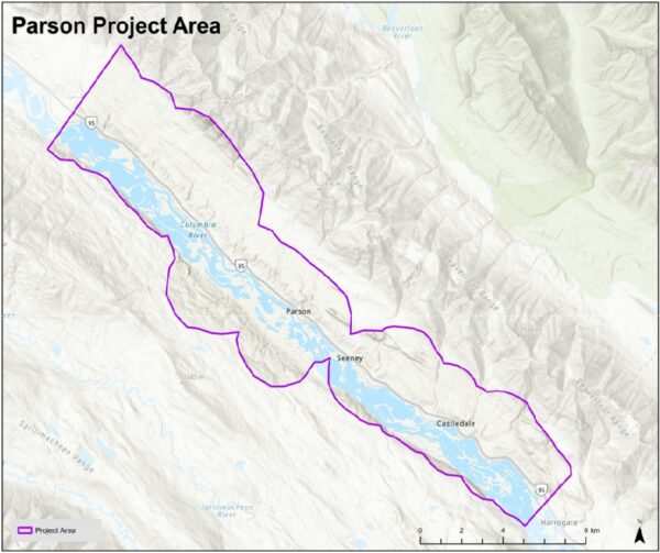
During the Argenta Creek wildfire in 2024, maps produced through a collaboration between Living Lakes Canada and the Argenta Safety & Preparedness Society were employed by the BC Wildfire Service to support their operational response. Firefighting teams reported that the use of these maps significantly decreased the duration needed for field reconnaissance. The goal is to utilize the local knowledge and water monitoring data in this project to protect homes, lives and ecosystem from the deadly effects of wildfires.
The project area covers the communities of McMurdo, Parson, Seeney and Castledale. Residents are encouraged to contribute their knowledge about creeks, standpipes, access paths, and other features on both public and private land—with permission—to assist data collectors in developing more detailed and interactive maps of local water sources. Consequently, this approach has been demonstrated to be an effective and reliable method.
“Saskatchewan is more prepared than ever for the 2026 wildfire season”. The northern and central regions are forecasted to be in a better position than last year. However, the southern region remains at higher risk due the drought conditions.
Newfoundland and Labrador is actively taking measures to boost its resilience to wildfires and ensure that communities threatened by this disaster are safe.
On April 8, 2026, Société de protection des forêts contre le feu (SOPFEU), initiated the publication of the Fire Danger Index in the southern regions of Montérégie and western Estrie, where snow cover had fully receded. The meteorological team at SOPFEU conducts daily monitoring of snow cover disappearance to progressively extend the geographic scope of the Fire Danger Index issuance.
Ontario’s Forest Fire Info Map is an interactive map that provides the forest fire danger rating as calculated by over 130 weather stations across Ontario’s Fire Region. This changes throughout the day to reflect up to date weather information. Around half of all wildfires are caused by human activities. To help lower the risk of forest fires, the public can take the precautions by visiting interactive map at ontario.ca/ForestFires to check fire danger levels and any restrictions in their area.
As the climate shifts, our strategies to safeguard communities and biodiversity need to adapt accordingly. Every year, we should aim to improve our readiness and stay ahead of our previous progress.


Be the first to comment