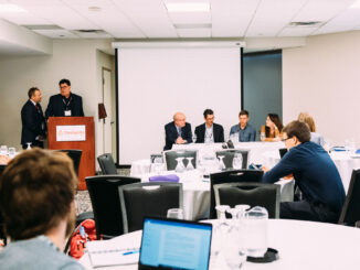
GoGeomatics Canada

GoGeomatics Canada’s Online Magazine is your source for the latest news in the Canadian geomatics sector. We publish articles about technology, projects, events, Canadian companies, and interviews with industry leaders. To submit an article to the GoGeomatics Magazine, please email your pitch to [email protected].
|||||
Technology

Your Canadian Geospatial Briefing for October 28th: Top 15 Largest Engineering Firms in Canada; Scanning the Earth with Lidar; A London Bar Uses Facial Recognition; Drone Delivery Canada and DSV Canada announcement; Canada’s Maritime Launch Services for C4M Upper Rocket Vehicle

Top 15 Largest Engineering Firms in Canada Canada has over 295,000 registered engineers in the country with an expected continuation in growth over the next few years. Here is a list of the top 15 […]

|||
Technology

Your International Geospatial Briefing for October 21st: How We Can Use Geospatial Tech for Good; AI: Cheat Sheet; In Chinese children’s film, anger grows over controversial map; What is openBIM and why is it important?; Making IoT More Intelligent with AI

How We Can Use Geospatial Tech for Good The winners of the most recent EthicalGEO Fellowship have been focusing on how geospatial tech and location data can be used for good, and not just targeted advertisement. The […]

|||||
Technology

Your Canadian Geospatial Briefing for October 15th: Indigenous Mapping Conference Offers New Skills; Launch of Institute for Earth and Space Exploration; Teranet & Nearmap Announce Partnership; N.B Municipalities Using Tech To Make Their Cities Smarter

Indigenous Mapping Conference Offers New Skills Last week was the 6thannual Indigenous Mapping Workshop. This year’s event was in Inuvik, N.W.T, and hosted 75 individuals from all over the globe. The purpose of this annual […]

|||
Technology

Your International Geospatial Briefing for October 8th: Geospatial tech makes human life easier; Core Instrument to Transforming a Country? Geospatial Data.; Historians Map Migrations with Geospatial Tech; MAXAR Develops for the U.S. Air Force

Geospatial tech makes human life easier During the national conference at the Punjab Remote Sensing Centre on Big Geospatial Data and Analytics, Modelling and Application (BiGMAP), many specialists took the time to discuss the influence […]

|||
Technology

Your International Geospatial Briefing for September 23rd: Geomatics institute in Zimbabwe engages youth in the field; Typography as a platform for smart cities and design; Research Project aims to build geospatial AI for landform detection

Geomatics institute in Zimbabwe engages youth in the field The president of the Zimbabwe Institute of Geomatics (ZIG) has recently stated in an interview that “the country has many professionals in the sector who are […]