
One of the highlights of GeoIgnite is back. The Canada Map and Poster Gallery returns to Ottawa this May, offering a unique window into the country’s geospatial creativity.
Attendees from past events have described the Gallery as a standout experience.
“The map gallery at last year’s conference was one of my favourite parts of the event.”
Kangkan Sarkar
Research Assistant, Carleton University
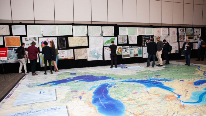
A shared space for Canada’s geospatial community
More than a curated display, the Gallery functions as a narrative space where maps and posters communicate research and lived realities across themes such as urban transformation, environmental change, and spatial relationships.
“The Canada Maps & Poster Gallery creates a shared space for the geospatial community to see itself. It brings together work from across Canada and makes visible how the field is contributing to real decisions and outcomes.”
Ted Mackinnon
Past President, Canadian Cartographic Association
Echoing that sense of identity and openness, Anusuya Datta from EarthDaily points to the Gallery’s Canadian approach.
“Having been to geospatial conferences around the world, what stands out here is how distinctly Canadian this program feels. It’s not just the content, it’s the way it comes together. There is a real openness in giving people at all levels a chance to show their work, and a volunteer effort behind it that reflects the collaborative nature of the community.”
Anusuya Datta
EarthDaily
Connecting maps to decision makers
Jonathan Murphy, Founder of GoGeomatics Canada, emphasizes the Gallery’s real-world relevance.
“Placing the gallery within GeoIgnite ensures that the work is seen by people shaping policy, programs, and investment decisions. It connects the conversation directly to real-world application.”
Jonathan Murphy
Founder, GoGeomatics Canada
For many attendees, the Gallery is a reason on its own to be at GeoIgnite.
Visit the Gallery without a full conference pass
The Canada Map and Poster Gallery is available through GeoIgnite’s Exhibition, Gallery and Networking Pass.
This pass provides access to the exhibition hall, the Canada Maps and Poster Gallery, the giant floor maps, refreshment breaks served in the exhibition hall, and networking areas.
Tuesday Exhibition, Gallery and Networking Pass: $225 CAD
Wednesday Exhibition, Gallery and Networking Pass: $175 CAD
This pass does not include access to plenary sessions, breakout sessions, the conference lunch, or full conference programming.
To compare conference passes and attendance options, read How to Attend GeoIgnite 2026.
Support from Canada’s academic community
That sustained enthusiasm is shared by leaders in academia as well.
Claus Rinner, Professor and Undergraduate Program Director in Geographic Analysis (Co-op) at Toronto Metropolitan University, and a top 2% Scientist for Geological and Geomatics Engineering, notes his continued support for the initiative.
“I’ve promoted the gallery once or twice in the past and am very happy to do this again.”
Claus Rinner
Professor and Undergraduate Program Director in Geographic Analysis (Co-op), Toronto Metropolitan University
His endorsement reflects the Gallery’s credibility within Canada’s academic and research communities, as well as its ongoing role in showcasing emerging and established geospatial work.
A place where ideas connect
For volunteers, the Gallery offers a vantage point on the geospatial field in motion. Seeing visitors engage with the maps and poster content, discuss insights, and share their perspectives captures the essence of the Gallery. It is a place where knowledge is explored, ideas spark, and connections are made.
As fellow volunteer Diego Álvarez reflects:
“This process has been a key opportunity to understand the dynamic landscape of Canadian geography, where the synergy between a robust public sector, managing the country’s vastness at every scale, and private technological innovation is driving fascinating new projects. It is truly inspiring to see how this integration of public state structures and private advancements is pushing the boundaries of geography across disciplines to empower Canadian society.”
Diego Álvarez
Volunteer, Canada Map and Poster Gallery
Whether you are a seasoned cartographer, a geospatial professional, or simply someone fascinated by the power of maps and geospatial tools, the Canada Map and Poster Gallery offers a compelling way to experience GeoIgnite 2026.
Attend GeoIgnite 2026 in Ottawa
GeoIgnite 2026 takes place May 11 to 13, 2026, in Ottawa.
Conference passes, student passes, faculty and instructor passes, and Exhibition, Gallery and Networking Passes are available through the registration page.


Be the first to comment