
GoGeomatics recently published a press release on the launch of the Esri Canada GIS Centres of Excellence in Higher Education. To get a better understanding of these new programs, we caught up with Dr. Brent Hall, Director of Education and Research at Esri Canada. His role at Esri is to foster growth and excellence in the use of GIS technology within the education and research communities.
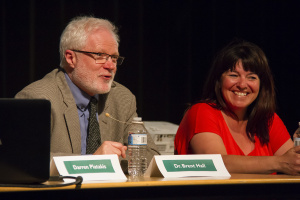
Prior to joining Esri Canada, Dr. Hall (pictured right) was Professor & Dean of the National School of Surveying at the University of Otago in New Zealand. He was previously Professor & Associate Dean of Computing in the Faculty of Environment at the University of Waterloo. He has published two books, numerous book chapters and over 60 international peer reviewed journal articles on aspects of GIS. He has also undertaken GIS projects in numerous countries, with a specific regional focus on Latin America and the Caribbean.
Read on for our full interview with Dr. Hall.
GoGeomatics: Hi Dr. Hall, thanks for taking the time to talk to GoGeomatics Canada. Please tell us about the Centres of Excellence in greater detail to give readers a practical understanding of what they will be like.
Dr. Hall: The word “centres” is used quite loosely in the sense that these are not physical, bricks and mortar entities. However, they may be attached to a specific faculty or academic department. They may also be housed in an existing GIS lab, or within an existing GIS research facility (such as a university GIS Centre). The specific configuration at each university depends largely on how each director decides to run their centre.
In general, the centres at each university are best understood as a network of academic faculty and senior students (i.e. people) on campus, potentially spread across multiple labs, departments and faculties, working on common interests in GIS teaching and research. The centres are managed by a director at each school and a management committee. The overall program is overseen by the directors and staff at Esri Canada.
GoGeomatics: Please describe the timeline of this project. When will the centres be launched?
Dr. Hall: The program was launched at the end of May this year (2014) when agreements were completed with each of the first seven participating institutions (comprising six initial ‘centres’ – the centre in Nova Scotia is run jointly between Dalhousie University and the NSCC – College of Geographic Sciences). The initial agreements are for two years from the time of signing. Over this time period we will add another two to three centres per year. Hence, by 2016 we hope to be working with a maximum of 12 centres. Each centre after two years will be able to extend for an additional two year period or to cease their participation in the program. If a centre opts out we will add a further centre in to keep a steady state of 12. This is a number we feel we can manage well with current staff.

GoGeomatics: When will the first students enroll, or graduate?
Dr. Hall: No students are “enrolled in the centres”, and nor are there any graduates. These centres support existing academic programs and do not introduce any new form of academic program or qualification at any of the participating universities. Hence, there is no process of admission or graduation and students participate in conjunction with a specific course/project or research need, as determined by participating professors.
GoGeomatics: How many students are expected?
Dr. Hall: As I mentioned before, these are not centres that seek to recruit students into a specific academic program that they will eventually graduate from. However, based on the number of participating students in an equivalent program run by Esri Inc., we would expect somewhere in the vicinity of up to a maximum of 30 participating students at each of the six centres by the end of the first two years of the program. A participating student in this context would be defined as a student who utilizes some form of support through the program.
GoGeomatics: Is this program modeled on a similar program either in Canada or abroad? If so, what has been the impact of that program?
Dr. Hall: Yes, it is modelled on the Esri Development Centre (EDC) program which is operated by Esri Inc. out of the United States. There are several differences between the EDC and Esri Canada Centres of Excellence programs, moreso in content than purpose. One of the objectives of this new program in Canada is to increase the level of engagement between Esri Canada and participating schools. There is also a centre of excellence program run by Esri UK, but its focus is on selected K-12 schools.
The Esri Inc. EDC program is reviewed annually and it is very well received by participating schools. It has provided the opportunity, especially, for small numbers of their students to attend annual gatherings such as the Esri Developer Summit in Palm Springs, and for a much larger number to become more engaged with advanced aspects of the Esri platform.
GoGeomatics: The goal of the Centre of Excellence program is to “encourage innovation in GIS research and promote teaching excellence in spatial data management and analysis in higher education across Canada.” How will those goals be achieved?
Dr. Hall: At the participating schools, initially, and then broadening the program in subsequent years, we hope to see an increased level of collaboration among senior undergraduate and graduate research students with the company (Esri) that is focused on new and innovative aspects of GIS technology. We hope to achieve greater familiarity of students with and comfort in use of the newer (Web, mobile, 3D) components of the Esri platform. We hope to see students graduating with an excellent working knowledge of enterprise-level GIS operations including the development of apps, GIS software customization via coding, and a sound knowledge of multi-user databases, among other things. If we achieve this goal by developing resources with the schools initially participating in the program, we can then make resources developed available to all schools.
GoGeomatics: Esri Canada is a private company. What role can industry play in contributing to education and career training, both now and in the future?
Dr. Hall: Industry has traditionally supported higher education by funding scientific research chairs as well as research-focused buildings and even general-purpose education buildings that can be found at basically every university in Canada. Beyond these high expense, high profile investments in people and infrastructure by very large companies and very wealthy individuals, small to medium sized companies such as Esri Canada can also contribute to education in multiple, but lower profile ways. For example, since virtually all universities and many colleges in the country use Esri software in their teaching programs, we support this by developing freely available tutorial-based lab packs with data that professors and students can access and work through to improve their software skills. These lab packs focus on tasks such as coding in Python and R, advanced spatial analysis, LiDAR data processing, Web mapping using JavaScript, and geodatabases from simple use cases to enterprise-level database use, with more planned in the future.

In addition, we are very active in supporting K-12 GIS education across the country with the goal of introducing young Canadians to spatial thinking and problem solving with GIS prior to their arrival at university of college. After graduation, the company has an Associate program that hires recent graduates for an 18 month internship, which has a very high retention rate. We also support students by providing scholarships at close to 60 universities and colleges across the country. Hence, Esri Canada contributes in numerous ways that seek to promote and support GIS education and thereby help to future proof the viability of the Canadian spatial information industry.
GoGeomatics: What are the benefits of this collaboration to students and academic institutions? What are the benefits to Esri?
Dr. Hall: This question is perhaps be best answered by students and profs after the first year of the program. The benefits to Esri are that it allows us to work closely with a small group of universities and one college that we have pre-existing ties with. We hope to discover issues and solutions that will improve student knowledge and use of GIS technology, and also to be able to gain knowledge about new and interesting research fields that by ourselves we do not have the time or personnel to explore. Participation in university-based research projects, such as the six year GeoThink project at McGill University (geothink.ca) allows us to become involved in a very hands-on way with research topics, such as the nature and role of open data and open governance and associated issues such as privacy in Canadian society. In this context, there is a comfortable mutual learning experience between the academic participants and industry. This is mutual learning process is to everyone’s advantage.
GoGeomatics: How will the Centres of Excellence promote GIS to K-12 students? Would Esri consider starting “Centres of Excellence” in schools at the K-12 level in the future?
Dr. Hall: One of the things we expect staff and students at each of the centres to do is to interact with students from local area schools (especially Grades 7 – 12). This will be a particular focus on GIS day each year, but at other times during the year we will encourage profs to bring Grade 12 students (not only in Geography, but in other subjects also) in to attend a class or interact with university students in a lab. We will also encourage students to spend a period of service by visiting a local area school and explaining what GIS is to students.
The idea of centres of excellence at k-12 schools is very good one, and something we have discussed. As noted above, Esri UK has one such program (currently with 6 participating schools – all private). In Canada we currently have a grant program open to K-12 schools, through which a teacher can apply to and, if successful, receive an allocation of ArcGIS Online credits for teaching use as well as Esri staff time for setup and mentoring the teacher through introductory lessons available through our lesson planner Web site (esri.ac/lessonplanner). So, yes, a complementary K-12 program is something that we will consider in the future.

GoGeomatics: How will this program be funded?
Dr. Hall: There are no financial disbursements from Esri Canada to any of the participating schools and any external grant money jointly applied for and awarded is spent exclusively on university-based research. Such grants that fund collaborative research with participating schools have and will continue to be sourced from Canadian government programs such as NSERC, SSHRC, CFI, Mitacs, and others. In these grants the typical contribution of Esri Canada is with in-kind staff support to support the activities of researchers and students. Very occasionally the company will support grant applications through a student stipend such as a co-op work term or a Mitacs scholarship. However, this level of assistance is not limited to the participating centres of excellence. Esri Canada participates in such relationships with many universities in Canada.
GoGeomatics: How do you see the future of geomatics and GIS in Canada?
Dr. Hall: This is a very open-ended question that could consume at least an article in its own right! In general, the future of geomatics and GIS in Canada continues to be very viable. Most students graduating from university with a GIS-centred focus or specialisation in their academic courses continue to find relevant jobs on graduating. Canada is especially well endowed with some excellent training colleges that span the nation geographically and offer post-graduation specialties to students wishing to achieve higher levels of technical competence prior to entering the workforce. In general, the success rate of graduates from these colleges is high, and there are no signs of any significant downturns that we are aware of.
However, there are distinct regional variances in the ability of some university and college geomatics/GIS programs to attract new students, and with universality in the overall number of universities and colleges that offer courses on GIS in undergrad curricula, some schools have sought to enhance their attractiveness to students by adding content or specializations that are intended to make their programs more attractive. Relative to even to a decade ago, there are now far more schools offering GIS/geomatics specialist certificates or diplomas in addition to an academic degree, as well as specialist degrees, which suggests that the education ‘market’ for geomatics/GIS may be close to becoming saturated with options. Hence, the need for schools to stay current and relevant with respect to courses and their content is relatively more important now than in the past. Overall this is good, as competition drives innovation and, without sacrificing quality in content, Canadian students are assured of receiving an education in this field that is second to none internationally. Canadian graduates in geomatics/GIS continue to be attractive to US and European companies because of the reputation of the education in this country. As use of the software continues to infiltrate new markets and new uses, the future seems promising for students choosing to focus on this area in their higher education career.


Be the first to comment