Easing the Aerial-to-CAD Bottleneck
Data capture is getting easier and faster, but the subsequent step of CAD linework generation is a bottleneck, and even more so with the present shortage of qualified drafters. AI is stepping in to help.
In 2017, the co-founders of what would become AirWorks Solutions Inc. first met and began discussing ideas for a new geospatial venture. Both had been successful entrepreneurs, and had combined backgrounds in aviation, aerial mapping, construction, and UAS. The focus turned to the rapid growth in aerial mapping, how to manage the data in a way that could best serve markets like construction and surveying, and where their expertise could have the most impact. The key question was: “Where do we see the biggest bottlenecks in this whole process?”

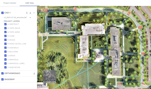
An as-built with 12 featrures classes (plus topography) chosen by a customer for automated CAD extraction from an orthomosaic.
A Matter of Recognition
“One of the biggest bottlenecks we recognized is the completion of the CAD files; creating vectors over the raster images and/or from LiDAR,” says David Morczinek, co-founder, and CEO of AirWorks. Morczinek had previously worked in aviation, with key roles at Airbus, and had also enrolled in the Sloan School of Management at the Massachusetts Institute of Technology (MIT). “While at MIT, I heard a lot of hype around how self-driving vehicles leverage computer vision to help them with obstacle avoidance. They look at the world as they drive and identify say, a curb, I don’t want the car to drive on the curb or hit a light post, or a person.” These examples of automated feature recognition provided a lightbulb moment.
“So, we said, surveyors and engineers, they want to know almost the same thing,” says Morczinek. “They want to know where edge of road is, back of curb, sidewalk, and buildings, in almost the same way, but in a different form. Morczinek teamed up with Adam Kersnowski, co-founder, and Chief Evangelist at AirWorks. Then they enlisted someone else at MIT to help them write their first algorithm. That algorithm allowed them to take an ortho image from a drone and extract a building footprint and edge of road. That got enough people excited, and they raised capital to start the company. They then we went into the development of algorithms to extract many more feature classes.

David Morczinek, co-founder, and CEO of AirWorks
Managing the Data Funnel
Capturing the data—aerial orthophotos and LiDAR—is now relatively easy and inexpensive. Such technology is no longer just the in hands of large firms and entities. Now many small surveying firms have drone programs. The platforms, sensors, flight execution and processing software are so affordable, that just about anyone with an FAA Part 107 certification can capture tens of square kilometers of images/LiDAR in a single day. The problem then becomes too much data, and how to turn it into useable end products, like 2D and 3D CAD drawings and models. Throwing more drafting time at the bottleneck can be costly and time consuming. And presently, firms are having trouble finding enough qualified drafters. AirWorks primary goal was to automate the extraction process.
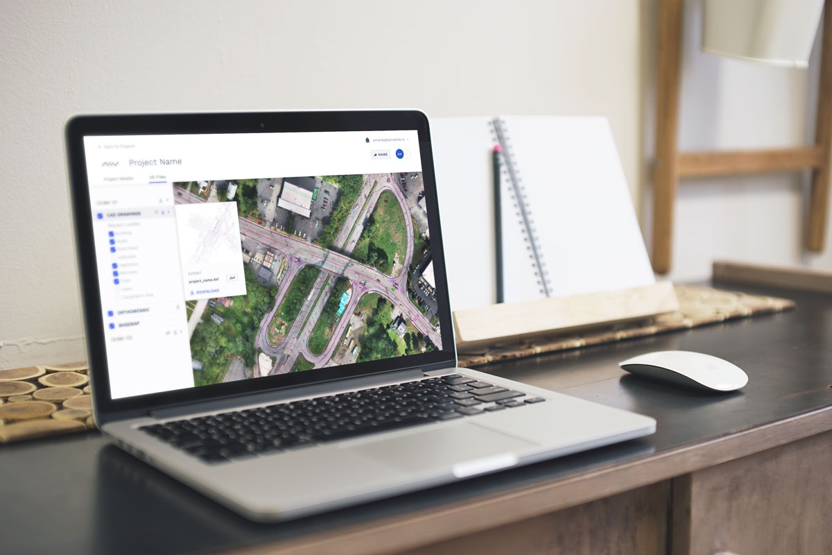
Their flagship product is AirWorks Automate. This extracts to CAD, a high percentage of the expected linework—usually around 85%—in the cloud as a service. The remaining linework can be resolved manually by the client, or as most customers chose, have it done by AirWorks. We’ll look deeper into the automation process below. Another popular product is AirWorks CAD, an online hands-on drafting tool that can be used to, for instance, clean up the AI extracted linework, or do manual heads-up drafting of items the AI did not catch.
Customers—surveyors especially—would be most interested in knowing how accurate and precise the automated process is; so AirWorks deliberately focused development for high-resolution applications. I have seen several automation services that do feature extraction for low-resolution applications like asset management and GIS theme building but this solution piqued my interest as it focuses on survey-grade outcomes.
Processing, Precision, and Accuracy
“We run vertical and horizontal assessments with RMSE reports,” says Kersnowski, who has a construction and UAS business background. “The Root Mean Square Error (RMSE) is the standard deviation of the residuals (prediction errors); that is where accuracy is established. We look at it from a quality standpoint. So, when somebody gives us a data set that has half an inch per pixel resolution, that is in alignment with survey grade accuracies. That doesn’t mean we can’t process lower resolution data; it’s just not going to be survey grade.” The client can provide ground checks shots to build out an RSME report.

Adam Kersnowski, co-founder, and Chief Evangelist at AirWorks
“One of our strategies as a company is that you can down sample resolutions,” says Kersnowski. “Meaning I can take a half inch resolution image and I can down sample that to mimic three inch or six inch, but you cannot go the opposite direction.” So, if you are capturing three-inch resolution and say looking at extracting impervious surfaces—edge of buildings, edge of roads—it’s only going to be as good as the resolution of that imagery set. One can always capture at higher resolutions and sample down to lower for appropriate applications.
High-resolution data is the way their feature recognition models are trained. “The labeling step on that training data is the actual hardest part of the entire process,” Morczinek says. “We almost think of the client deliverable as a byproduct of our training data. That is the most time consuming and costly part of training AI for this automation. So, what we’ve done is create a big data model with high-resolution imagery.” As they process more, the training model grows, and the AI learns and improves as more diverse data is fed into the model over time.
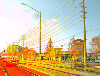
Presently, AirWorks solution is primarily computer vision based. “If you were to ask me, what is the best dataset to bring into our platform, to have the most robust sort of data, that would be photogrammetry,” says Morczinek. “We love orthomosaics, and we get color—RGB. And a point cloud from photogrammetry. But where that fails is that you’re mainly just getting the tops of features. That’s where a point cloud from LIDAR, really helps.” They rely more on the photogrammetric point cloud because it has color to it. But they also have customers who are merging LiDAR point clouds with RGB images point clouds. Kersnowski say that is going to be more of the pathway forward, where they will further train models and algorithms for feature extraction. Merged points clouds, and point clouds from other sources, like street-level LiDAR, could only boost the utility of this service, and AirWorks is open to working with those. Think about mobile mapping systems, backpack data capture units, scanning total stations, and even street-level-LiDAR-on-demand—there are definitely some interesting possibilities ahead.
The Automation Step
As noted, their online automation step extracts about 85% of the desired features, and the customer can then fill in the gap with their own drafters, or as most customers choose, AirWorks uses humans in the loop for QA/QC and to add additional features manually. You subscribe to the service, purchase an appropriate number of credits, and upload your data. Note that the geo-registration of the data is up to the customer, to ensure the resultant CAD drawings or models are output in the desire reference framework (e.g., datum and projection).
“We extract any feature classes. We currently offer 14 classes automatically (with AI),” says Kersnowski. “Other feature classes can be added added manually, but we will also further automate that process in the near future.”
The customer goes through a checkout process, where they get to select the different bundle types,” says Kersnowski. “So, if we’re just doing 2D, they would select that. If they’re doing 2D and topography, they would select that bundle, or just topography.” They now have a new bundle called “feature elevation”, so that any linework can have elevation. You choose the area you want extracted to CAD or upload a KML of the area.
Depending on how you purchased your license and what processing and output options you choose, you’d get a different cost per acre. “We sell our subscription by the year,” says Kersnowski. “Some of our clients buy 300 acres for the year because they’re a smaller company. And some of our clients buy thousands or tens of thousands of acres for the year, and the cost per acre is different. With the 300-acre package it would be the mid-to-high $30s per acre. For a 10,000-acre package it starts to drop down into teens per acre—an economy of scale.” For one example project I looked at, 22 acres came in at $660.
Humans in the Loop
If you have chosen for AirWorks to draft the remaining elements that the automation did not catch, this produces the QC version of that data set. This is done by their engineers in Boston. While the automation step may only take hours to process, there is a queue for the QC step. Presently, with demand high, this may be several days.
In the sample datasets, I noticed clearly defined areas of “no data”. This is reassuring that they are not simply going to extrapolate or project into areas where there is no source data, or where the data cannot meet high confidence levels, like under heavy tree canopy. The no-data areas are delineated, and contours cut off. Depending on the quality of source data, and how well the vegetation features can be stripped down to the ground, there may not be many of these areas. Such areas can be identified as places where the customer might want a surveyor to go back and to do terrestrial in-fill.
With the high demand in mind, AirWorks would like to encourage customers to do more of their own drafting of the remaining features. Either in their own CAD software, or AirWorks CAD, that runs in the cloud and can be accessed by a whole team. I looked at data from some of their customers, to see how well the linework lined up with the image. Features like top of curb, edge of sidewalk, etc., lined up to 1-2 pixels. The topography formed along logical break lines, with few ambiguities for the QC step to have to deal with.

A popular application for this automation service is for surveyors doing assured sitemaps, like ALTA Surveys common in the U.S.
Prime Applications
Their customer base spans several sectors of AEC. There are as-built surveys of existing sites for design of new structures. Then there are post-construction as-builts. They have customers who are doing design and permits for adding fiber to existing suburbs, others doing impervious surface delineation to compute drainage surcharges, and many more applications. But with surveyors in mind, I looked at datasets from customers doing land title surveys, which are a type of assured site map.
In the U.S., this is often an ALTA survey. Founded over a century ago, the American Land Title Association is a national trade association representing thousands of title insurance companies, title and settlement agents, independent abstracters, title searchers and real estate attorneys. A lender may require an ALTA survey, which is a detailed land parcel map, showing all existing improvements, utilities, and significant observations within subject property. The survey also details the licensed surveyor’s findings concerning the property boundaries and how they relate to the title. There are published, high-accuracy standards.
Many surveyors have been flying the sites with UAS and doing heads-up drafting for many of the subject features. There will always be some terrestrial survey needed, especially for the boundary elements and other select features, but the efficiency that imaging and LiDAR brings makes it an attractive addition. Some of AirWorks most frequent customers are surveying firms that do large site, and/or high volumes of ALTA surveys. Looking at some outputs AirWorks produced for customers doing ALTA surveys was quite impressive.
If one can get 85% of the drafting done at such prices per acre, before manual heads-up drafting cleanup, and with a finished product of this quality, I can certainly see why this type of automation service has generated great appeal.


