
- Industrial logging expansion and the end of roadless protection
- The data bottleneck for physical AI
- Open source satellite damage mapping in conflict zones
- Blue Marble and Avenza connect field and office workflows
- Mapping and naming sea forests to bring them into policy
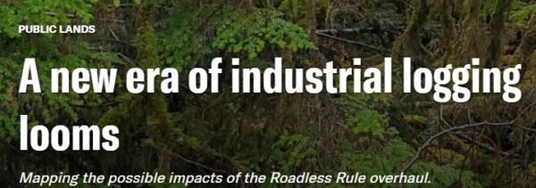
Industrial logging expansion and the end of roadless protection
A major policy shift in the United States is moving toward opening tens of millions of acres of previously protected forest to logging through accelerated regulatory and administrative changes. For the geospatial community, this is a clear reminder that maps are not neutral. They define what is protected, what is available for development, and how quickly those boundaries can change. The story also highlights the growing importance of geospatial monitoring in tracking land use change, water systems, biodiversity, and infrastructure expansion. While this is a United States example, the same pressures exist in Canada across forestry, resource development, and Indigenous land stewardship, where mapping plays a central role in decision making.
If policy decisions can rapidly redefine what is protected land, how should geospatial professionals contribute to transparency and accountability in those changes?

The data bottleneck for physical AI
As AI systems move into the physical world, the limiting factor is no longer computing power but access to large volumes of structured real world data. This includes imagery, sensor feeds, terrain, and environmental context collected across a wide range of conditions. The cost and complexity of gathering this data at scale is forcing companies to turn toward synthetic data to fill gaps and accelerate development. For the geospatial sector, this is a fundamental shift. Spatial data is no longer just used for analysis after the fact. It is becoming a core input required for AI systems to function. In Canada, this raises important questions about how national scale physical data is collected, governed, and maintained across sectors such as transportation, defence, and infrastructure.
If AI systems depend on structured representations of the physical world, who is responsible for building and maintaining that data layer in Canada?
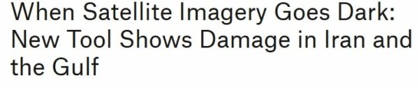
Open source satellite damage mapping in conflict zones
A new tool developed by Bellingcat demonstrates how open satellite data can be used to estimate damage in conflict zones when access to commercial imagery is limited. Using radar data from Sentinel satellites and comparing it against historical baselines, the system identifies changes in the built environment that may indicate destruction. What is notable is not just the application, but the method. A relatively simple statistical approach combined with open data is producing results that are operationally useful. This points to a broader shift where geospatial intelligence is becoming more accessible and less dependent on expensive proprietary sources. Similar approaches could be applied in Canada for wildfire monitoring, northern infrastructure assessment, and disaster response in areas where data access is limited.
If high value geospatial intelligence can be produced using open data and simple methods, how should national agencies and commercial providers adapt their role?
Blue Marble and Avenza connect field and office workflows
The integration of Blue Marble and Avenza platforms signals a shift toward continuous geospatial workflows that connect field data collection directly with office based analysis. By linking mobile mapping, offline data capture, and desktop processing tools into a single environment, the gap between field and office is being reduced. This reflects a broader move in the industry toward operational systems where data is collected, processed, and used in near real time. For Canadian practitioners working in remote environments, infrastructure projects, and natural resource sectors, this has direct implications for how work is organized and delivered. The emphasis is moving from isolated projects toward persistent data environments that support ongoing decision making.
As geospatial work becomes continuous and field integrated, how should organizations rethink their workflows, staffing, and technology choices?
Mapping and naming sea forests to bring them into policy
An initiative to map and name previously unrecognized underwater ecosystems highlights an important principle in geospatial work. If something is not named, mapped, and structured, it is unlikely to be included in policy or decision making. By creating a unified dataset and assigning identities to these sea forests, the project is moving them from fragmented data into recognized environmental assets. This has broader relevance for Canada, where large areas of ecological and cultural importance remain inconsistently mapped or integrated into national systems. The story underscores the role of geospatial professionals in turning data into recognized entities that can influence conservation, funding, and governance.
What important environmental or cultural assets in Canada remain effectively invisible because they are not consistently mapped or defined within our systems?


Be the first to comment