Cet article est aussi disponible en français.
This article is the 2nd part of GIS Open Source versioning tool for a multi-user Distributed Environment and it is an interview of certain stakeholders involved in this versioning open source development.
A- Interview with Dami Sonoiki, GIS Department Manager and Samuel Aiyeoribe, Lead GIS Architect at eHealth Africa in Kano Nigeria.
1- What projects and workflow in eHealth Africa is this FOSS4G tool being used for within your GIS Team?
One of our largest data management platforms is the Geospatial Database dedicated for our National Polio program support. The data is used to support Polio Vaccination Campaigns in Northern Nigeria to ensure maximum vaccination coverage during every round of campaign.
 Thus, the database must be kept up to date with the latest available geospatial data. This always requires having multiple staff processing geospatial data from multiple locations. Hence this is a good use case for the plugin. The plugin is also currently being used to manage geospatial data among multiple countries where eHA operates. This has helped simplify workflow, improved efficiency and increased data integrity.
Furthermore, we use the QGIS Versioning plugin to manage our Health Facility Database.
2- What did you see as the next development of such QGIS versioning plugin?
It will be great to develop and enable spatial filtering when using the PostGIS checkout. This is currently possible with SpatiaLite checkout, but it will be great if this can be the next phase for PostGIS checkout.
In addition to the above, the possibility to implement a PostGIS checkout (offline form the source DB) to another PostgreSQL/PostGIS instance will be a good plugin upgrade.
3- Why did eHA decide to use and develop using FOSS4G tools for some of its GIS projects?
Over the years, our health programmes have grown from dealing with various partners to offering support and technology transfer to government agencies. One major area we needed to consider was long term sustainability with respect to recurring cost of software licensing. FOSS4G tools looked promising option for cutting down cost while retaining system functionalities.
 Like every technology and platform, FOSS4G has its own peculiar challenge, for example getting the needed application support on time. But today these challenges have offered new frontiers for organisations like Boundless, Oslandia, etc. Where these challenges became opportunity for organisation like eHealth Africa is that more funds are freed-up from paid licenses and channelled to staff training. Staff are now better equipped and well grounded to deal with challenges FOSS4G can bring.
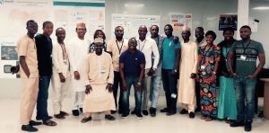
Recently, eHealth Africa GIS Team of over 20 staff were trained by a UK based organisation using Boundless module on QGIS, PostgreSQL/PostGIS and Geoserver.

4- Why did eHA decide to use and push data updates to OpenStreetMap?
Over the course of implementing and updating the Polio Geospatial Database, we discovered that the huge data we have collected and processed can be consumed by other agencies like NGOs, government agency and the public. We also thought of the best means people can make use of it freely without any copyright limitation. The best platform to achieve this was the OpenStreetMap (OSM) platform.

We decided that the platform will be a great avenue to create and produce critical geospatial data and having great GIS expertise. We decided in addition to the features we uploaded to digitise Nigeria road network which powers a lot of public health and humanitarian response in Nigeria. As of today, eHealth Africa has mapped and contributed over 60% of digitised road network Nigeria data on OSM.
B- Interview with Yves Moisan, freelancer Python Developer
1- Why you think the QGIS versioning plugin and its recent technical development make it easy to use and support?
Form a developer’s point of view, the QGIS plugin system is both mature and well documented. It rests on the Qt library, which is also well documented.
![]() The Python bindings to Qt are so good that even looking at Qt C++ examples helped with the Python code !
The Python bindings to Qt are so good that even looking at Qt C++ examples helped with the Python code !
2- What advantages does open source development have over other proprietary solutions in the market?
Enhancing the plugin’s original functionality for eHA was a very interesting project for me. Building on open source code, not only, helped me find resources, but also strengthened my sense of community. The ease with which one can organise one’s development environment is also a characteristic of open source software. I could install the QGIS code base for any version from GitHub, compile locally and develop the plugin against that version of QGIS. Just download, no fuss. Very empowering.


Be the first to comment