Creating a new GIS from scratch is a tough undertaking. It involves a lot of innovation. Ecere, a Canadian company based in Gatineau, Québec has been developing a software platform that has positioned them to do just that.
This article is third in a series of three in which we interview Ecere’s Chief Technology Officer, Jérôme St-Louis.
GoGeomatics: What are the characteristics of the GNOSIS SDK, which distinguish it from other geomatics 3D visualization software such as ESRI’s ArcGIS Globe?
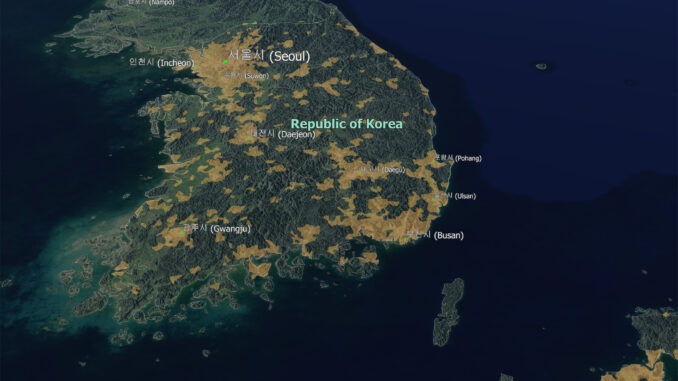
Jérôme St-Louis: The GNOSIS SDK has been developed with optimal performance in mind. This can be achieved by using the GPU for graphics acceleration as well as the optimization potential for native compiled applications. Another aspect that guarantees constant performance is our multi-resolution pyramidal tiling system, which applies to both raster and vector data as well as to elevation models.
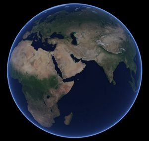
This tiling system also comprises features which are adapted to the polar zones, taking into account that the same longitude difference corresponds to a smaller distance approaching the poles. This is distinguished, among other things, from the tiling grids used for example on the web with the Web Mercator projection. Our grid is better suited to 3D viewing on a globe, and requires less information to be transmitted and stored when the data is standardized in latitude / longitude (EPSG-4326 / WGS-84). This uniformity of the presented data, once processed, facilitates and accelerates the projection in real time, and a view with GNOSIS can easily pass from one projection to another, including the 3D globe and map projections. A meridian of origin may, in particular, be modified dynamically.
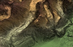
Another innovative aspect of GNOSIS is its 3D terrain engine which performs real-time optimization of the mesh from an elevation model. The level of triangulation is automatically increased where the terrain is more rugged, and the level of detail can be adjusted according to the capabilities of the material. This makes it possible to balance the ideal performance with adequate rendering, as well as minimize the use of resources.
GNOSIS also includes highly flexible cascading styling features that allow you to adjust presentation and symbology from map attribute data or dynamic data from real-time sensors. These features include an advanced labeling algorithm.
The multi-platform aspect is also very important. An application developed using GNOSIS can be automatically deployed to multiple desktop, mobile, and web platforms by writing a single version of the source code. In addition, our tools are highly interoperable and can be used in several programming languages, in conjunction with our GUI toolkit or with another cross-platform toolkit such as Qt. Data can be easily exchanged between GNOSIS, other platforms such as ESRI products and open source products such as QGIS.
We also offer support for processing and viewing from drones in the form of point clouds. Again we aim to distinguish ourselves by the speed of processing as well as the resulting quality.
Finally, we offer our services at a competitive price. We aim to achieve a high level of satisfaction of our customers thanks to the more personalized service that we are able to offer. We are a small local company established here in Québec / Canada, where we also carry out all R&D.
GoGeomatics: What type of people are you looking to bring into your team to help achieve your goals?
Jérôme St-Louis: Since we are primarily a software development firm, in the future we are mainly planning on hiring additional software developers. In addition to computer science, software engineering, and computer graphics background, additional experience in Geographical Information Systems, geomatics as well as within specific industries where geomatics is being applied is a valuable assets for potential candidates. Depending on the direction our service offering will take, we might be looking to bring on board cartographers and GIS analysts as well.
In order to bolster the adoption of our tools, we hope to establish strong strategic partnerships with important players in the GIS industry, with the open-source geospatial community, as well as with educational institutes.
GoGeomatics: Looking back, what advice would you give geomatics professionals who want to develop new geomatics software?
Jérôme St-Louis: I would encourage them to research the state of the current technology, as well as the tools that can help them or components such as open-source libraries that they could take advantage of in order to achieve their goals more quickly.
I would recommend that they set their goals well, as well as the areas where they want and are able to innovate. They will then be able to invest their resources and energy to ensure that they develop advanced technology.
They should plan the stages of development by attempting to establish a realistic schedule with ample contingency so that their project is successful.
Collaboration with technology companies such as ours can also be interesting, for example by developing plug-ins that can integrate with existing geomatics tools while providing functionality specific to certain application domains.
Finally, I would encourage them to learn more about the many funding programs available here at all levels of government, such as tax credits for Scientific Research and Experimental Development (SR&ED), and the Industrial Research Assistance Program of the National Research Center of Canada (NRC-IRAP)
GoGeomatics wants to thank Jérôme for talking to us about GNOSIS and the challenges of developing a new geomatics software suite.

Ecere Corporation offers a comprehensive suite of geospatial software including a cross-platform visualization API capable of both 3D and cartographic real-time projection, a GIS tool for styling, processing and publishing maps, as well as a map server.
GNOSIS (http://ecere.ca/gnosis/) is particularly well suited for real time visualization of large scale data sets at varying levels of details, and the real time 3D visualization of elevation models with draped raster imagery or vector data.
The product is highly optimized to achieve optimal performance, and is capable of rendering both map data as well as tracked objects, applying dynamic styles and symbology, while easily keeping up with frequent updates.
Ecere also provides the open-source Ecere SDK, featuring a cross-platform GUI toolkit, an IDE, and the eC programming language (http://ec-lang.org/).

Image Credits:
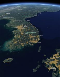
All images Copyright (c) Ecere Corporation, rendered by Ecere Corporation’s GNOSIS technology
1. Korea Globe View
Blue Marble Next Generation — Reto Stöckli, NASA Earth Observatory
Population area, Cities — NaturalEarthData.com
Elevation Data — Jonathan de Ferranti (viewfinderpanoramas.org) partly from Shuttle Radar Topography Mission
2. Alaska Elevation Data
3. Blue Marble Next Generation + View Finder Panoramas




Be the first to comment