Technology
Open Data Portals and Geomatics: The Polar Data Catalogue
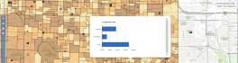
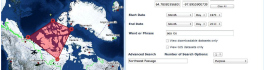
The growing interest in providing open data access has long been integrated into the field of Geomatics. However, the use of Geomatics within open data portals is relatively uncommon. This inclusion provides an interactive and […]