
Technology
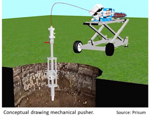
The LGM-2 Live Gas Pipe Mapping System
Can you imagine a mapping probe entering a live 2” utility pipe through a standard vertical hot tap? Well, you…
Canadian Geospatial Briefing May 10th: Developing Tools to Protect Canada’s Biodiversity; Tracking impact of industrial projects on B.C. species at risk; 3D satellite mapping shows that glaciers are melting faster than ever; Geospatial Maturity Index shows that Calgary is a leader in GIS programs; Community engagement to measure impact of climate change on coastal environments in the Estuary and Gulf of St Lawrence; Surprising locations in Canada that have seen the largest increase in house prices
Carleton and Partners Developing Tools to Protect Canada’s Biodiversity Dr. Joseph Bennett, a biology professor at Carleton University and his…

International Geospatial Briefing May 3: Growing problem of deepfake satellite images; Bird migration map shows huge influx into Michigan; Google Earth timelapse visualizes human footprint; Remote Sensing to study chimoanzees; Mapping of childhood undernutrition in India
False satellite images created by machine learning raise concerns about the reliability of data AI technologies has been used to…
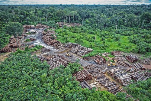
How Remote Sensing Applications Will Help Put a Price on Carbon
Quantifying our Resources Advances in remote sensing are pushing forward our abilities to quantify natural resources. As satellites improve, offering…
6 Reasons Why Data Scientists Choose SafeGraph Data
This was republished from an original post on safegraph.com: 6 Reasons Why Data Scientists Choose SafeGraph Data SafeGraph’s laser focus…
5G Roll Out: An Unprecedented Backbone Challenge
All 5G roll out forecasts point in the same direction: a vast increase of backbone fiber optics will be required…
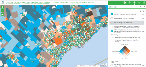
Canadian Geospatial Briefing April 26th: Ontario COVID-19 Vaccine Pharmacy Locator; 5G drones fly over UBC; AI & remote sensing for future Lac à Paul tailings dam; UBC prof uses Sim City-like program to map disease paths; Remote sensing map of Canada’s first highway to the Arctic
UWindsor researcher maps which Windsor neighbourhoods need help accessing vaccines Research by Carina Luo, a geospatial data analyst at the…
Got a Drone – Now What? Mapping with your UAV
Got a Drone – Now What? Mapping with your UAV It was inevitable that the proliferation of drone technology would…
INSITE Lifecycle Project Tracker Enables & Delivers Real-Time Data Updates
When conducting Lidar surveys, efficiency and success are determined to a degree by conditions outside of the surveyors’ control. The…
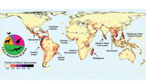
International Geospatial Briefing April 19th: Wyoming Mapping Project Helps Identify Important Habitats; Map of the Mafia Gives Deeper Insights into Former Operations; Animated Map Shows History of Earthquakes and Tsunamis Around the World; OGC API Allows Vector Data Transmission in Any Coordinate Reference System; Interactive Map Could Help Scientists Discover Previously Unknown Species
New Wyoming Mapping Project Helps Identify Important Habitats for Protection A new mapping project by the Wyoming Game and Fish…

Progress in Addressing GPS/GNSS Vulnerabilities
An overreliance on GPS/GNSS for positioning, navigation and timing applications underscores key vulnerabilities. Defense, security, safety, commerce, and critical infrastructure…

How Deploy Solutions can help bridge the communications gap in times of climate change crisis
Our Changing Climate The world we live in is changing, with global warming reshaping climate and causing more frequent, more…
