Technology
Mineral Exploration in Brazil with AI… the story behind the Map
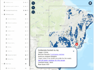
Since the days of the first Gold Rush, when a prospector would head off into the bush with a shovel, a gold pan, and a compass, maps have played an essential role in mineral exploration. […]