analysis

Google Earth Engine – What is a Data Cube and Why Canadians Should Care

What is a data cube and how is it used for big data analytics?  How does a data cube work…

CANMAP, and SHIFTing gears at COGS

At the end of last month, John Wian hosted the Annual General Meeting (AGM) of the CANMAP Research Institute in…

QGIS: Performing Viewshed Analysis on Archaeological Sites

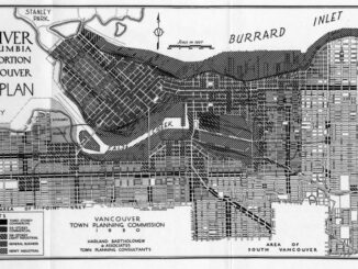
In 1927 a Vancouver bylaw was enacted that limited the height of buildings to a maximum of six stories in…

My COGS GIS Education, Part II

In my first article, I introduced the how and why I chose to attend COGS from the fall of 2014…

Remote Sensing QGIS: Semi-Automatic-Classification Plugin (SCP)

Semi-Automatic Classification Plugin   Today I’m going to take a quick look at one of the remote sensing plugins for…

Top Ten Climate Change Maps and GIS Applications

Awareness for climate change has been steadily increasing ever since the Green Revolution in the 1960s. There is a plethora…

Tim Webster and his Applied Geomatics Research Group (AGRG) team in Halifax, Nova Scotia

Tim Webster: Interview about Past, Present, & Future: Applied Geomatics Research Group

Dr. Tim Webster, is a renowned research scientist with the Applied Geomatics Research Group (AGRG) in Middleton, Nova Scotia. He is…

Esri Canada Community Maps Program: Why more communities need to take advantage of this

The Community Maps Program (CMP) was introduced by Esri Canada in 2009 allowing organizations to share and host geographic data. …

UBC Unveils New Masters of Geomatics for Environmental Management

The UBC Faculty of Forestry is excited to announce that the official approval of the Master of Geomatics for Environmental Management…

Geospatial Earth Observation Using Blimps, Balloons and Kites

These days drones are all the rage. Nevertheless, there are other ways to collect data from the sky! Blimps, balloons and kites…

Software Development – The Key to Ecere’s Success

It is rare to learn of a GIS company in which much R&D is done up front to create the…

The Integrated Cadastral Information (ICI) Society and ParcelMap BC

This is the first of two articles on the release of ParcelMap BC Data, which we see as a significant…