Atlantic Canada

Your Canadian Geospatial Briefing for October 16th: #DontLetGoCanada; Australia + UK + Canadian Space Agency; Fogo Island; Alberta UAVs; Climate change impacts Atlantic Canada

Join #Don’tLetGoCanada to preserve our space legacy!  Canada has long been a leader in space robotics and science, Earth observation,…

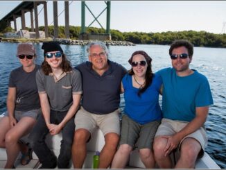
Tim Webster and his Applied Geomatics Research Group (AGRG) team in Halifax, Nova Scotia

Tim Webster: Interview about Past, Present, & Future: Applied Geomatics Research Group

Dr. Tim Webster, is a renowned research scientist with the Applied Geomatics Research Group (AGRG) in Middleton, Nova Scotia. He is…

High Resolution Mapping Along the Coastal Zone Workshop

Event Recap: COGS & CIG & GANS Cooperate for Mapping Workshop

The Canadian Institute of Geomatics (CIG) Nova Scotia Branch and the Geomatics Association of Nova Scotia (GANS), two regional professional organizations that foster the application of geographic information within the geomatics sector recently collaborated to host a high resolution mapping workshop at the Centre of Geographic Sciences (COGS) in Lawrencetown, Nova Scotia.

High Resolution Mapping Along the Coastal Zone - https://geomatics.one

Atlantic Canada: COGS: Geomatics Professionals Coming to Discuss High Resolution Coastal Mapping

High Resolution Coastal Zone Mapping This collaborative effort by GANS & the CIG will engage the geospatial community & increase awareness on the value…

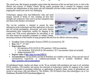
Feb 7-8: Two Day Workshop on High Resolution Mapping Along Coastal Zones

The coastal zone, that dynamic geographic region where the interaction of the sea and land occurs, is vital to the…

High Resolution Mapping Along the Coastal Zone: CIG & GANS Workshop 7 – 8 February 2017

The Geomatics Association of Nova Scotia (GANS) and the Canadian Institute of Geomatics (CIG) Nova Scotia Chapter would like to…

CIG Advancements in Geomatics 2016 Conference in New Brunswick Sept 26th-28th

Advancements in Geomatics – Research and Collaboration for Informed Decisions in a Changing World The Canadian Institute of Geomatics (CIG)…

Geomatics Atlantic 2016: Call for Presentations By June 30th

Call for Presentations It gives me great pleasure to announce that the Canadian Institute of Geomatics – New Brunswick Branch…

Canadian Government Supports Advanced Geomatics Research

Leading Edge Geomatics will be able to develop new and advanced airborne mapping technology thanks to a repayable government contribution…

2016 Canadian Geomatics Events & Conferences

This is our list Canadian geomatics conferences and events for 2016. Here you will find events pertaining to GIS, remote…

Brandt expands positioning technology offering into Atlantic Canada

REGINA, Feb. 6, 2015 – Brandt Tractor is pleased to announce the expansion of their commitment to the growing Canadian positioning…

Scene Sharp Receives $500,000 Investment from Government of Canada

Scene Sharp Technologies Inc.™ has received $500,000 in investment from the Government of Canada through the Atlantic Canada Opportunities Agency…