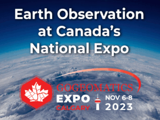
climate

GeoIgnite 2020 Video: Deploy Solutions talk: New Horizons in Space Apps

Session: Deploy Solutions talk: New Horizons in Space Apps Development Session date: July 24, 2020. Speaker: Nicholas Kellett, Founder and CEO of…

Canada supports innovative solutions for agricultural and environmental challenges

Climate change is destabilizing our environment and bringing more extreme weather. Farmers and agricultural workers know, first hand, how important…

Successful launch of Canadian RADARSAT Constellation Mission

MDA, a Maxar Technologies company, announced that the three RADARSAT Constellation Mission (RCM) satellites developed by MDA for the Canadian…

Your Canadian Geospatial Briefing for September 17th: LiDAR; Maxar Technology; Melting at Lowell Glacier; National Road Network

A Canadian Company joins the Lidar Race LiDar is the biggest technological barrier to autonomous vehicles becoming available to consumers.…

Urthecast, Maxar, Climate Atlas, Hybrid GIS, ArcticDEM: Your Monday Briefing

In the news: Climate data and those who can access it, LiDar mapping at work in the Okanagan, and Business…

Google Earth Engine – What is a Data Cube and Why Canadians Should Care

What is a data cube and how is it used for big data analytics?  How does a data cube work…

Master’s Thesis Student Recruitment: Amphibious Housing in Vietnam

University of Waterloo searching Funded Master’s (MA or MES) research project Dr. Carrie Mitchell (UW-Planning) and Dr. Brent Doberstein (UW-Geography…

Free Satellite Imagery For You: Sentinel 1 & 2

Sentinel constellations and data products As the ENVISAT program is coming to an end, the European Space Agency has begun…

COGS NSCC students use Geomatics to explore the history of Black Loyalists & Joggins Fossil Cliff

NSCC students make major impact in two small communities with huge historical significance Students at Nova Scotia Community College’s Centre…

My COGS GIS Education, Part II

In my first article, I introduced the how and why I chose to attend COGS from the fall of 2014…

Free Webinar March 15th: NRCan, OGC, & USGS Arctic Spatial Data Pilot Demonstration

The Canada Centre for Mapping and Earth Observation invites you to attend the Arctic Spatial Data Pilot Demonstration Webinar. Managed and…