
engineering
Conversations with Michael Goodchild on Questions of Geography
Recently, I had the opportunity to sit down with Michael Goodchild and talk about his book and Geography. Michael was…
PCI Geomatics Delivers High Volume Production System (GXL) to Skymap Global in Singapore
MARKHAM, Ontario, Canada—May 25, 2016: PCI Geomatics, a world leading developer of remote sensing and photogrammetric software and systems, announced…
eyesMap3D: The most accurate and powerful 3D photo modeling software
Global based technology company eCapture announced today the launch of its versatile and intuitive software eyesMap3D, to generate accurate 3D…
Teledyne Optech introduces low-cost, automated airborne surveying at GEOINT 2016
Teledyne Optech is pleased to announce that it will showcase its latest airborne systems including the autonomous Optech Eclipse at…
Pickett and Associates Boosts Surveying Capabilities with the Optech Galaxy
Teledyne Optech is pleased to announce that Pickett and Associates has upgraded their airborne surveying capabilities with the highly advanced…
UNB Student Wins American Fellowship Award
Ryan White, a Ph.D. student working with Prof. Richard Langley in the Department of Geodesy and Geomatics Engineering, has won…
GoGeomatics Coming to Kelowna, BC
As a former Burnaby resident and fairly new to the field of GIS as a 2013 graduate of BCIT’s GIS…
Teledyne to Acquire CARIS
Teledyne Technologies Incorporated (NYSE:TDY) (“Teledyne”) and CARIS jointly announced that the CARIS business and its international affiliates (collectively, “CARIS”) have…
SNRC: UAV Integration Highly Valued in Canadian Marketplace
Due to a foreseeable increase in the demand for UAV acquired aerial imagery in resource management, various firms are already…
2016 Student UAS Competition- Phase 1 Winners
Phase 1 of the 2016 Student UAS Competition is complete. A judging panel, comprised of Canadian subject matter experts, has…
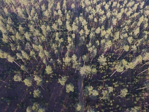
UAV Technology in the Canadian Forestry Sector
The Unmanned Aerial Vehicle (UAV) industry is soaring! Civilian drones are being applied in various global industries ranging from agriculture…
GIS Certification: ASPRS Certification
One type of certification available for GIS and Geomatics professionals is the ASPRS Certification program available from the American…
