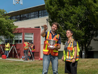
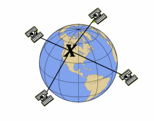
My COGS GIS Education, Part II
In my first article, I introduced the how and why I chose to attend COGS from the fall of 2014 to spring 2016. In Part 2, I wanted to give some insight into the first-year […]
Graph Databases and GIS & Technology (GIS&T) In the era of big data, graph databases are becoming very popular as they can address important challenges in terms of data size and data complexity. A graph […]
Geospatial information science and technology (GIS&T) has rapidly evolved over the last few decades. This evolution has created a highly demanding job market for GIS professionals [3,4]. Recently, students, graduates, and professionals are more and […]
The Art of Being a Cadastral Surveyor: The key abilities every surveyor needs There is an art to being a land surveyor. Surveyors take extremely accurate measurements with sophisticated tools to create plans that become legal […]
Monday, November 14, 2016 marks the third annual Day of Geography, presented by Geospatial Niagara, Canada’s contribution to Geography Awareness Week. This years theme is Exploring the Power of Parks which runs from November 13 […]
There are many GIS and geomatics certification options available to Canadians. They have been discussed in detail in previous articles. A summary of these different options is listed in the table below. How they compare, […]
Ryan White, a Ph.D. student working with Prof. Richard Langley in the Department of Geodesy and Geomatics Engineering, has won the American Association for Geodetic Surveying (AAGS) 2015 Graduate Fellowship Award. Each year, the U.S. […]
One of the GIS Certifications available to Canadians specifically is the Certified Geomatics Specialist certification available from the Canadian Institute of Geomatics (CIG). Certification is offered in 6 areas: GIS/LIS, Photogrammetry, Remote Sensing, Cartography, Geodesy, […]