")
Creating a survey control network for hundreds of kilometers in northern BC and be challenging for a variety of reasons. Firstly, active control stations are almost non-existent. Secondly, the published survey control monuments may not have been updated recently. Thirdly, these monuments are sparse as well. However, Natural Resources Canada (NRCAN) has a solution with Precision Point Positioning (PPP). This article will showcase the precision of NRCAN’s PPP.
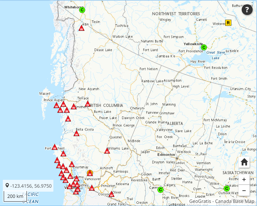
Figure 1: Map of Canadian Active Control Stations (nrcan.gc.ca)
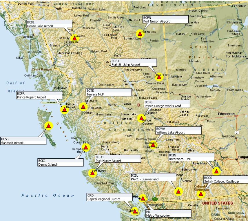
Figure 2: Map of British Columbia Active Control Stations (gov.bc.ca)
What is PPP
NRCAN’s PPP is an online Global Navigation Satellite Service (GNSS) positioning tool where users upload collected GNSS data and a precise coordinate is returned via email. To solve for a position, this service uses precise satellite orbits, clock and bias corrections. A major advantage of this service is its ability to independently obtain a coordinate without the need of being close to another GNSS station. (nrcan.gc.ca) Once processed, the user will obtain a report with the processed coordinate and detailed statistics of the processed coordinate.
Precision of PPP
In a recent survey done close to Meziadin Junction, BC, 3 control points were established. These are CW38, CW40 and CW42 which were first established on July 3rd, 2022 and reoccupied on the September 10th, 2022. Observation times ranged from 6 hours to 12 hours. The GNSS receivers used were an IGAGE IG3S geodetic grade GNSS receiver made for static observations. These log both L1 and L2 frequencies, 3 GNSS constellations, phase and code data. (igage.com)
For best results 2 weeks were allowed to pass before uploading the 6 datasets to the PPP online service. This was to allow for the final orbital satellite corrections to become available which can take between 12 to 18 days after the survey. (nrcan.gc.ca) Upon retrieval from an email, the following results were tabulated. (terraremote.com)
CW38
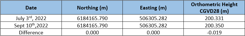
Table 1: CW38 PPP Results (terraremote.com)
CW40

Table 2: CW40 PPP Results (terraremote.com)
CW42
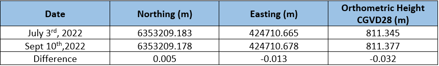
Table 3: CW42 PPP Results (terraremote.com)
Conclusion
From the results presented, results can range from 0mm to 32mm. “Will these be good enough from a project?” or “what ways can we improve precision?”, are some questions that immediately arise. However, advantages of using this service would be the flexibility of not relying on active control and avoiding the limitations of static GNSS baseline surveying methodologies. Perhaps a good starting point would be evaluating the error budget of a project and determining what flexibilities can be afforded.
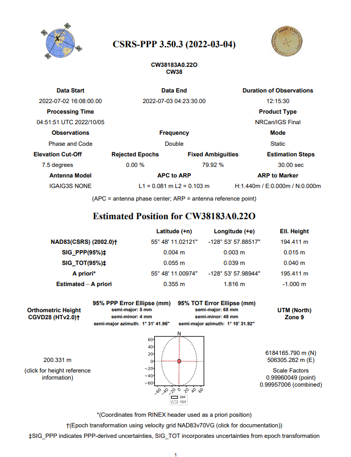
Figure 3: Sample PPP Result Page (nrcan.gc.ca)
Resources
https://webapp.csrs-scrs.nrcan-rncan.gc.ca/geod/tools-outils/ppp.php
https://www.nrcan.gc.ca/maps-tools-and-publications/geodetic-reference-systems/data/10923


Be the first to comment