• facebook
  • Twitter
  • Linkedin
  • Youtube
  • Linkedin Group
  • Post a Job
  • Post an Ad
  • Post an Event
  • Post a Directory Listing
  • Post a Press Release
  • Media Kit
  • My Account
  • Login
GoGeomatics
  • MAGAZINE
    • BIM & GIS
    • Community
    • Conference news
    • Earth Observation
    • Education & Careers
    • GEOAI
    • Announcements
    • Reality Capture & Lidar
    • Science
    • Technology
  • Directories
    • ASSOCIATION
    • INDUSTRY
    • EDUCATION
    • Open Data
  • EVENTS
    • GeoIgnite Events
    • Events Calendar
    • GoGeomatics Meetups
  • Services
    • Advertising
    • Marketing
    • Post a Job
    • Post an Ad
    • Post an Event
    • Post a Press Release
    • Post a Directory Listing
    • Media Kit
    • Web Design
  • Find a Job
  • Volunteer
    • Start a GoGeomatics Group
    • Editors & Writers Group
  • About Us
    • About Us
    • Contact Us
    • Frequently Asked Questions
  • Videos
HomeLearning

Learning

MacKinnon Carto2013 Open Data Talk
Technology

The Evolution of Canadian Data Collection and Distribution

7 August 2013 T Mackinnon | aerial

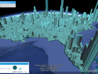
One thing I am sure that almost anybody in geomatics would agree with is that major components of any geospatial projects is the data and, like most things in our society, tend to evolve over […]

||
Community

Should we be called geomatics or something else?

6 August 2013 Robert Ryerson | ACRS

In order to determine whether geomatics is the most appropriate term for this field it may be useful to review some history. In the mid-1980s the various sub-disciplines of what is now called geomatics, consisting […]

No Picture
Education & Careers

Algonquin College Postgraduate GIS Certification Co-op

31 July 2013 GoGeomatics Canada | 2013

“Algonquin GIS Co-op is a Win-Win for Students and Employers” Employers are taking the opportunity to evaluate potential future employees while contributing to the educational process.  Students are gaining invaluable work experience at a key […]

GEOINT Canada||Kandahar Airfield Afghanistan Neil Thompson|Neil Thompson with Canadian Military Geo Tech's in the field
Education & Careers

Neil Thompson: Geospatial Intelligence & Canadian Military

23 July 2013 GoGeomatics Canada | 2014

GoGeomatics had the chance to interview Neil Thompson, the Managing partner of the WCGroup. Neil is also the former Director of Geospatial Intelligence for the Canadian Forces and a retired Colonel.  You can have a […]

||||||||||
Technology

Designing with Information: GIS with Dimension, Ease of Use & Visually Unique

15 July 2013 Edgar Baculi | accuracy

Geomatics and other industries which desire data in accurate yet visually stimulating presentations of communication and information are frequently turning heads at the evolving use of infographics. This inquiry of data and technology fused with […]

No Picture
Technology

The Future Of GIS Scripting? Designing A Functional GIS Using Simplified Coding

3 June 2013 Zachary Klaas | application

  Suppose you could write yourself a working GIS at home, in a very simple language. Would you? In this article, I would like to seriously consider that question. People sometimes think that it is […]

No Picture
Community

Twitter: What is the Purpose of this Social Media Tool?

27 May 2013 Peggy March | advertising

Twitter gives us unlimited access to another spatial realm-for the time being- in the spirit of our exponentially rapid development of and engagement with social media. I think Twitter can be the best thing that’s […]

Original map by John Snow showing the clusters of cholera cases in the London epidemic of 1854
Education & Careers

Looking Back at my First Year, GIS & Geographic Analysis at Ryerson University

1 May 2013 Edgar Baculi | analysis

After successfully completing my first year at Ryerson University in Toronto, I wanted to share some thoughts about my experiences. I am excited to be joining an industry that is so important, and literally,  a […]

Posts pagination

« 1 … 10 11 12 … 18 »

Events

Notice
There are no upcoming events.

View All Events

Services

  • Post a Job
  • Post an Ad
  • Post an Event
  • Post a Directory Listing
  • Post a Press Release
  • Media Kit
  • My Account
  • Login

Jobs

Post a Job
  • Software Engineer – Geographic Information System (GIS)
    Ottawa, ON
  • GIS Data Quality Analyst
    Burnaby, British Columbia
  • GIS Cartographer
    Montreal, QC
  • SENIOR PLANNER SPATIAL ANALYSIS SIPA
    Toronto, ON
View All Jobs
  • Directories
    • Associations Directory
    • Industry Directory
    • Education Programs
    • Open Data
  • Volunteer
    • Start a GoGeomatics Group
    • Editors & Writers Group
  • About Us
    • GoGeomatics Media Kit
    • Who We Are
    • Contact Us
    • FAQ’s
    • Advertising
    • Marketing
  • Subscribe
GoGeomatics
GoGeomatics is the largest and most popular communications hub promoting the Canadian geospatial community. The business was incorporated in 2011. GoGeomatics hosts over 100 fun, free, location technology networking events each year in cities across Canada.

© 2025 GoGeomatics

  • facebook
  • Twitter
  • Linkedin
  • Youtube
  • Linkedin Group