PCI

The top 6 Satellite Remote Sensing Software tools

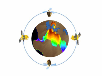
Nowadays, satellite remote sensing comes in handy and can now be employed in our day-to-day activities. This technology, with the…

Hacking to liberate RADARSAT-1 data

How four individuals came together at the recent Ottawa Space Apps Challenge to create intuitive access to the RADARSAT-1 Catalog…

Top 5 Reasons you should attend GeoIgnite 2019

The Geoignite 2019 conference program spotlights the technology sector’s influential leaders as partners and speakers, shares insights on the intersection…

PCI Geomatics presents free user group meeting on June 17th, 2019, from 1pm-5pm in Ottawa

PCI Geomatics is pleased to announce that we are hosting a free user group meeting on June 17th, 2019, from…

Our Biggest Events Ever Across Canada with 500 Participants & 20 Sponsors: 5th Annual 2018 GoGeomatics Canada Back to School Socials

The 5th annual 2018 Back to School GoGeomatics socials were a huge hit with students and professionals. We hosted events…

GoGeomatics Thanks our Gold & Silver Sponsors for our 15 Canada-wide 2018 Back to School GoGeomatics Socials

The GoGeomatics Meetups and Back to School Socials couldn’t be the events that they are without the help of our…

Mystery Speaker Revealed for Next Ottawa GoGeomatics Social April 25th

GoGeomatics has swept aside the curtain to reveal Masroor Hussain, Senior Scientist and Software Developer at PCI Geomatics, as the…

My COGS GIS Education, Part II

In my first article, I introduced the how and why I chose to attend COGS from the fall of 2014…

PCI Geomatics and PrecisionHawk Enter into Long Term Partnership

PCI Geomatics, a world leading developer of remote sensing and photogrammetric software and systems, announced today it has entered into…

How Canadian Remote Sensing Was Made Commercially Successful & Exportable

This piece started as a note on some of my experience as an international consultant in remote sensing specifically and…

BCIT GIS student project Tetrad

Become a BCIT GIS Student Project / Practicum Sponsor

The BCIT GIS department has been graduating students for 25+ years.  Our students come from BC, but as well, across…

PCI Geomatics Delivers High Volume Production System (GXL) to Skymap Global in Singapore

MARKHAM, Ontario, Canada—May 25, 2016: PCI Geomatics, a world leading developer of remote sensing and photogrammetric software and systems, announced…