• facebook
  • Twitter
  • Linkedin
  • Youtube
  • Linkedin Group
  • Post a Job
  • Post an Ad
  • Post an Event
  • Post a Directory Listing
  • Post a Press Release
  • Media Kit
  • My Account
  • Login
GoGeomatics
  • MAGAZINE
    • BIM & GIS
    • Community
    • Conference news
    • Earth Observation
    • Education & Careers
    • GEOAI
    • Announcements
    • Reality Capture & Lidar
    • Science
    • Technology
  • Directories
    • ASSOCIATION
    • INDUSTRY
    • EDUCATION
    • Open Data
  • EVENTS
    • GeoIgnite Events
    • Events Calendar
    • GoGeomatics Meetups
  • Services
    • Advertising
    • Marketing
    • Post a Job
    • Post an Ad
    • Post an Event
    • Post a Press Release
    • Post a Directory Listing
    • Media Kit
    • Web Design
  • Find a Job
  • Volunteer
    • Start a GoGeomatics Group
    • Editors & Writers Group
  • About Us
    • About Us
    • Contact Us
    • Frequently Asked Questions
  • Videos
Homephotogrammetry

photogrammetry

Technology

Airborne Topo-Bathymetric Lidar Combined with Thermal Imaging for Fish Habitat Studies in Rivers from LiDAR CANEX 2024

24 April 2024 Kruti Mehta | Airborne surveying

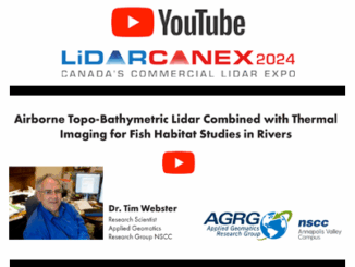
Dr. Timothy Webster, a Research Scientist at the Applied Geomatics Research Group (AGRG) based at Nova Scotia Community College’s Annapolis Valley Campus, recently presented research at Lidar CANEX 2024. The presentation is on the use […]

Technology

International Geospatial Digest for March 4th, 2024

4 March 2024 Volunteer Editors and Group Writers | AI

Lake Rotorua’s Hidden Secrets Revealed Empowering Disaster Resilience: Geospatial Training in Bangladesh Russia’s Pursuit of Nuclear-Powered Space Warfare: A Looming Threat SimActive’s Goal to Enhance 3D Mapping with Multi-Camera Drone Payloads Mapping the World’s Coral […]

Community

Media Sponsors Announced: Canadian GIS & GIM International at the GoGeomatics Expo

31 July 2023 GoGeomatics Expo | Archaeology GIS

Thank you to Canadian GIS & Geomatics  & GIM International for being media sponsors for the GoGeomatics Expo in Calgary, taking place November 6 to 8, 2023. Canadian GIS & Geomatics is a network of […]

Community

The American Society for Photogrammetry & Remote Sensing (ASPRS) Joins the GoGeomatics Expo as Association Sponsor

24 July 2023 GoGeomatics Expo | AMERICAN SOCIETY FOR PHOTOGRAMMETRY AND REMOTE SENSING

Exciting News! The American Society for Photogrammetry and Remote Sensing joins as an Association Sponsor for the GoGeomatics Expo in Calgary, November 6 to 8, 2023. Founded in 1934, the American Society for Photogrammetry and […]

Community

Balko Technologies joins the GoGeomatics Trade Show

20 June 2023 GoGeomatics Canada | Archaeology GIS

Balko Technologies will be exhibiting at the GoGeomatics Expo in Calgary November 6-8th, 2023. Balko Technologies develops and manufactures the only modular drone mounted lidar system available on the market. Its innovative, flexible and versatile […]

Technology

International Geospatial Digest April 24th, 2023

24 April 2023 Volunteer Editors and Group Writers | 3D model

Digital twin technology brings Pompeii to life How Satellite Data Is Helping Tackle the Urban Heat Issue NV5 closes acquisition of L3Harris’ geospatial division NISAR satellite to map Himalayas’ seismic zones Chinese scientists let AI […]

|||||
Community

Becky Morton, President and CEO of GeoWing Mapping, Inc. on International Women’s Day

8 March 2023 Kenneth Ang | ASPRS

Supporting International Women’s day, I spoke with Becky Morton who is the President and CEO of GeoWing Mapping, Inc. as well as a former ASPRS President. Tell us about your geospatial career. I began my […]

|
Technology

International Geospatial Briefing November 28th, 2022

28 November 2022 Volunteer Editors and Group Writers | 3D model

Germany Builds Digital Twin of Rail Network in NVIDIA Omniverse Kalmar Municipality Streamlines Digital Capture for Community Planning How Drones and Photogrammetry Can Support the Energy Transition Dutch Scientists Develop a More Accurate and Robust […]

Posts pagination

« 1 2 3 … 12 »

Events

Notice
There are no upcoming events.

View All Events

Services

  • Post a Job
  • Post an Ad
  • Post an Event
  • Post a Directory Listing
  • Post a Press Release
  • Media Kit
  • My Account
  • Login

Jobs

Post a Job
  • Canada Maps and Poster Gallery Volunteer Leads — GeoIgnite 2026
    remote
  • GIS & Data Analytics Lead
    Beaumont, AB
  • Lead Surveyor, Projects/Arpenteur-géomètre principal, projets; arpenteuse-géomètre principale, projets
    North Bay, Thunder Bay
  • Senior GIS Developer
    Calgary, AB
View All Jobs
  • Directories
    • Associations Directory
    • Industry Directory
    • Education Programs
    • Open Data
  • Volunteer
    • Start a GoGeomatics Group
    • Editors & Writers Group
  • About Us
    • GoGeomatics Media Kit
    • Who We Are
    • Contact Us
    • FAQ’s
    • Advertising
    • Marketing
  • Subscribe
GoGeomatics
GoGeomatics is the largest and most popular communications hub promoting the Canadian geospatial community. The business was incorporated in 2011. GoGeomatics hosts over 100 fun, free, location technology networking events each year in cities across Canada.

© 2025 GoGeomatics

  • facebook
  • Twitter
  • Linkedin
  • Youtube
  • Linkedin Group