Newsmakers & Press Releases
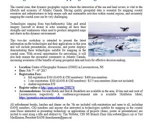
Feb 7-8: Two Day Workshop on High Resolution Mapping Along Coastal Zones
The coastal zone, that dynamic geographic region where the interaction of the sea and land occurs, is vital to the lifestyle and economy of Atlantic Canada. Having quality geospatial data is essential for mapping coastal […]