
Tech/Projects
Esri Canada User Conference Toronto 2012
As this is my first article with GoGeomatics Canada, I would like to start off by saying a warm hello…
The Ottawa Tree Canopy Cover Mapping Project
The City of Ottawa Official Plan set a target of 30% tree canopy cover for the entire city. To the…
Welcome to the New GoGeomatics Canada!
Here at GoGeomatics Canada, we want to say hello to our new users and “surprise” to our existing members. We…
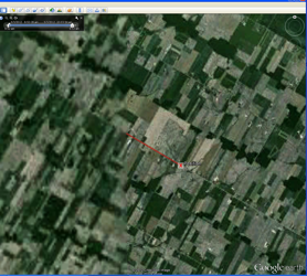
Kincardine to Ottawa, Ontario Drive: Testing Google Earth vs. ArcGIS 10 GPS Capabilities
I had just finished a trip in Kincardine, Ontario and was preparing for the upcoming eight-hour long drive back to…
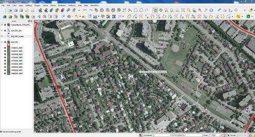
Measuring Tree Canopy Cover in an Urban Environment
To properly and effectively design and manage the city’s tree canopy it is important to quantify the amount and composition…
Out of Place — An Introduction
I know things that others don’t, I feel things that others can’t And yet its not part of this time…

Top 10 Canadian Geomatics Twitter Feeds
We have scoured the net and reviewed a number of Canadian Twitter streams. Skilled tweeters can pack a good deal of pertinent information and keen insight into 140 characters. The trouble is, they can be hard to find in a swelling sea of self-aggrandizing micro bloggers. That’s why we have assembled a list of the top ten Twitter feeds from Canadian geomatics professionals, personalities, and organizations.