• facebook
  • Twitter
  • Linkedin
  • Youtube
  • Linkedin Group
  • Post a Job
  • Post an Ad
  • Post an Event
  • Post a Directory Listing
  • Post a Press Release
  • Media Kit
  • My Account
  • Login
GoGeomatics
  • MAGAZINE
    • BIM & GIS
    • Community
    • Conference news
    • Earth Observation
    • Education & Careers
    • GEOAI
    • Announcements
    • Reality Capture & Lidar
    • Science
    • Technology
  • Directories
    • ASSOCIATION
    • INDUSTRY
    • EDUCATION
    • Open Data
  • EVENTS
    • GeoIgnite Events
    • Events Calendar
    • GoGeomatics Meetups
  • Services
    • Advertising
    • Marketing
    • Post a Job
    • Post an Ad
    • Post an Event
    • Post a Press Release
    • Post a Directory Listing
    • Media Kit
    • Web Design
  • Find a Job
  • Volunteer
    • Start a GoGeomatics Group
    • Editors & Writers Group
  • About Us
    • About Us
    • Contact Us
    • Frequently Asked Questions
  • Videos
Homevideo

video

Community

GeoIgnite Talk On YouTube: The National Canadian Elevation Data Strategy Update from NRCan

16 June 2021 GoGeomatics Canada | 3D

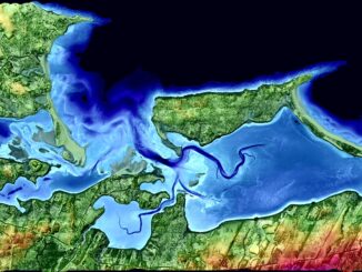
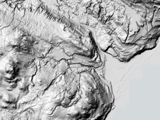
Natural Resources Canada is hard at work on the National Elevation Data Strategy, which aims to provide Canadians with an accurate three-dimensional representation of the country, in support of government priorities. This is Canada’s DEM. […]

|||||
Technology

Google Earth Engine – What is a Data Cube and Why Canadians Should Care

19 April 2017 Sabina Zaidi | 2012

What is a data cube and how is it used for big data analytics?  How does a data cube work with remotely sensed data? Before writing this article I had never heard of a data […]

|||||||
Community

Event Recap: The 2017 Canadian Surveyors Conference in Ottawa

30 March 2017 Francis Guo | 2017

On March 1st and 2nd land surveyor professionals, as well as industry exhibitors, headed to Ottawa for the 2017 Canadian Surveyors Conference. The annual general meetings of land surveyors associations was also held on February […]

|||||||||||||||||||||
Education & Careers

My COGS GIS Education, Part II

22 March 2017 Richard Davenport | 2012

In my first article, I introduced the how and why I chose to attend COGS from the fall of 2014 to spring 2016. In Part 2, I wanted to give some insight into the first-year […]

No Picture
Community

Top Ten Climate Change Maps and GIS Applications

7 March 2017 Priscilla Ancinelli | agriculture

Awareness for climate change has been steadily increasing ever since the Green Revolution in the 1960s. There is a plethora of data, maps, and Geographic Information Systems (GIS) applications available freely or accessible to the […]

||||||
Education & Careers

Geospatial Earth Observation Using Blimps, Balloons and Kites

7 February 2017 Theresa Pinter | 2012

These days drones are all the rage. Nevertheless, there are other ways to collect data from the sky! Blimps, balloons and kites are alternative was to collecting data or remote-sensing imagery. These are great unconventional solutions for […]

Education & Careers

Upgrade your Geospatial Skills: leveraging the power of MOOCs

30 January 2017 Florin-Daniel Cioloboc | analysis

What I want to share with you are some resources related to something called Massive Open Online Course (MOOC) where you can learn new skills, refresh your current ones or to simply satisfy your thirst […]

High Resolution Mapping Along the Coastal Zone - https://geomatics.one
Newsmakers & Press Releases

Atlantic Canada: COGS: Geomatics Professionals Coming to Discuss High Resolution Coastal Mapping

30 January 2017 GoGeomatics Newsmakers | 2017

High Resolution Coastal Zone Mapping This collaborative effort by GANS & the CIG will engage the geospatial community & increase awareness on the value that geospatial data provides to effective decision making January 30, 2017 (Halifax, NS) – Next week […]

Posts pagination

1 2 … 9 »

Events

Notice
There are no upcoming events.

View All Events

Services

  • Post a Job
  • Post an Ad
  • Post an Event
  • Post a Directory Listing
  • Post a Press Release
  • Media Kit
  • My Account
  • Login

Jobs

Post a Job
  • Canada Maps and Poster Gallery Volunteer Leads — GeoIgnite 2026
    remote
  • GIS & Data Analytics Lead
    Beaumont, AB
  • Lead Surveyor, Projects/Arpenteur-géomètre principal, projets; arpenteuse-géomètre principale, projets
    North Bay, Thunder Bay
  • Senior GIS Developer
    Calgary, AB
View All Jobs
  • Directories
    • Associations Directory
    • Industry Directory
    • Education Programs
    • Open Data
  • Volunteer
    • Start a GoGeomatics Group
    • Editors & Writers Group
  • About Us
    • GoGeomatics Media Kit
    • Who We Are
    • Contact Us
    • FAQ’s
    • Advertising
    • Marketing
  • Subscribe
GoGeomatics
GoGeomatics is the largest and most popular communications hub promoting the Canadian geospatial community. The business was incorporated in 2011. GoGeomatics hosts over 100 fun, free, location technology networking events each year in cities across Canada.

© 2025 GoGeomatics

  • facebook
  • Twitter
  • Linkedin
  • Youtube
  • Linkedin Group