• facebook
  • Twitter
  • Linkedin
  • Youtube
  • Linkedin Group
  • Post a Job
  • Post an Ad
  • Post an Event
  • Post a Directory Listing
  • Post a Press Release
  • Media Kit
  • My Account
  • Login
GoGeomatics
  • MAGAZINE
    • BIM & GIS
    • Community
    • Conference news
    • Earth Observation
    • Education & Careers
    • GEOAI
    • Announcements
    • Reality Capture & Lidar
    • Science
    • Technology
  • Directories
    • ASSOCIATION
    • INDUSTRY
    • EDUCATION
    • Open Data
  • EVENTS
    • GeoIgnite Events
    • Events Calendar
    • GoGeomatics Meetups
  • Services
    • Advertising
    • Marketing
    • Post a Job
    • Post an Ad
    • Post an Event
    • Post a Press Release
    • Post a Directory Listing
    • Media Kit
    • Web Design
  • Find a Job
  • Volunteer
    • Start a GoGeomatics Group
    • Editors & Writers Group
  • About Us
    • About Us
    • Contact Us
    • Frequently Asked Questions
  • Videos
Homeweb map

web map

|||||||||||||||||||||||||||||||||||
Community

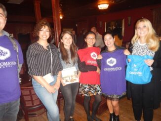
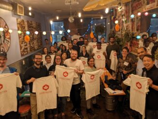
2022 Back to School Socials in Pictures – Thank you Sponsors & Participants!

29 September 2022 GoGeomatics Canada | alberta

The 7th annual GoGeomatics 2022 Back to School Socials have been a tremendous success. Our groups and group leaders across the country came together to put together some great events. Many thanks go to our […]

||||||||||||||||||||||||||||||||||||||||||
Community

2019-2020 Back to School Socials in Pictures – Thank you Sponsors & Participants!

7 November 2019 Jon Murphy | 2019 GoGeomatics

The 6th annual GoGeomatics 2019 Back to School Socials have been a tremendous success.  After coming off the success of GeoIgnite 2019 National Conference in Ottawa. Our groups and group leaders across the country came […]

Newsmakers & Press Releases

Mapbox and Sparkgeo Announce Web Map Analytics Integration

24 July 2019 GoGeomatics Newsmakers | Mapbox

Mapbox and Sparkgeo today announced a new integration of Sparkgeo’s web map analytics technology, Maptiks, with Mapbox GL web maps. This integration provides developers building with Mapbox GL access to Maptik’s robust map analytics, to […]

URISA BC|
Newsmakers & Press Releases

URISA BC – Engage: Make It So With GIS in Community Engagement

27 April 2017 GoGeomatics Newsmakers | 2017

What: Engage: Make It So With GIS in Community Engagement Where: Vancouver, BC When: Thursday, 15 June 2017 from 8:00 AM to 5:00 PM (PDT) From private companies to municipal and national governments, from parents […]

|
Newsmakers & Press Releases

URISA BC: Vancouver Call for Presentations on GIS Trends in Community Engagement

13 March 2017 GoGeomatics Newsmakers | 2017

Call for Presentations Following the success of our December event, the URISA BC Executive Team is busy planning our next seminar for the Vancouver Marriott Pinnacle Downtown. Join us in mid-June, 2017 for URISA BC’s […]

||BC Pinot Noir Map enlarged section|BC Pinot Noir Map
Technology

GIS in Action: How Does BC Pinot Noir Express Terroir?

8 March 2017 Karl Kliparchuk | 2012

Editors note: In this previously published article, Karl Kliparchuk, BCIT GIS Program Head & Instructor uses GIS to explore the aromas and flavors of wine from British Columbia, Canada. We are breaking down BC wine […]

No Picture
Technology

Esri Canada Community Maps Program: Why more communities need to take advantage of this

20 February 2017 Shivam Vyas | analysis

The Community Maps Program (CMP) was introduced by Esri Canada in 2009 allowing organizations to share and host geographic data.  The CMP is accessible to public and private organizations and web users.  The platform for […]

No Picture
Technology

Canadian Geomatics Innovation: Ecere Develops a Next Generation GIS

11 January 2017 Ozair Khan | 2014

Not many companies undertake the ambitious goal of creating a new geospatial software suite from scratch. Ecere, a Canadian company based in Gatineau, Québec has been developing a software platform that has positioned them to […]

Posts pagination

1 2 … 7 »

Events

Notice
There are no upcoming events.

View All Events

Services

  • Post a Job
  • Post an Ad
  • Post an Event
  • Post a Directory Listing
  • Post a Press Release
  • Media Kit
  • My Account
  • Login

Jobs

Post a Job
  • Canada Maps and Poster Gallery Volunteer Leads — GeoIgnite 2026
    remote
  • GIS & Data Analytics Lead
    Beaumont, AB
  • Lead Surveyor, Projects/Arpenteur-géomètre principal, projets; arpenteuse-géomètre principale, projets
    North Bay, Thunder Bay
  • Senior GIS Developer
    Calgary, AB
View All Jobs
  • Directories
    • Associations Directory
    • Industry Directory
    • Education Programs
    • Open Data
  • Volunteer
    • Start a GoGeomatics Group
    • Editors & Writers Group
  • About Us
    • GoGeomatics Media Kit
    • Who We Are
    • Contact Us
    • FAQ’s
    • Advertising
    • Marketing
  • Subscribe
GoGeomatics
GoGeomatics is the largest and most popular communications hub promoting the Canadian geospatial community. The business was incorporated in 2011. GoGeomatics hosts over 100 fun, free, location technology networking events each year in cities across Canada.

© 2025 GoGeomatics

  • facebook
  • Twitter
  • Linkedin
  • Youtube
  • Linkedin Group