
Geared towards the general public, Soar.Earth presents an online platform that resembles a digital, free-of-charge atlas. Pooling in from crowd-sourced content, including satellite imagery, hobbyist drone photos and environmental remote sensing data, it almost feels like an Instagram for maps and images, where users can store, view and curate their maps and drone images.
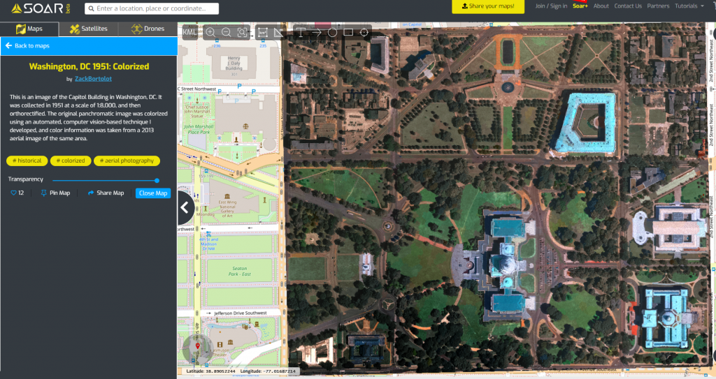
Soar’s community-driven platform offers a great opportunity for people to share their map products, currently having hundreds of user-generated maps all over the world on the atlas. By processing and tiling the ECW and GeoTIFF files, Soar allows an efficient display and re-projection into the web application where imagery can be exhibited simply on web browsers. The easiness of creating and presenting imagery would encourage more people to share their work on the internet, without needing to have any professional software.
Gallery for drone photos
After drone pilots have uploaded their drone images, Soar also allows them to monetize their photos once the value is realized. In addition to being a digital atlas, the Soar platform serves as a gallery for drone photos. Instead of letting the drone photos sit idle in the hard-drive, drone enthusiasts are able to generate value from their images and also contribute the global drone community.
View and download near-real time satellite imagery from Sentinel or Landsat for Free
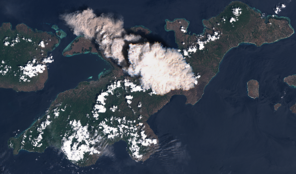
Beyond the collaborative part of the platform, Soar offers users free access to Landsat-8 from NASA and Sentinel-2 from European Space Agency satellites with 30-metre and 10-metre resolution images. While the satellite image from major providers, like Google Earth, remain statics, Soar. Earth jazzes up the satellite content every day. Alongside the 50-centimetre high-resolution images offered by Soar, which is 20-times sharper than the Sentinel-2, satellite feeds allow users to inspect the changes on Earth regularly. It includes events such as hurricanes, wildfires, melting of icecaps and volcanic eruptions. Anyone should be able to explore the planet from above.
In the future, Soar is looking to include additional high-definition imagery from JAXA and NOAA satellites.
Democratizing access to satellite images
Personally, I am fond of the idea of democratizing access to resources such as satellite images, which were traditionally exclusive to large corporations and platforms to display geospatial data, which again did not come free-of-charge normally. Observing the Earth is no longer the privilege of the deep pockets but regular and curious individuals like you and me. Affordable and high-resolution satellite imagery is particularly beneficial to non-profits, schools and universities.
The featured image is a Sentinel-2 image detailing the surface geology and vegetation in the southern part of Iceland by Valters Zeizis.


Be the first to comment