• facebook
  • Twitter
  • Linkedin
  • Youtube
  • Linkedin Group
  • Post a Job
  • Post an Ad
  • Post an Event
  • Post a Directory Listing
  • Post a Press Release
  • Media Kit
  • My Account
  • Login
GoGeomatics
  • MAGAZINE
    • BIM & GIS
    • Community
    • Conference news
    • Earth Observation
    • Education & Careers
    • GEOAI
    • Announcements
    • Reality Capture & Lidar
    • Science
    • Technology
  • Directories
    • ASSOCIATION
    • INDUSTRY
    • EDUCATION
    • Open Data
  • EVENTS
    • GeoIgnite Events
    • Events Calendar
    • GoGeomatics Meetups
  • Services
    • Advertising
    • Marketing
    • Post a Job
    • Post an Ad
    • Post an Event
    • Post a Press Release
    • Post a Directory Listing
    • Media Kit
    • Web Design
  • Find a Job
  • Volunteer
    • Start a GoGeomatics Group
    • Editors & Writers Group
  • About Us
    • About Us
    • Contact Us
    • Frequently Asked Questions
  • Videos
Homecomment

comment

Community

CANMAP, and SHIFTing gears at COGS

2 April 2017 Robert Maher | 2016

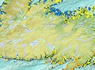
At the end of last month, John Wian hosted the Annual General Meeting (AGM) of the CANMAP Research Institute in Bridgetown. The CANMAP Research Institute was formed in the early 1980’s by John, with input […]

Newsmakers & Press Releases

The Open Geospatial Consortium (OGC): proposed GeoRSS Community Standard

29 March 2017 GoGeomatics Newsmakers | 2017

The Open Geospatial Consortium (OGC®) is requesting public comment on the proposed GeoRSS Community Standard.  First available in 2006, GeoRSS is a simple, yet powerful, approach for geo-enabling RSS/Atom feeds – that is, tagging them […]

|
Newsmakers & Press Releases

WEBINAR March 29: GSDI Coastal and Marine SDI Best Practices

21 March 2017 GoGeomatics Newsmakers | 2017

COINAtlantic would like to extend an invitation on behalf of the Global Spatial Data Infrastructure (ASDI) Association to participate in their webinar on Coastal and Marine SDI Best Practices—March 29th at 2PM CEST. GSDI Coastal/Marine […]

||
Technology

GIS Open Source versioning tool for a multi-user Distributed Environment (part 1)

15 March 2017 Nicolas Gignac | 2014

Editors note: This article has been jointly written by Nicolas Gignac, Dami Sonoiki (eHealth Africa) and Samuel Aiyeoribe (eHealth Africa). These authors would like to thank Yves Moisan, Vincent Mora (Oslandia) and Vincent Picavet (Oslandia) for their […]

||
Technology

Outil de versionnement des données géographiques à code source ouvert pour des environnements multi-contributeurs (partie 1)

15 March 2017 Nicolas Gignac | 2014

Note des éditeurs : Cet article a été écrit conjointement par Nicolas Gignac, Dami Sonoiki (eHealth Africa) et Samuel Aiyeoribe (eHealth Africa). Ces auteurs aimeraient remercier Yves Moisan, Vincent Mora (Oslandia) et Vincent Picavet (Oslandia) pour leur support et […]

|||||||||||||||||||||
Education & Careers

My COGS GIS Education

9 March 2017 Richard Davenport | 2014

What About COGS The Centre of Geographic Sciences (COGS) is one of the best colleges in Canada for learning GIS.  As a COGS graduate myself I am writing this article to help future students make […]

||BC Pinot Noir Map enlarged section|BC Pinot Noir Map
Technology

GIS in Action: How Does BC Pinot Noir Express Terroir?

8 March 2017 Karl Kliparchuk | 2012

Editors note: In this previously published article, Karl Kliparchuk, BCIT GIS Program Head & Instructor uses GIS to explore the aromas and flavors of wine from British Columbia, Canada. We are breaking down BC wine […]

No Picture
Community

Top Ten Climate Change Maps and GIS Applications

7 March 2017 Priscilla Ancinelli | agriculture

Awareness for climate change has been steadily increasing ever since the Green Revolution in the 1960s. There is a plethora of data, maps, and Geographic Information Systems (GIS) applications available freely or accessible to the […]

Posts pagination

« 1 2 3 … 11 »

Events

Notice
There are no upcoming events.

View All Events

Services

  • Post a Job
  • Post an Ad
  • Post an Event
  • Post a Directory Listing
  • Post a Press Release
  • Media Kit
  • My Account
  • Login

Jobs

Post a Job
  • Canada Maps and Poster Gallery Volunteer Leads — GeoIgnite 2026
    remote
  • GIS & Data Analytics Lead
    Beaumont, AB
  • Lead Surveyor, Projects/Arpenteur-géomètre principal, projets; arpenteuse-géomètre principale, projets
    North Bay, Thunder Bay
  • Senior GIS Developer
    Calgary, AB
View All Jobs
  • Directories
    • Associations Directory
    • Industry Directory
    • Education Programs
    • Open Data
  • Volunteer
    • Start a GoGeomatics Group
    • Editors & Writers Group
  • About Us
    • GoGeomatics Media Kit
    • Who We Are
    • Contact Us
    • FAQ’s
    • Advertising
    • Marketing
  • Subscribe
GoGeomatics
GoGeomatics is the largest and most popular communications hub promoting the Canadian geospatial community. The business was incorporated in 2011. GoGeomatics hosts over 100 fun, free, location technology networking events each year in cities across Canada.

© 2025 GoGeomatics

  • facebook
  • Twitter
  • Linkedin
  • Youtube
  • Linkedin Group