features

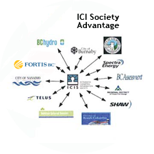
The Integrated Cadastral Information (ICI) Society and ParcelMap BC

This is the first of two articles on the release of ParcelMap BC Data, which we see as a significant…

Upgrade your Geospatial Skills: leveraging the power of MOOCs

What I want to share with you are some resources related to something called Massive Open Online Course (MOOC) where…

Canadian Geomatics Innovation: Ecere Develops a Next Generation GIS

Not many companies undertake the ambitious goal of creating a new geospatial software suite from scratch. Ecere, a Canadian company…

Altus Geomatics’ Contributions to Fallsview Construction Helped to Create World-Class Canadian Casino

When construction began on Niagara Fallsview Casino Resort in 2001, the spectacular natural surroundings belied a particularly difficult problem for…

New Brunswick: CARIS Announces release of HIPS and SIPS™ 10

Fredericton, NB, Canada – November 01, 2016 – Teledyne CARIS™ is pleased to announce the release of HIPS and SIPS™ 10.…

NB 911 Bureau Receives Esri Canada Award of Excellence in GIS

FREDERICTON, Esri Canada User Conference – October 25, 2016 – Esri Canada today presented the NB 911 Bureau, a branch…

Montreal: SimActive Offers Free Trial of UAV Software

Montreal, Canada, October 11th, 2016 – SimActive Inc., a world-leading developer of photogrammetry software, is pleased to announce a new…

DigitalGlobe’s Basemap Suite Expands: 250 Million Square Kilometers of 30 cm Imagery

DigitalGlobe, Inc. (NYSE: DGI), the global leader in Earth imagery and information about our changing planet, today announced that its…

Fall Reading in Canada: landscape, language, geography

Last week, I picked up a copy of Robert MacFarlane’s ‘Landmarks’. I had read all of his previous works and…

Volunteer & Map Canada: Statistics Canada Crowdsourcing Pilot Project

Statistics Canada has launched a new pilot project using OpenStreetmap.  For  many Canadians outside of the geomatics community this is…

Airobotics Selects SimActive’s Photogrammetry Software for its Automated Industrial Drone Solution

Montreal, Canada, August 30th, 2016 – SimActive Inc., a world-leading developer of photogrammetry software, is pleased to announce that Airobotics…

Using Colour Transparency to Map Election Results

As the 2016 United States presidential election careens towards its conclusion in November, GIS plays a prominent role in both planning…