NRCAN
Interview with Ted Mackinnon: Promoting Canadian GIS & Geomatics on Twitter
GoGeomatics has been actively using Twitter to reach out to the geospatial community since 2009. We have written and hosted…
Operational Use of Remotely Piloted Aircraft System (RPAS) for Geomatics Applications
Recently, I reviewed a report by the Canadian Council of Geomatics on the use of Remotely Piloted Aircraft Systems (RPAS)…
CCMEO: GeoConnections Funding Geomatics Projects for 2016-2018
For this announcement, GeoConnections is focusing funding towards projects that address the following themes: -Innovative adoption and further development…
How Canadian Remote Sensing Was Made Commercially Successful & Exportable
This piece started as a note on some of my experience as an international consultant in remote sensing specifically and…
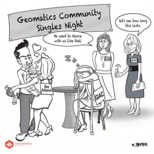
Building Bridges: GeoAlliance
On March 15-16th the GeoAlliance is hosting a strategy event in Calgary you can see here. They are trying to bring together members…
Elevation Web Services: Limitations and Prospects
Elevation Web Services: Limitations and Prospects Elevation data is necessary for a wide range of geospatial applications such as creating…
MDA to operate Canada’s ground station infrastructure and expand its international business
Richmond, BC – MacDonald, Dettwiler and Associates Ltd., a global communications and information company, today announced that it has signed…
GeoAlliance: NRCan’s Sisyphus
Want to learn more about this issue? Check out these articles: CGCRT/GeoAlliance: Getting off on the Wrong Foot CGCRT Says…
Submit Your Questions on the Canadian Geomatics Environmental Scan
GoGeomatics is busy preparing for the soon-to-be released Canadian Geomatics Environmental Scan and Value Study. A summary report synthesizing the…
Summary Report: Canadian Geomatics Environmental Scan & Economic Value Study
NRCan has released a summary report synthesizing the findings of two long-anticipated studies that will illuminate the status of the…
NRCan & GoGeomatics Ottawa: First Public Talk of the Open Federal Geospatial Platform
Students, professionals, and senior executives in Ottawa were privileged to get to hear about the Federal Geospatial Platform in it’s…


