
AT&T prepares for 5G
5G is part of an oncoming data storm. 5G will be connected to autonomous cars, robotic factories, and seamless AR/VR, and it will require a faster, more efficient network. To that end, industry consortiums like O-RAN and the Linux Foundation are forming to face challenges in the sector. Representatives from AT&T are attending the Open Networking Summit in San Jose to discuss solutions, including their ongoing work with the O-RAN Alliance, the creation of open source software, and the AT&T Dedicated Internet white box. The goal for AT&T is to show customers that this network transformation is real, and new models are necessary for the world to be ready for 5G.
3D at Depth captures Navy Devastator

World leading subsea LiDAR laser expert 3D at Depth Inc. has successfully performed an underwater survey technique that integrates photogrammetry with Subsea laser LiDAR technology to create reverse-engineered 3D models. During a 2018 expedition to document a US Navy Douglas TBD-1 Devastator aircraft resting at the bottom of Jaluit Lagoon in the Republic of the Marshall Islands, 3D at Depth deployed its SL3 laser at varying ranges from the wreck site; the laser ultimately delivered photogrammetric data with 5.7 million vertices and rendered an exact 3D model of the Devastator. 3D at Depth will be showcasing their SL3 technology at Ocean Business 19 in Southampton, United Kingdom from April 9-11th.
The GIC in New Zealand and Australia
A new industry consortium, the Geospatial Intelligence Centre, has announced its program launch into Australia and New Zealand. Based in the United States, the GIC will provide insurance companies with access to aerial imaging libraries and geospatial data, allowing the companies to expedite claims through rapid remote post-disaster property assessment, saving time and money on site inspections. The program launch will begin with the collection of high-resolution imagery of the 12 largest metropolitan areas in the two countries. Through the GIC’s disaster response program, an aircraft fleet will collect data from impacted areas to be published on the GIC Web Map Portal so insurers can search by location, compare before-and-after images, and make accurate decisions when dealing with claims.
Smart Cities at the Geospatial World Forum
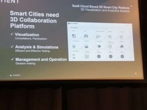
Smart cities need smart infrastructure. That’s the word from the second day of the Geospatial world forum, attended by GoGeomatics founder Jonathan Murphy. The sessions brought together strategists, executives, GIS managers and smart city coordinators who agreed that infrastructure is essential to building smart and resilient cities. Panels of experts gathered to discuss the duty of professionals to create solutions for future generations, better use of data, evidence-based development, and risk assessment. Developers have the immense challenge of designing cities that can handle growing populations, withstand the tests of time and tolerate floods, earthquakes, and other natural disasters, using the geospatial technology available.
Vulcan’s new Maxar subscription
Vulcan has joined Maxar Technologies’ cloud-based EarthWatch platform, allowing Vulcan’s Domain Awareness Systems team to view, stream, and download optical satellite data. Maxar aims to protect savannah and marine environments (as well as many livelihoods) through the partnership by delivering actionable insight to decision makers. Multiple initiatives stand to benefit from the subscription, including anti-poaching, coral reef preservation, power distribution and detection of unregulated fishing. Art Min, VP of impact at Vulcan, says he hopes to empower leaders to create social and environmental benefits.


Be the first to comment