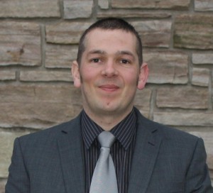
 GoGeomatics recently had the opportunity to talk with Andrew Hoggarth, Marketing and Sales Manager, CARIS . As a senior executive in the Geomatics industry, Andrew has a wealth of experience to share about CARIS and how his technical expertise has led him to a senior position in a business role.
GoGeomatics: We would like to start the interview by asking you a little about yourself and how you got into geomatics as a profession. To get us started can you tell us where you are from and which schools have you attended?
Andy: I am from the Northern part of England originally, I went to West Craven High School in Barnoldswick, Lancashire and then moved South to attend the University of Bedfordshire, 30 km’s north of London.
GoGeomatics: Why did you choose to work in the Geomatics field?
Andy: I decided at a young age that I wanted to be a cartographer. I was interested in geography and I enjoyed technical drawing, it seemed obvious to me that I should make maps. I went on to study Mapping Science at University where I quickly realized that I could make good money if I practiced my trade in dangerous places around the world. The idea of mapping places un-seen by the majority appealed to me, this led me into the field of hydrographic survey, where I quickly specialized in high resolution seafloor mapping.
GoGeomatics: You are a senior executive with CARIS. Can you tell us about what you are doing that and what CARIS does specifically?
Andy: CARIS is a developer of geomatics software, The company was born out of the University of New Brunswick, which has a rich history in geomatics and computer science. The founder, CEO and President of CARIS, Dr. Salem Masry was a professor at UNB and setup CARIS in 1979 as a way to commercialize his research work. CARIS developed land management systems for the Atlantic provinces and developed GIS systems used by municipal engineers. Early on in the companies history CARIS was approached by the Canadian Hydrographic Service (part of the Dept. of Fisheries and Oceans) to develop a digital mapping system to meet their needs.
CARIS continues to work in the area of Land administration but has become renowned internationally for it’s work in Marine Geomatics, CARIS is recognized as a world leader in ocean mapping with software solutions focused on processing sonar measurements and creating maps and charts and also distribution of marine geospatial datasets through the Internet.
I’ve been with CARIS for almost 9 years and currently head up our global marketing and sales activities.
GoGeomatics: Could you provide us with a brief background on how your career has led you to your current position? How has geomatics shaped your experiences and led you to your current position?
Andy: I started out in 1997 as a data processor / cartographer for a UK survey company called RACAL (later became Thales GeoSolutions). My role was to take seafloor measurements from multibeam sonar and process them into georeferenced DEMs from which I would create engineering charts for the purpose of laying telephone cables and oil pipelines. I became adept in CARIS software, which was used for this task. This skill set was not widespread so I was kept busy as the submarine cable market boomed in the 90’s. The company I worked for was merging with its biggest competitor so it seemed a good time for a new challenge in a different part of the industry. CARIS had already mentioned to me that I was ever interested in a position with them to let them know. In 2003 I moved to Fredericton, New Brunswick to work with CARIS as the Customer Services Manager, with a responsibility of ensuring that users of CARIS software could get their job done. This was a good fit as I had been on the other end of the phone in my previous working life, so understood the urgency that software problems could cause users. In 2006 I was asked to take over the position of Marketing and Sales Manager because of my industry knowledge and client focus. The move from highly technical to business orientated was a challenge but I quickly embraced it and found that I enjoyed it more. This is a trend that I see frequently in the field of geomatics, many of my peers have made this transition from technical to business also.
GoGeomatics: According to your LinkedIn profile, in your previous position as a senior development engineer you were involved with multibeam technology. Can you elaborate on what you did in this position? How did you manage to get this position?
Andy: Multibeam Sonar became commercially viable in the 90’s, the de-classification of GPS by the US military helped with it’s application as mapping the seafloor required being able to position the sonar on the ship accurately. Having conducted multibeam sonar surveys in the waters off about 50 different countries and gaining lots of good experiences I decided to take an office position within the company as a Development Engineer. My role was to define procedures, train new users, trouble shoot difficult problems and analyze results to ensure that they met the specifications. I was still able to get into the field in this role but mainly to test new sonar systems or help out on difficult projects.
GoGeomatics: How do you use your technical background and geomatics experience in your current role as a marketing and sales manager?
Andy: In the field of geomatics it’s important that people in senior business positions understand the needs of the industry intimately. When I visit clients or potential clients I think they appreciate dealing with someone who has used the tools in similar real world situations. I understand their pressures and can help them find ways to be more efficient.
On the marketing side when planning campaigns with my team it’s important to be able to identify the business benefits of the solution in question and be able to highlight the pertinent aspects that will grab the attention of the user, I don’t think this would be as easy for someone with a strictly business background.
Let’s switch gears and talk about the geomatics industry and hiring in general for geomatics.
GoGeomatics: As a senior executive, can you describe any exciting developments that are happening in geomatics today? What types of projects is CARIS involved with?
Andy: Data volumes from Sonar, Laser and other sensors is ever expanding, having sophisticated and scaleable technology to process and visualize the data in normalized ways is one of the areas of real focus at the moment. In ocean survey we have spent many years using software to determine the seafloor placement from a cloud of measurements, effectively removing all points that aren’t seafloor detections. There is now a desire to find out more about what is going on in the water column itself, effectively the area between the sea surface and seafloor. Processing water column data can help us understand fish movements, or track the path of gas or oil plumes in the water, the need for this became evident in the recent oil disaster in the Gulf of Mexico. Our latest version of our popular CARIS HIPS and SIPS products has a new Water Column Imaging toolset for this purpose, which we are quite excited about.
GoGeomatics: For CARIS what do you look for when hiring a junior or mid level professional?
Andy: Real world experience is very important to us, we can provide that however by sending our employees on missions with some of our close clients such as NOAA or the Canadian Hydrographic Service. A degree or postgraduate course in a geomatics related field is usually required but perhaps the most important trait is being a committed, hard working and enthusiastic team player.
GoGeomatics: If you were entering the job market and thinking of pursing a career in geomatics what would be the skills that you would want in your tool box?
Andy: I do a lot of work in South America, there’s lots going on there in relation to geomatics, I wish I spoke Spanish, I need to find the time to learn it. As well as the usual topics like geodesy, which is as important today as ever, I think excellent IT skills and knowledge, especially with the move to more internet based applications is critical.
Not enough of the geomatics graduates I see know enough about web mapping or OGC standards for example and this is the way the software industry is heading.
GoGeomatics: What would you recommend for someone who is looking to move from a technical position to a project management, education or sales type role in geomatics? How should they do it?
Andy: Geomatics companies like CARIS all need project managers, sales people and business developers. These are the positions that are often most difficult to fill, which is strange as they often pay very well. Assuming you have a good level of technical experience, an eye for business and the personality type required for these types of roles, then I suspect many employers would be interested in hearing from you.
If your goal is to work a 40-hour week however then it might not be the career for you.
Andy, thank you for taking the time to answer these questions for GoGeomatics


Be the first to comment