
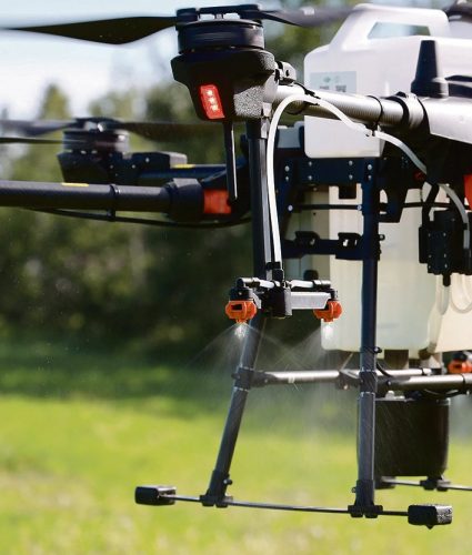
Drone spraying research promising
Drone spraying would be ideal for touch-ups and misses in a field after a large sprayer comes through, or for targeting weeds in areas that are difficult to access, Tom Wolf, sprayer consultant and scientist said.
However, PMRA (Pest Management Regulatory Agency) allows applying chemical pesticides with a drone only for research purposes right now.
This summer, two students with LandView Drones are responsible for doing research with two large spray drones. They are testing the Chinese manufactured DJI Agras T20 and the American manufactured Hylio Ag 122 to collect data, aiming to prove that spraying with drones is safe and beneficial.
Read more here
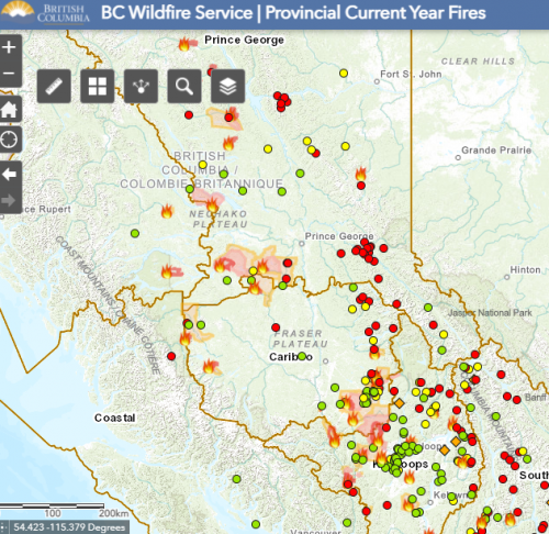
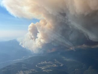
B.C. wildfire map 2021: Location and size of the fires burning around the province
Many wildfires have been reported in the province of British Columbia since late June. Some of them are particularly visible or currently causing a threat to the safety of British Columbians. They are called wildfires of note. Most of them are ignited by lightning (naturally-caused) but some fires are human-caused.
Lots of communities have received evacuation alerts due to the fires. BC Wildfire Service produced a map that represents useful information such as location, size, date and cause of fires burning across the province.
Read more here
Manitoba Infrastructure Projects Map
The Government of Manitoba has released a new interactive map tool that shows all infrastructure projects within the province. This map represents projects in Design, Construction, In-Service and Seasonal Shutdown status.
A list in the left window panel of this tool provides a descriptive location and project status of Manitoba Infrastructure projects displayed in the map area. The project summary list can be filtered by highway number, project status, municipality name, and project type.
View Manitoba Infrastructure Projects Map here

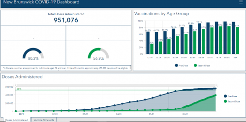
The Dashletes: The team behind the N.B. COVID dashboard
Robert Harris, the geomatics manager for NB 9-1-1, and his team of geomatics analysts are providing mapping and location intelligence to emergency services during floods, fires and other natural disasters. They have been asked to share COVID-19 data with the general public. The New Brunswick COVID-19 dashboard is the outcome of their teamwork.
Normally, the work we do stays behind the scenes and it’s geared towards emergency managers or senior officials, so it was a nice change to be able to showcase our skills.
Robert Harris, Geomatics manager for NB 9-1-1
The team connects with coworkers at Public Health, the regional health authorities, and the federal government for data collection. The New Brunswick border and compliance and inspection workers are other sources of required data for the dashboard.
Read more here
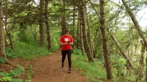
New database of maps of all P.E.I. trails aims for fall launch
There are over 200 trails on Prince Edward Island. Recreation P.E.I in partnership with the provincial government is creating a new database of every single trail on the Island.
The mapping project, which is started in March, is funded by the sport, recreation and physical activity division of the Department of Health and Wellness.
Two trail mappers have been using a global navigation satellite system receiver that acquires coordinates from satellite signals and connects to a smartphone. They are also capturing photos of trails infrastructures such as the sign, benches and bridges.
Read more here
sh


Be the first to comment