
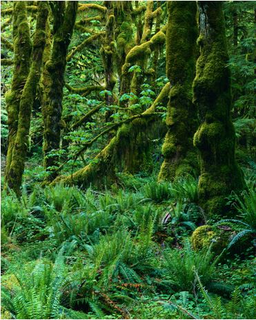
As climate change and managing our environment responsibly become larger topics in industry, the media, and to everyday people, sustainable practices are continuously increasing in significance. Being able to predict the growth and status of a forest over time is critical for forest management planning, in addition to observing forest hydrology, managing wildlife, studying forest ecosystems, controlling forest fires, and understanding the landscape. The company GaiaStudio Software Inc. based out of Richmond, BC, aims to provide a cloud-based technology that can allow users to project forest ecosystem dynamics over time. This in turn will aid in decision making and allow planning for sustainable ecosystem management.
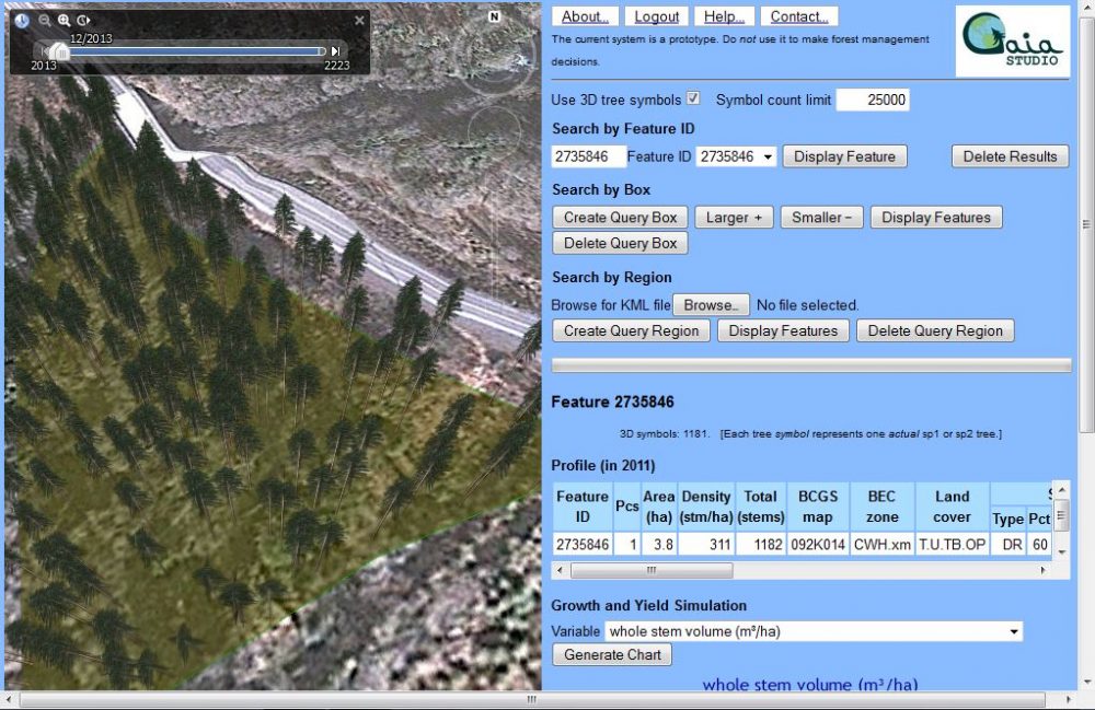
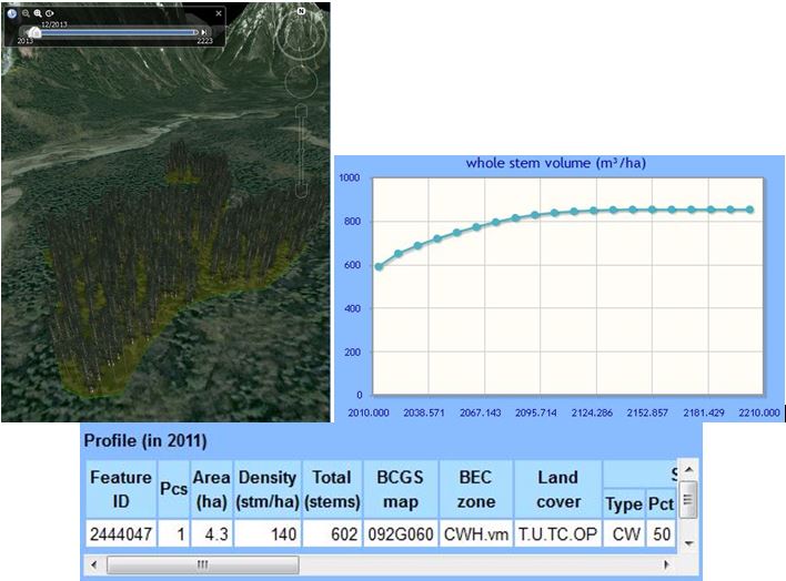
The present working prototype region consists of six NTS map sheets of 1:250000 scale that cover all of Vancouver Island and some of the BC mainland. The GaiaStudio platform uses the Google Earth API as a user interface and incorporates a forest-growth model VDYP provided by the BC Ministry of Forests, Lands and Natural Resource Operations. VDYP allows variable density yield prediction for unmanaged forests. The software accesses provincial forest inventory data on landscapes represented by polygons and displays the data along with 3D landscape visualization. It also allows a user to upload a KML file and look for existing data within the KML region. A graph is also plotted and is capable of displaying various forest and stand statistics, such as whole stem volume, as a product of the predicted year in the future. Tree symbols in 3D can also be displayed on the visualization, and a time-slider is provided to show tree heights on a particular predicted year. Other GIS data can easily be incorporated and stored in GaiaStudio’s cloud-based system, and it is multi-user oriented.
The present inventory data used in GaiaStudio is all from the BC Ministry of Forests. The Ministry data is collected through field sampling and photogrammetry. Tree visualization is based on forest model projection density and area calculations for each polygon of a particular forested region. The original data records up to 6 tree species and their proportional abundances per polygon, and by using species percentages, species, and area, the VDYP model is able to represent the mix of trees in a polygon.
The GaiaStudio software is still a work in progress, and currently has some limitations. Presently only unmanaged forests are considered in the system, and the software works best for mature and old forests. The current working area only covers Vancouver Island and a small part of the southwest BC mainland. Predicting young forests and managed forests will require using the provincial model TASS/TIPSY, and GaiaStudio will incorporate more capabilities with time. The most important goal at present is to work towards fully developing the current prototype into commercial software that can benefit many users.
I thank Michael Gerzon and Martin Feuchtwanger of GaiaStudio for sharing their time with me and showing me their project.
![]()
![]()


Be the first to comment