
All-in-one mapping-grade GPS/GNSS handhelds shined in their day, but advances in mobile computing, bring-your-own-device, affordable high precision, and pay-as-you-go options, are seeing a rise in more flexible component systems.
Integrated mapping handhelds were an amazing tool, dominant in an era that saw the rise of widespread digital asset and resource mapping. This was coincident with and contributed to a boom in the development geographic information systems and digital asset management systems. They also put the power of precise GPS (and later GNSS) field mapping, with minimal training, into the hands of just about anyone. These purpose-built devices were designed to deliver field collected positions and attributes to GIS platforms through prescribed workflows.
Such devices deserve praise for revolutionizing field asset and resource mapping and were truly the state-of-the-art solutions. The shift way from these integrated hardware devices is not due as much to faults or shortcomings as it is to the reality that the underlying technologies evolved so rapidly—paradigm shifts. While development of handhelds adapted to incorporate these changes, the evolution of external components and alternatives upended original value propositions.
Ironically, in some ways, resource and asset mapping systems have come full circle—from component to integrated and back to component. For some of the early implementations, in the days when there was only one constellation, the field mapper might have a backpack with an antenna mount, a receiver and batteries inside, connected to a field data collector. Such systems were almost always a combination of proprietary hardware and software—mixing and matching was near impossible. Field collectors had a display and keypad, and often ran early versions of legacy (and mostly discontinued) mobile operating systems.
This was followed by the era of integrated antenna/receiver/data collector handhelds. Those were widely adopted in the asset and resource mapping communities. And now in the present day, once again, systems comprising several separate components are the new standard: antenna on a pole, mobile phone/tablet, and a GNSS receiver as a positioning peripheral. Users now have many choices to mix and match hardware and software.
Not Bad, It’s Just That Other Options Got Better
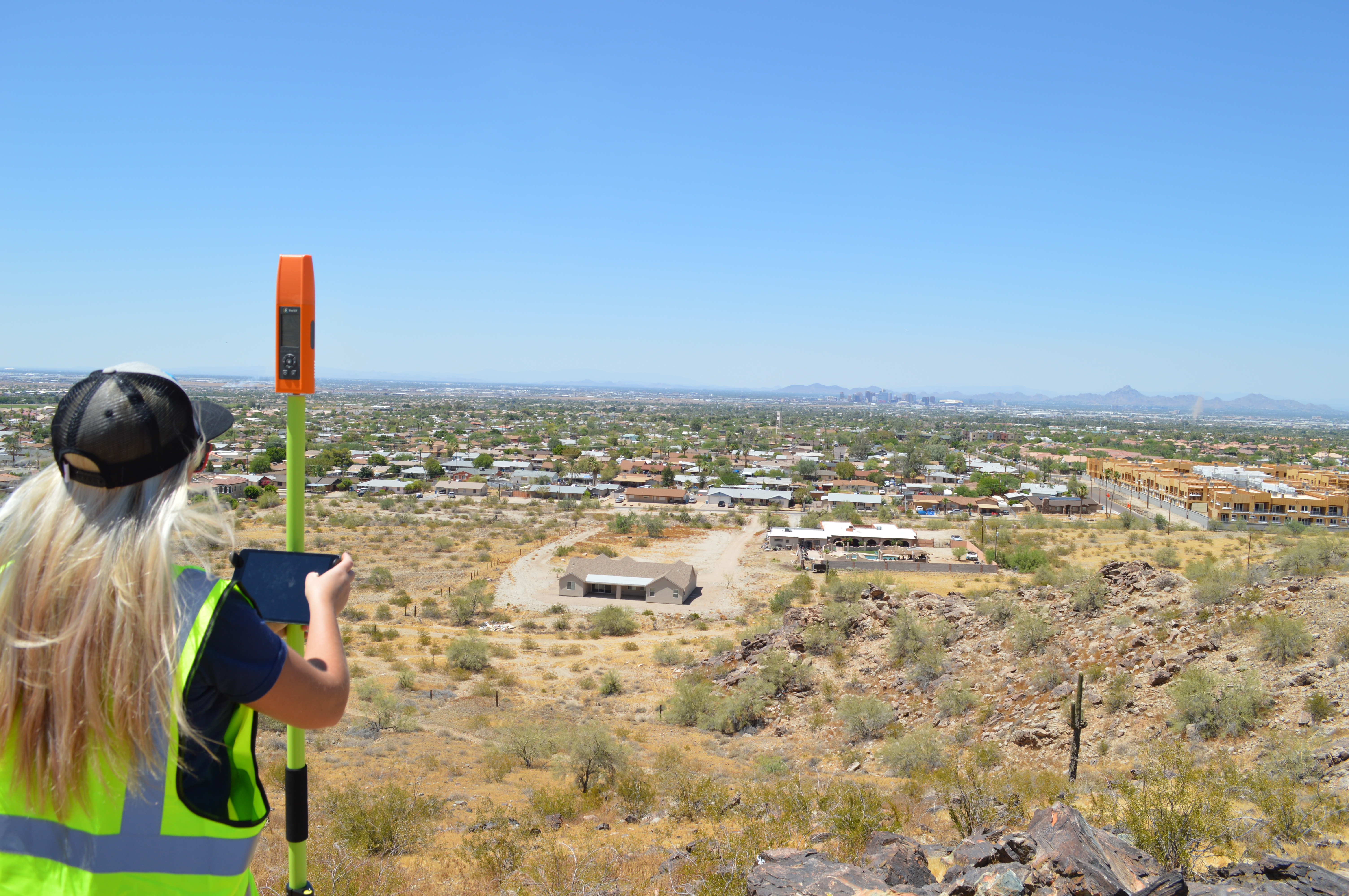
“We all have a powerful computer in our pockets and we can use these as high-accuracy mapping tools with modern GPS hardware,” said Ryan McGinnis, GNSS, GIS and UAS specialist with Anatum Geomobile Solutions. McGinnis and Anatum provide geospatial services and equipment sales, and a key sector they serve is field asset and resource mapping. McGinnis notes that one of the key factors driving the supplanting of traditional handhelds by component systems is the demise of purpose-built data collectors; “You’re out in the field and you’re working with an iPad and the iPad battery goes down, or you drop it. No sweat, you just pull your phone and log into your [mapping software] account and you pick up right where you left off. Allowing you to get more done while reducing downtime in the field.”
That’s not to say that consumer phones and tablets are the best option for all needs, there are many popular ruggedized data collectors. Many of those also run on common operating systems (OS), like IoS, Android, or Windows, that are far less likely to suddenly become obsolete like OS in legacy handhelds did.
We live in an era of near ubiquitous mobile data connectivity, apps, the cloud, and field mobility components. This has touched every industry, including geospatial. The digitization of AEC; infrastructure life cycles through survey, design, construction, and operations are increasingly managed in the cloud, app-driven, with multiple real-time high precision positioning corrections options. In addition, there is an explosion of reality capture sensors, IoT, augmented and mixed reality interfaces, and a steady progression towards autonomy and robotics. It was inevitable that asset and resource mapping would ride this wave.
There are many field mapping software options, like Esri ArcGIS Field Maps (the successor to ArcPad, Survey 123 and Collector), Global Mapper, TerraFlex, Penmap, and more. Many of these are hardware and OS agnostic. So with a phone, tablet, or ruggedized field collector running a standard OS, users have many choices for mapping apps. And if their precision needs are more than the default low precision of most consumer devices, a peripheral GNSS device can be connected. McGinnis calls this “bring your own device”, a term for an approach becoming quite common in the mapping community—and now even spreading (to some degree) to high precision markets like surveying.
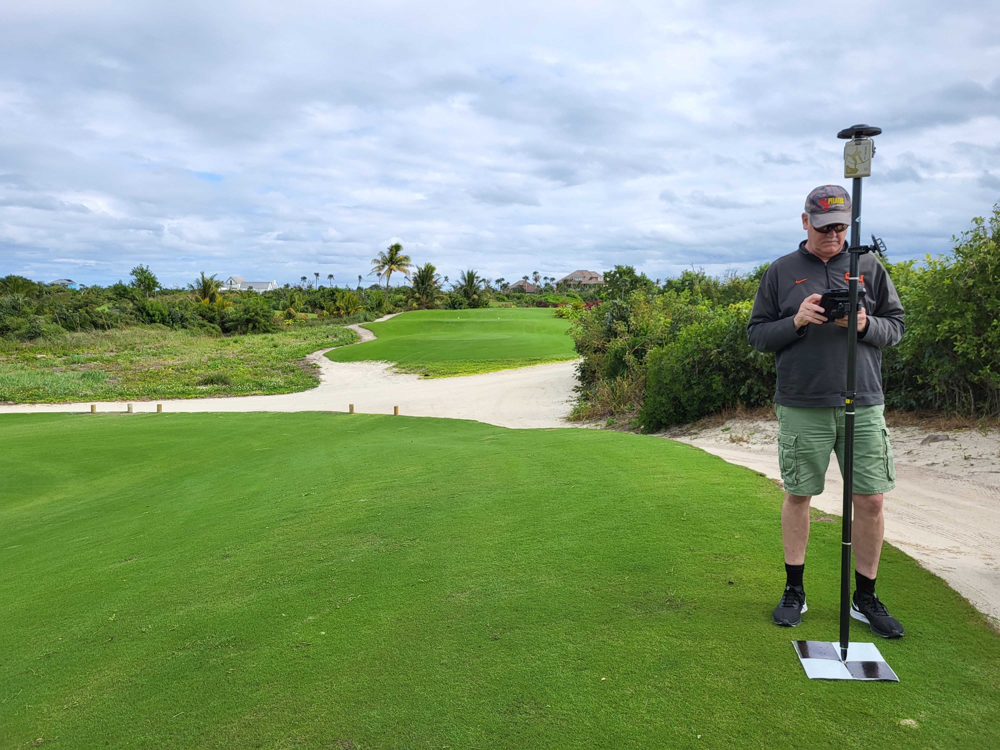
Speaking of precision, one element of all-in-one handhelds was often a handicap that many users did not realize might have been contributing to the low-precision results they’d see. Using the built-in antenna, held down at waist level, is not a very good place for a GNSS antenna. Your body can block signals, and the lower you are the more susceptible you can be to multi-path hazards. While many handhelds had jacks for external antennas, many users did not use those. In the days of low-precision, they might not have noticed a difference, but high-precision comes with a premium on GNSS best practices. Many users are a bit savvier about GNSS fundamentals than in years past. And it is great to see manufacturers and dealers encouraging users to get the antenna up on a pole.
Many GNSS manufacturers offer tiers of receivers, with different prices for different precision capabilities. “Many of our customers will opt for a lower precision receiver, if they only need sub-meter, feet, or decimeter. Like an Eos (Eos Positioning Systems®) Arrow 100, or 100+,” said McGinnis. “If they want centimeter precision, they pick the Arrow Gold® or Gold+. With one of these, and an RTK correction source, we can turn our smart phone, tablet, or ruggedized tablet into a survey-grade mapping tool.” This is an example of centimeter capable receivers that field mappers can connect to their phone/tablet/collector and add high precision to their field operations. It should be noted that to achieve high precision, the user needs to connect to external correction sources.
These can range from free services like WAAS for meter precisions, to RTK networks (some free, some for fee) for centimeter precisions. Network RTK (NRTK) approaches like VRS or MAC provided by local, state, regional or nationwide real-time GNSS networks (RTN), deliver corrections by mobile internet (i.e. cellular). Many of the later versions of legacy integrated handhelds did accommodate external corrections. McGinnis cautions his users that the ability to collect centimeter precision does not mean the user can do the types of work that require (by law) a licensed land surveyor.
However, for situations where there is no cellular connectivity, the user may not necessarily have to resort to post-processing (very common in the early days of GPS field mapping). There are multiple global correction services that deliver augmentation data via geostationary communications satellites. The solution is precise point positioning (PPP), and while some implementations can yield near-survey-grade precisions (though much weaker in vertical results), some do not, and there may also be a need to wait until the solution converges.
These real-time PPP services require subscriptions. But there are tiers of subscription that can yield different levels of precision. “The Eos receivers we provide for our customers can use the Hemisphere Atlas Global Correction Service [PPP],” said McGinnis. “There is Atlas Basic for 50cm, A30 for 30cm—a foot, and A10 for 6cm-18cm.” McGinnis is also a fan of the component approach to mapping systems as it offers “flexibility in adding additional sensors, like laser rangefinders, underground utility locating devices, as they open up high-accuracy, real-time mapping workflows not previously recognized”.
Today’s field asset and resource mappers have many options for GNSS hardware and corrections services to meet their precision and budget needs. However, as many find out, high precision can become addictive. There is an oft expressed sentiment that the limitations of early era GPS, and the costs associated with higher precisions at that time, lead to low expectations for the precision of GIS mapping. But times of changed; we do not have to be locked into the legacy low-precision paradigm for geospatial.
Another driver for more flexible and affordable GNSS systems like these is the proliferation of UAS for geospatial mapping applications. UAS operators are using high-precision systems as base-station for RTK and/or PPK post-processing or use rovers to establish ground control points (GCP).
Any aspirations for “digital twins” will require higher precisions for many elements, especially for geo-registering reality capture, like lidar and photogrammetric devices. For example, capturing underground utilities while the construction trench is still open. There are solutions like the Pix4D viDOC that is a high-precision GNSS receiver, that can use external corrections to yield centimeter precisions, and a downward facing laser to record the height above the ground. You attach an iPhone (12 or higher) or iPad with the flash-lidar and camera combo that can create a registered point cloud of the as-built conditions. It is almost as simple was waving the phone over the trench. There are other solutions like this as well.
s high-precision became more practical and easy to achieve, those last few centimeters could still be costly. Despite this, a shift in conventional wisdom came from recognition that for applications like utilities management, the extra investment up-front in higher-precision gear was well worth it in the long run. After all, the biggest expense in field mapping is labor, and adding precision and efficiency adds more value to every field hour. Fortunately, new technologies and service models are filling these growing needs.
Pay-as-you-go Precision
In a scenario where you need high-precision daily, the user could justify the additional up-front costs. The same with a corrections service. But what of the users who may only hit the field a few days a month or year? Or an organization that may want to provision a large group of interns to do some mapping for just the summer?
There are several approaches to serving these varied scenarios. One is from GNSS solutions manufacturer Bad Elf. Bad Elf had anticipated the growth of the bring-your-own-device market and developed their flagship full-constellation integrated GNSS receiver/antenna, the Flex. It can be purchased in several configurations.
You can buy it for full price and you can use corrections services, like NRTK, or PPP services (the Flex can use Atlas), or a base-rover configuration (with and additional base receiver sending corrections via radio). The Flex can also tap into a nationwide RTK service called Polaris, operated by Point One. With the full purchase option, the Flex is essentially a survey-grade, centimeter precision rover (though at a lower cost than many survey rovers). This can be a good fit for frequent users. Examples might be large utility or surveying crews.
Or, for infrequent users, they can purchase a low-cost version that defaults to low-precisions, but they can purchase and use ‘tokens’ that unlock the high-precision capabilities (e.g. one token per day). Again, when external correction services (or an RTK base) are used, it can be operated as a survey-grade, centimeter precision rover.
Larry Fox, VP for marketing and business development at Bad Elf, has been in the GNSS sector for many years, including the integrated handheld era. He related some of the thinking behind development of the Flex: “Old school handhelds were a vertical stack solution. Not well suited for the trend we see in industry; the field worker of today isn’t just a data collector or an attribute updater. They’re doing work order management, they’re doing tracking, they have email, they are plugging into cloud solutions. So bringing your own device, or company supplied device is doing more than simply the data collection piece. It is a work tool. And the external GNSS, the peripheral, is an extension of that hardware.”
Depending on the application, Fox said that the emphasis could shift from specs to business models: “Take for instance the AEC sector. When we sell the product, they may look at it as a way to shift CAPEX [capital expenditure] dollars into operational costs. Reducing CAPEX allows for wider rollout whereas the variable model allows for cost to be attributed to the operational budget. Essentially customers’ job cost the variable component. TCO [total cost of ownership] is far lower than traditional models.”
Field mobility devices and solutions are now much better suited for enterprise mobile device management (MDM). “Now you can actually have relatively secure data and apps and a more controlled environment for mobile devices that are actually accessing the internal systems of an organization,” said Fox. “Another one of the distinct advantages of mobile devices today, like Android phones, tablets, iPhones, et cetera, is that the whole ecosystem evolves in six month increments. Purpose-built devices ran generally, a legacy operating system that may or may not ever update in the entire ownership of that product.”
Another Pay-as-you-go Example
A slightly different approach to the pay-as-you-go precision is the Catalyst system from Trimble (that we reviewed in GoGeomatics). At its core, it is based on software-defined-receiver (SDR) technology. Rather than application specific integrated circuits (ASIC), the positioning engine runs on standard processors. This enabled the developers to put some processors inside a low-cost antenna, and all of the other operations can be done via apps on a phone.
The user has to only purchase the low-cost antenna (DA2, under $500) and connect it via Bluetooth to their own phone or tablet. The antenna has a quick-attach adapter that fits on standard survey poles, and you can power the antenna via USB with standard battery banks. Depending on your expected usage patterns, you can choose from different subscription packages with different prices per hour of connection depending on what bundle you choose (e.g. number of hours, monthly, yearly). Your up-front investment is minimal, and you only pay when you need it.
To achieve centimeter precision, you need to feed corrections to the system. This can be from public or private RTN. Or, if you are working in parts of the country covered by Trimble’s own RTN (VRS Now), that is included in your subscription, as is their global PPP service (RTX).
Simply More Flexibility
There are many more manufacturers of GNSS receivers/antennas that can be utilized as positioning peripherals in component field mapping systems; we’ve only covered a few. Each of these examples, and others, offer more options for field asset mapping than old school integrated devices.
However, there are users who prefer an integrated device, and there are many on the market, updated to incorporate the latest technologies. I’ve tried some and they are so much better than the ones from the legacy days. Several manufacturers offer both, like the Leica GeoSystems handhelds and tablets, field mapping software, and GNSS peripherals for component systems.
Sometimes it can be very handy to have an all-in-one device, set up for a specific workflow, and you can put people I the field with minimal training. There is something for everyone. And fortunately, there are many more choices among those “somethings” out there.


Be the first to comment