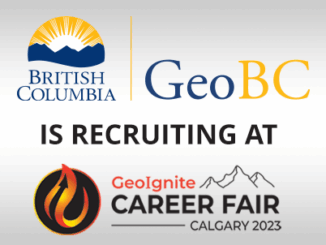
BC

May 5: Vancouver: NRCan Discovery Centre Science Open House

Come talk to scientists in Canada’s oldest science agency at a Canada 150 Open House.  Visitors can check out over…

URISA BC

URISA BC – Engage: Make It So With GIS in Community Engagement

What: Engage: Make It So With GIS in Community Engagement Where: Vancouver, BC When: Thursday, 15 June 2017 from 8:00…

Thunder Bay, Ontario

New GoGeomatics Group in Thunder Bay, Ontario

GoGeomatics is excited to introduce the Thunder Bay GoGeomatics group as the newest grass roots effort by local geospatial professionals,…

Canadian Hydrographic & National Surveyors Conferences: 2018 Victoria, BC: March 26-29

2018 Canadian Hydrographic & National Surveyors Conferences  March 26-29, 2018, Victoria B.C. Sponsor and Exhibitor Registration is now opened.  You…

URISA BC: Vancouver Call for Presentations on GIS Trends in Community Engagement

Call for Presentations Following the success of our December event, the URISA BC Executive Team is busy planning our next…

GIS in Action: How Does BC Pinot Noir Express Terroir?

Editors note: In this previously published article, Karl Kliparchuk, BCIT GIS Program Head & Instructor uses GIS to explore the…

UBC Unveils New Masters of Geomatics for Environmental Management

The UBC Faculty of Forestry is excited to announce that the official approval of the Master of Geomatics for Environmental Management…

New Galileo navigation system is experiencing clock failures

  Since December 15, 2016, the new Galileo global satellite navigation system has been up and running. Unfortunately, there are…

The Integrated Cadastral Information (ICI) Society and ParcelMap BC

This is the first of two articles on the release of ParcelMap BC Data, which we see as a significant…

Graph Databases – Recent development in Neo4j may help accommodate the Geospatial Community

Graph Databases and GIS & Technology (GIS&T) In the era of big data, graph databases are becoming very popular as…

Marine Geomatics Primer: Using UUVs to Take Flight Underwater

Unmanned Underwater Vehicles One of the most interesting things to happen in regards to marine geomatics technology has been the…

Canadian Geomatics Innovation: Ecere Develops a Next Generation GIS

Not many companies undertake the ambitious goal of creating a new geospatial software suite from scratch. Ecere, a Canadian company…