resources

GIS Open Source versioning tool for a multi-user Distributed Environment (part 2)

Cet article est aussi disponible en français. This article is the 2nd part of GIS Open Source versioning tool for a multi-user Distributed…

EnerGIS 2017: Call for Papers & Scholarship Opportunities

EnerGIS 2017 6/5/2017 to 6/6/2017 Suburban Pittsburgh, Pennsylvania. Join us for our 5th annual conference June 5th and 6th  2017!…

Remote Sensing QGIS: Semi-Automatic-Classification Plugin (SCP)

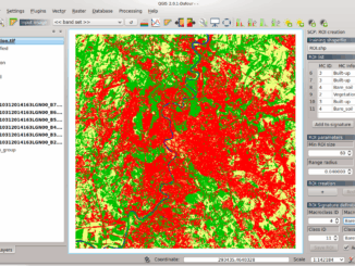
Semi-Automatic Classification Plugin   Today I’m going to take a quick look at one of the remote sensing plugins for…

Free Webinar March 15th: NRCan, OGC, & USGS Arctic Spatial Data Pilot Demonstration

The Canada Centre for Mapping and Earth Observation invites you to attend the Arctic Spatial Data Pilot Demonstration Webinar. Managed and…

Toronto & Calgary: Federal Floodplain Mapping Workshop March 28th & 30th

The Federal Floodplain Mapping Guidelines workshop, hosted by Canadian Water Resources Association (CWRA) on behalf of the Government of Canada,…

Top Ten Climate Change Maps and GIS Applications

Awareness for climate change has been steadily increasing ever since the Green Revolution in the 1960s. There is a plethora…

Eastern Canada

Grand Banks to the Gulf of Mexico: My Canadian Geomatics Career

I often contemplate what it would have been like working at the same job for an entire career. Mind you,…

GNOSIS – A New Geomatics Software Suite

Creating a new GIS from scratch is a tough undertaking. It involves a lot of innovation. Ecere, a Canadian company…

The Integrated Cadastral Information (ICI) Society and ParcelMap BC

This is the first of two articles on the release of ParcelMap BC Data, which we see as a significant…

Upgrade your Geospatial Skills: leveraging the power of MOOCs

What I want to share with you are some resources related to something called Massive Open Online Course (MOOC) where…

High Resolution Mapping Along the Coastal Zone - https://geomatics.one

Atlantic Canada: COGS: Geomatics Professionals Coming to Discuss High Resolution Coastal Mapping

High Resolution Coastal Zone Mapping This collaborative effort by GANS & the CIG will engage the geospatial community & increase awareness on the value…

Marine Geomatics Primer: Using UUVs to Take Flight Underwater

Unmanned Underwater Vehicles One of the most interesting things to happen in regards to marine geomatics technology has been the…