Technology
TopoDOT Compares Data and Applications of UAV and LiDAR Point Cloud
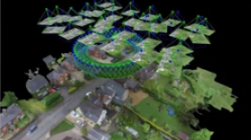
On April 5, 2022, LiDAR COMEX 2022 held a live stream presentation on “data comparison and applications of UAV imagery-based point cloud and LiDAR-based point cloud for surveying and mapping. The speaker was Jennifer Triana, […]