Meghan Miller: Creative Canadian Cartographer
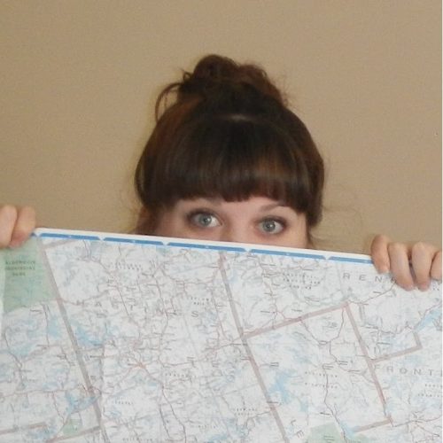
GoGeomatics recently had the pleasure of speaking with a creative cartographer who has a passion for paper maps. Find out how Meghan came to her current position with Canadian Cartographics Corporation (CCC) and what led her to a career in Cartography!
 GoGeomatics: Can you tell us a little about yourself?
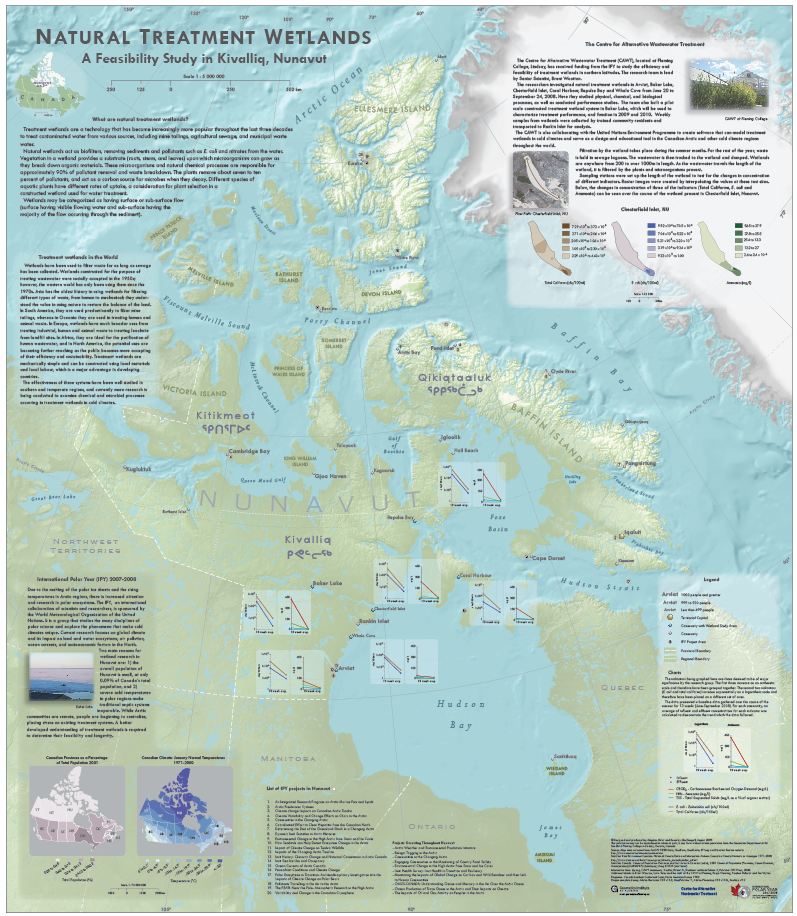
Meghan: My name is Meghan Miller. On weekdays my location is 43º52’59.19”N 78º51’12.02”W and I am quite fond of maps and plants. After high school, I attended UPEI for biology, where I specialized in plant sciences. Upon graduation, I realized there wasn’t that much I could do with my BSc. So, I decided to go teach English in Seoul, South Korea and save some money, while doing some thinking. About halfway through my year long stint in South Korea, the thought of going back to school started to kick in. I had really enjoyed my biogeography courses in university, had always liked maps and was rapidly discovering I did not have the patience for teaching small children. I did some research online and found a couple of schools in Canada offering GIS. I settled on Fleming as it had a cartography program, which shared a common first semester with the Applicatons program (database/computer programming). And at that point I was undecided as to what direction I would head.
GoGeomatics: What did you think of the program at Fleming? Did it prepare you for work in the real world?
Meghan: I enjoyed the program at Fleming. There were two different streams of GIS: Applications or Cartography. While I was attending, they had a common first semester where you took courses from each stream to help you to decide the path you wanted to take. In the end, I chose the Cartography stream; simply because it made (and still makes) me happy.Steve Pelletier taught the majority of the cartography classes. He is very passionate about what he does, and it comes across in his teaching. In addition to cartography, I was trained in typography, colour, design principles, spatial analysis and how to integrate those elements into a clean end product. In the final semester, all students were responsible for completing a co-operative project. It allowed us to use all of the skills gained during our time at Fleming to produce a quality cartographic product for an outside client. It was an incredibly valuable experience.
Every day that I go to work, I employ the principles that were taught at Fleming. There are fewer cartography positions out there than there once were; but they are out there. With enough perseverance and hard work, a person can make a living as a cartographer in today’s online age.
GoGeomatics: How long did it take you to find your first job in Cartography after you graduated?
Meghan: It took me a little bit less than a year to land my first job, in part because I held out for a cartography position. What I ended up doing was using Yellow Pages to come up with a list of heritage/environmental consulting companies in the city I was living and going in and dropping off resumes. I offered to do work as a volunteer, just so I could get some experience in the workforce. My name got passed around a bit and that was how I ended up at Strata360.
GoGeomatics: Can you tell us what your first job at Strata360 was like?
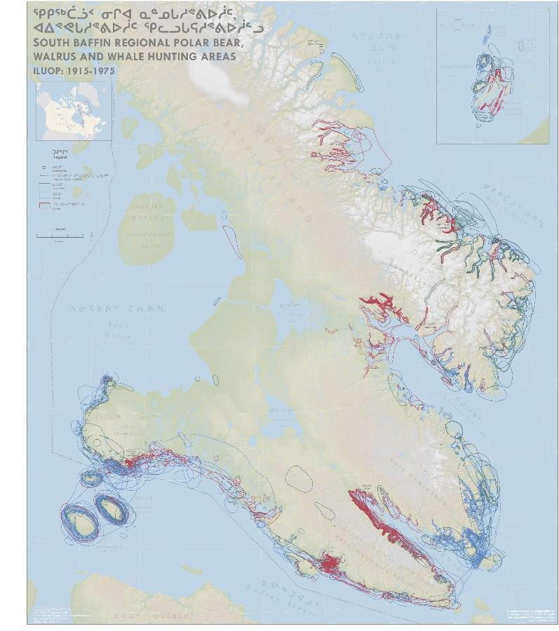
Meghan: My first real job was with the heritage consulting firm Strata360(Montreal, QC). I worked remotely from Ottawa ON. My title was Geospatial Data Analyst / Cartographer. The project I was involved in was with the Qikiqtani Inuit Association (QIA). The Inuit Land use Project was started in the 1970’s in an effort to catalogue the knowledge held by the hunters of the time. Returning this information to the Inuit wasn’t possible until recently, due to the advances in geomatics and associated digital technology. My responsibility was to take this information, which was being stored in the National Archives in Ottawa, and analyse the content units (interviews, hand drawn maps etc.) that make up the land use and local knowledge map data for this population, and to organize it in a way that was useful and clear to the Inuit association of today. To do all of this, the information was digitized using ArcGIS. Hand drawn maps were georeferenced, features were digitized and the appropriate attribute data was derived from the interviews. This information was then entered and managed in a database. A series of wall maps were also created which depicted a variety of hunting patterns and demonstrated how the land has been used over time.
GoGeomatics: You are currently working for Canadian Cartographics Corporation (Formerly Rand McNally Canada) in Oshawa, Ontario. How is it working with some of the most experienced Cartographers in the country?
Meghan: While in Ottawa, I was working mostly working independently. I was responsible for troubleshooting my own problems. While there was always someone on the other side of the internet to troubleshoot with, or pick that exact shade of blue, it couldn’t compare with the situation I’m in now. It has been fantastic to get back working as a part of a team! There is over 150 years of combined cartography experience in our office. At the beginning, it was a bit daunting, but everyone was willing to share their knowledge, and make recommendations on how to best approach things. All the cartographers have their own area of expertise, so rarely does a question go unanswered.
GoGeomatics: What does it mean, on a day-to-day basis, to be a Cartographer for such a large mapping distribution firm? What Software is used?
Meghan: Being a cartographer is an important role in the company’s operational plan. Cartographers are the first step in the product building stage, researching up-to-date data, implementing it through the software we use, and eventually coming up with a product that gets printed and then sold. It’s all very time sensitive; quality control is crucial. All of this is done using the Adobe Creative Suite, predominantly Adobe Illustrator, with layouts being completed in InDesign.
GoGeomatics: What’s your opinion on the progression of digital mapping, and how it’s affecting the paper mapping firms such as CCC?
Meghan: Of course, the convenience of having maps at the push of a button is alluring to everyone. And the increasing number of hardware delivery systems capable of providing “maps and routing in an instant” are what people have gravitated toward recently. However, there are still advantages to having up-to-date print maps available. Print maps give you the bigger picture, not just point A to point B routing. Often you can find a more practical route using a print map vs. a digital routing device. Print maps can also be more specialized and can show you many features other than just streets; these features may need to be downloaded from another source if you are using digital mapping. Print maps are also indispensable as a back-up should you lose your GPS or cell phone signal while en-route. There are also areas of the country where digital data is perhaps not as complete as what you would find on a print map – remote and rural areas as an example. I believe there will always be a spot in our glove compartment or backpack for a paper map.
GoGeomatics: Are there any skills or tools you would like to learn to improve your work at CCC, or to upgrade your career in the future?
Meghan: I have found that the longer one stays at a workplace, the more specialized one becomes. Every cartography company has its own approach to map making. Some may put more focus on the data and analysis side of things, whereas others focus more on the graphics. My main goal is to stay current in my field by keeping my different skill sets in working order, be it by learning new open source GIS software or doing tutorials to keep up with the most recent version of Illustrator.
GoGeomatics: What’s your favorite projection?
Meghan: I would say my favorite projection is Buckminster Fuller’s Dymaxion. Click on the link to view an animation of the unfolding of a map using the Dymaxion projection. I like the Dymaxion projection because it reminds me of being back in elementary school and making our own globes while learning about prisms. Sure, I didn’t know then that it did a decent job at preserving shape and area for a global projection. It was just really neat to have your own little globe in your hand. These days, I have rediscovered it in a couple of different places online showing a variety of global trends. It catches your attention as it is completely different than the Robinson or the regular Plate Carrée. The shapes of the continents are still recognizable, and as another plus, it can be viewed from any direction and still be useful (no set north, south, east and west). Pretty neat eh?
GoGeomatics: Can you show us your favorite map?
Meghan: It’s pretty hard for me to choose one map that would be my favorite, so I wont. Instead I will direct you to the following website: http://leahevanstextiles.com/ . ‘Arpent Bend’ or ‘Soil Survey #2’ would be my top 2 picks. Stumbling across Leah’s work on the internet made me realize that I was getting too comfortable inside my own box of tools. I was thinking of maps as something that were created digitally or on paper and that they needed to have a purpose, to help someone get somewhere, or to display some statistic or information. My daily work creating road maps had started to make me forget about maps as art. Quilting is a hobby of mine, but it never occurred to me to make quilts of maps, maps were for work, and stayed in the office. I would say that Leah Evan’s work has inspired me to look outside the box a little more with respect to my interests and to make a conscious effort to think more creatively in all aspects of my life.
Thanks Meghan for a creative look into how you came to your current position with CCC!


This is one of the most inspiring stories i have read in the recent past. Nice interview there with Meghan, its nice to see how she started and went through different jobs to where she is today.
Nice Cartography Work Meghan
Meghan, you truly our inspiration!
Hi Meghan..
How are you? I really inspire from your work. I am a Geographer & a GIS Engineer in a reputed GIS & Remote Sensing company, working in India from past 3 years.I will be very great full, if i can help you in the field of GIS software learning & to use them for plant, environment study.
Wonderful story!
Your story touch me because I was also a creative cartographer who has a passion for paper maps… Times change, my cartographer title is gone and I work in front of a computer. I’m glad to see that cartographer work is still alive. GIS is fantastic but…yes, I miss the smell of a printed map right out from the press.
Good continuation! Bonne chance!
Thanks Melanie for sharing Meghan’s inspiring career.